
Download
3D Flyover
Add to list
More
3.3 km
~56 min
163 m
Loop
“A short, wild upland loop where prehistoric tombs and sweeping views outshine the boggy sting.”
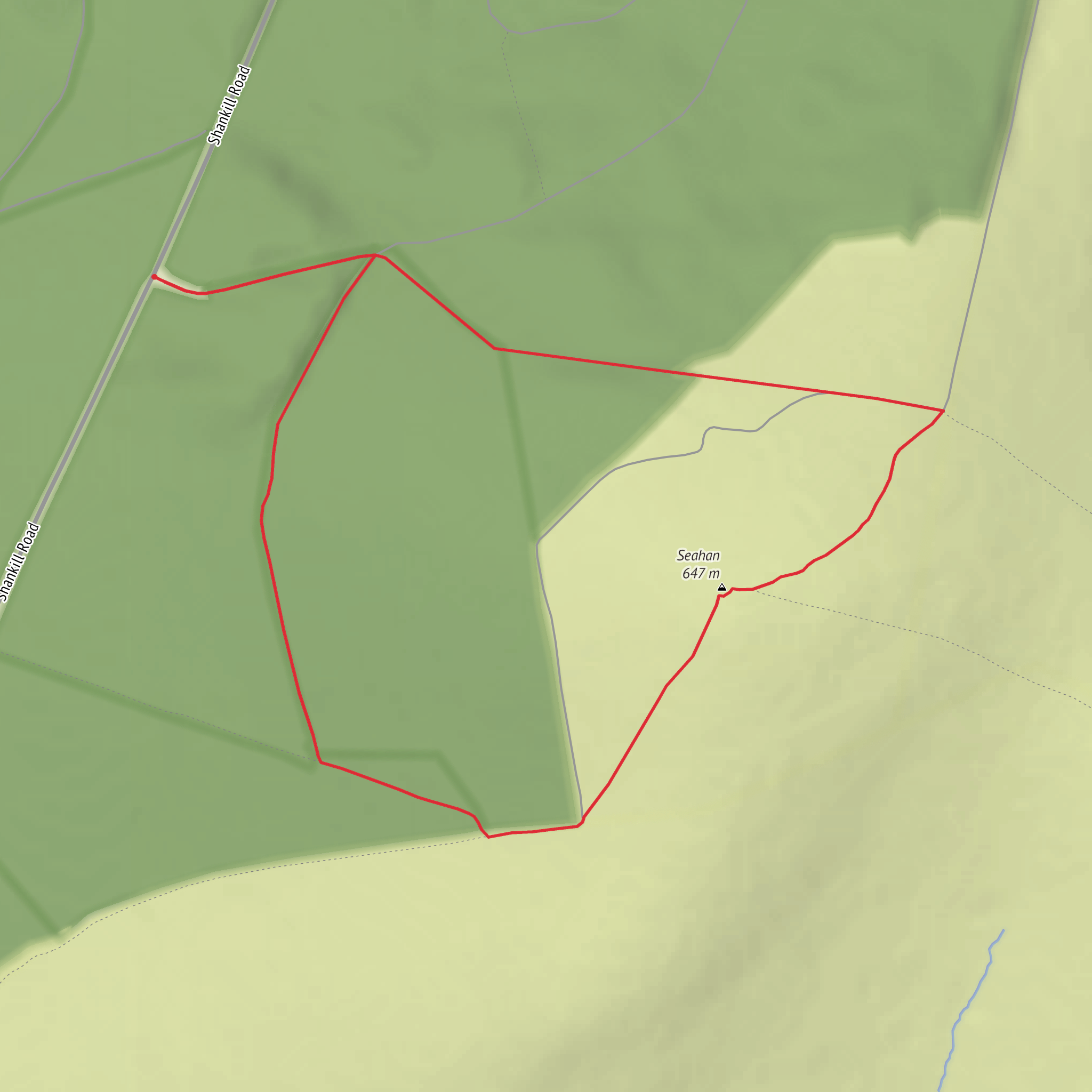
This compact mountain loop packs a surprising amount into roughly 3 km / 1.9 miles, climbing about 200 metres / 656 feet over open upland ground on the Dublin–Wicklow border. Although the distance is short, the terrain makes it feel more serious than the numbers suggest. Expect a steady pull onto exposed hillside, sections of rough or boggy ground, and stretches where the line of travel can be less obvious in mist or poor light, so this is best treated as a proper hillwalk rather than a casual stroll. The area around Seahan is known for open views and ancient archaeology, and the medium difficulty rating is a fair guide for hikers with decent fitness and suitable footwear. (alltrails.com)
The nearest useful landmark for the start is the minor-road approach on the Kilbride side, south of Blessington in County Wicklow, near the Seefin/Seahan uplands and not far from Kilbride Military Camp. Parking in this area is limited, with only small roadside or informal parking spots mentioned by route sources, so arriving early is wise if coming by car. Public transport is poor for this trailhead; the practical approach is usually to drive from Dublin via the Blessington direction and then continue on the smaller local roads toward the upland access points near Kilbride. If relying on navigation, use HiiKER and check the exact start carefully before setting off, as these mountain access roads can be easy to overshoot. (trips.ie)
What the route feels like
From the outset, the route heads into open mountain country rather than sheltered woodland. The climb is short but noticeable, gaining most of its height quickly enough to raise the heart rate, and the ground can vary from grassy and peaty to stony and wet underfoot. In dry weather the loop is much more straightforward; after rain, boggy patches can become the defining feature of the walk. Wind exposure is another factor here, especially once you gain the higher ground, so even on a mild day it is worth carrying a warm layer and waterproof shell. Sources describing the wider Seahan–Seefin uplands repeatedly note rough, boggy terrain and indistinct paths, which is important context even for a shorter loop in the same area. (alltrails.com)
Because the route is only around 3 km / 1.9 miles, many hikers will complete it in well under two hours, but pace depends heavily on conditions. A dry, clear day can make this feel like a brisk scenic outing; low cloud, wet peat, or strong wind can slow progress considerably. Waterproof boots are strongly recommended, and trekking poles can help on uneven or slick ground. If visibility drops, careful route-finding matters more than the modest mileage suggests. HiiKER is the best tool to have ready before leaving the car. (alltrails.com)
Landmarks, views, and archaeology
The standout feature of Seahan is its archaeology. The summit tombs on Seahan are considered among the most important monuments in the Dublin Mountains and form part of a wider chain of Neolithic passage tombs spread across nearby summits. These monuments were deliberately placed with clear sightlines between peaks, and from Seahan the tombs on Seefin and Seefingan can be seen in suitable conditions. That intervisibility is one of the most fascinating aspects of the landscape: this is not just a hillwalk, but a walk through a prehistoric ceremonial skyline. (dublinmountains.ie)
The broader region is rich in deep-time history. Nearby Seefin holds a passage tomb dating to roughly 3300–3000 BC, around 5,000 years old, and the Seahan monuments belong to that same upland tradition of Neolithic construction. This means the hills around the loop were significant long before modern trails existed, and hikers are moving through a landscape that was clearly important to prehistoric communities. The area is also layered with Irish legend: Seefin’s name is linked to Fionn mac Cumhaill, and local tradition connects Fionn and the Fianna with both Seahan and the nearby Glenasmole valley. (dublinmountains.ie)
On a clear day, expect broad views across the Dublin and Wicklow uplands, with long sightlines that help explain why these summits were chosen for tomb building in the first place. The open aspect gives a real sense of space despite the short route. In changing weather, the same openness can feel wild and atmospheric, with cloud moving quickly across the ridges and hollows.
Surfaces
Unknown
Dirt
Comments and Reviews
User comments, reviews and discussions about the Seahan Loop, Ireland.
average rating out of 5
0 rating(s)
