
Download
3D Flyover
Add to list
More
7.1 km
~1 hrs 53 min
286 m
Loop
“Boggy uplands, ancient cairns, and wide Wicklow horizons make this a compact, stirring mountain circuit.”
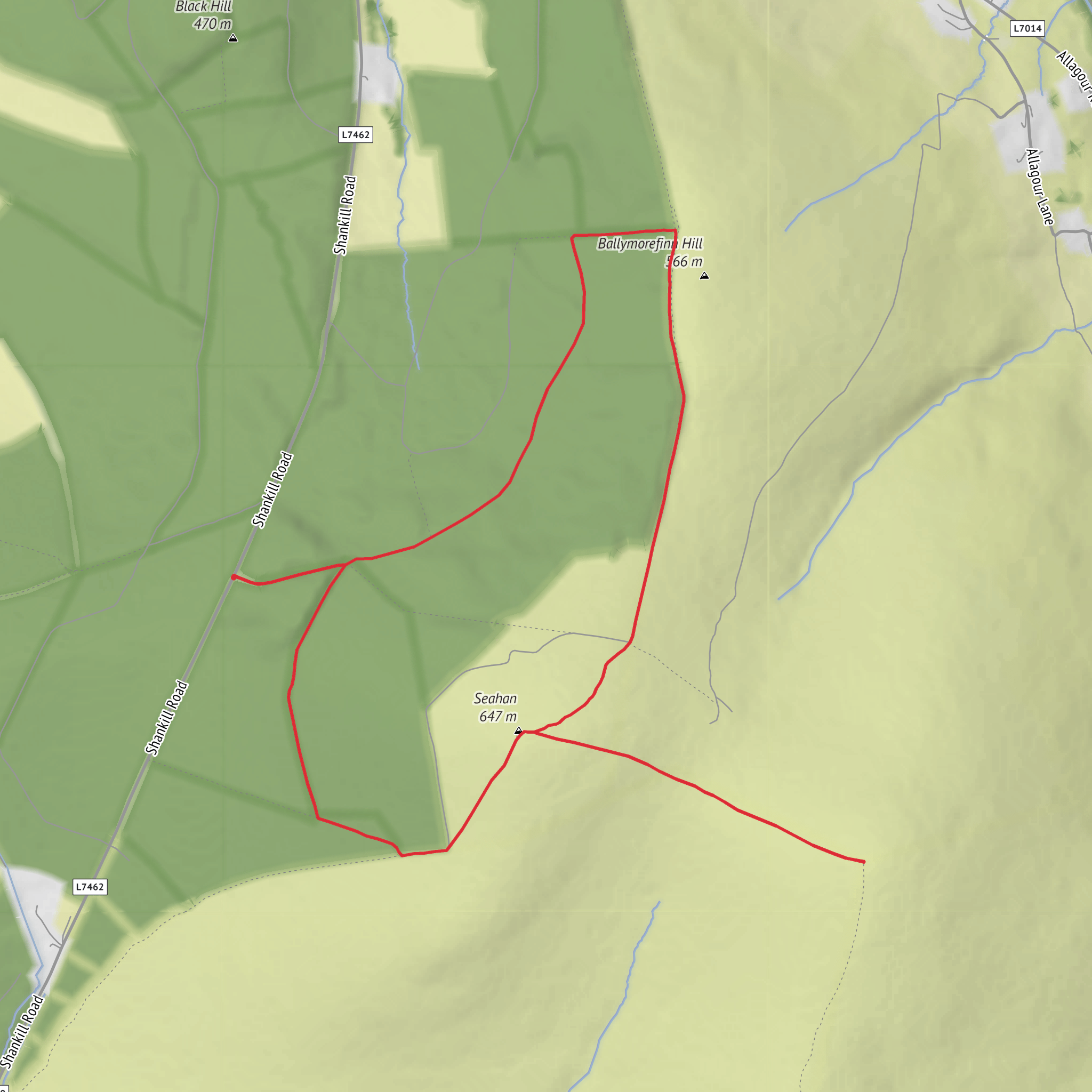
This medium circular walk in the Wicklow uplands gives a compact but rewarding outing of about 7 km (4.3 miles) with roughly 300 m (985 ft) of ascent, combining open mountain ground, broad views, peatland terrain, and a strong sense of prehistoric and upland history. Seahan rises to about 647 m (2,123 ft), while nearby Corrig Mountain reaches about 617 m (2,025 ft), and both sit on the Dublin–Wicklow boundary in a landscape of rounded summits, blanket bog, and old military and farming ground. (dublinmountains.ie)
The start is most closely associated with the upland access area near Kilbride Camp / Manor Kilbride, County Wicklow, which is one of the best-known landmarks below Seahan and Corrig. Heritage material for the area places Kilbride Camp in the basin formed by Seahan, Corrig, Seefingan, and Seefin, making it a useful reference point when planning the approach. (blessington.wicklowheritage.org)
If arriving by car, the usual approach is via the Manor Kilbride / Kilbride Camp side of west Wicklow, using the local mountain roads that climb toward the open uplands below Seahan. Parking arrangements in these areas can be limited and informal, so it is worth checking access and route positioning carefully on HiiKER before setting out. Public transport is much less straightforward here than on lower Wicklow walks: the nearest practical services are generally in the Blessington or west Wicklow area, after which a taxi is often needed to reach the mountain access point. Because trailhead naming can vary across mapping sources in this upland zone, using HiiKER to confirm the exact start location is especially important. (blessington.wicklowheritage.org)
What the route feels like
Expect a short mountain circuit rather than a groomed walking trail. Even though the distance is modest, the medium rating makes sense because the ground can be uneven, wet, and exposed. This is classic Wicklow upland terrain: grassy tracks in places, but also peat, boggy patches, rough trods, and sections where the line of travel may feel less obvious, especially in mist. One older route note for this mountain group specifically mentions that after the Seahan section, signage can become sparse toward Corrig, which is a good reminder not to rely on waymarking alone. HiiKER is the right tool to have open before you leave the car. (alltrails.com)
The climbing is likely to come in one main pull onto the shoulder and summit area, followed by rolling ground between tops rather than constant steep ascent. Around 300 m (985 ft) of gain over 7 km (4.3 miles) usually means the walk feels steady and energetic rather than extreme, but soft ground can make it more tiring than the numbers suggest. In windy or wet weather, the exposed plateau and summit ridges can feel significantly more serious.
Landmarks and terrain along the way
Seahan is the more historically striking summit. It stands on the county boundary and is one of the tallest peaks in the Dublin Mountains, crowned by a prehistoric cairn associated with a wider network of hilltop passage tombs. The broader Seefin–Seahan–Seefingan group is particularly important archaeologically, with Wicklow tourism and the Dublin Mountains Partnership both highlighting these monuments as Neolithic structures dating back roughly 5,000 years. That means this is not just a hillwalk through open country, but a route across a ceremonial landscape that long predates roads, farms, and modern county lines. (visitwicklow.ie)
Corrig adds a wilder, more rugged feel. The name is associated with rocky ground, and the mountain sits on the ridge system linking toward Seefingan and the higher Wicklow interior. The area around Corrig is also tied to blanket bog habitat, with survey material identifying the saddle and slopes between Corrig and Seefingan as upland bog terrain. Underfoot, that often translates to soft, springy peat, wet hollows, and occasional muddy stretches that can slow progress, especially after rain. (mountainviews.ie)
Views, if the cloud lifts, are one of the biggest rewards. From these tops you are in a transition zone between the Dublin Mountains
Surfaces
Unknown
Dirt
Asphalt
Comments and Reviews
User comments, reviews and discussions about the Seahan and Corrig Circular Walk, Ireland.
average rating out of 5
0 rating(s)
