
Download
3D Flyover
Add to list
More
6.4 km
~2 hrs 18 min
618 m
Out and Back
“A steep, boggy pull into the wild Comeraghs, rewarded with dramatic falls and sweeping upland views.”
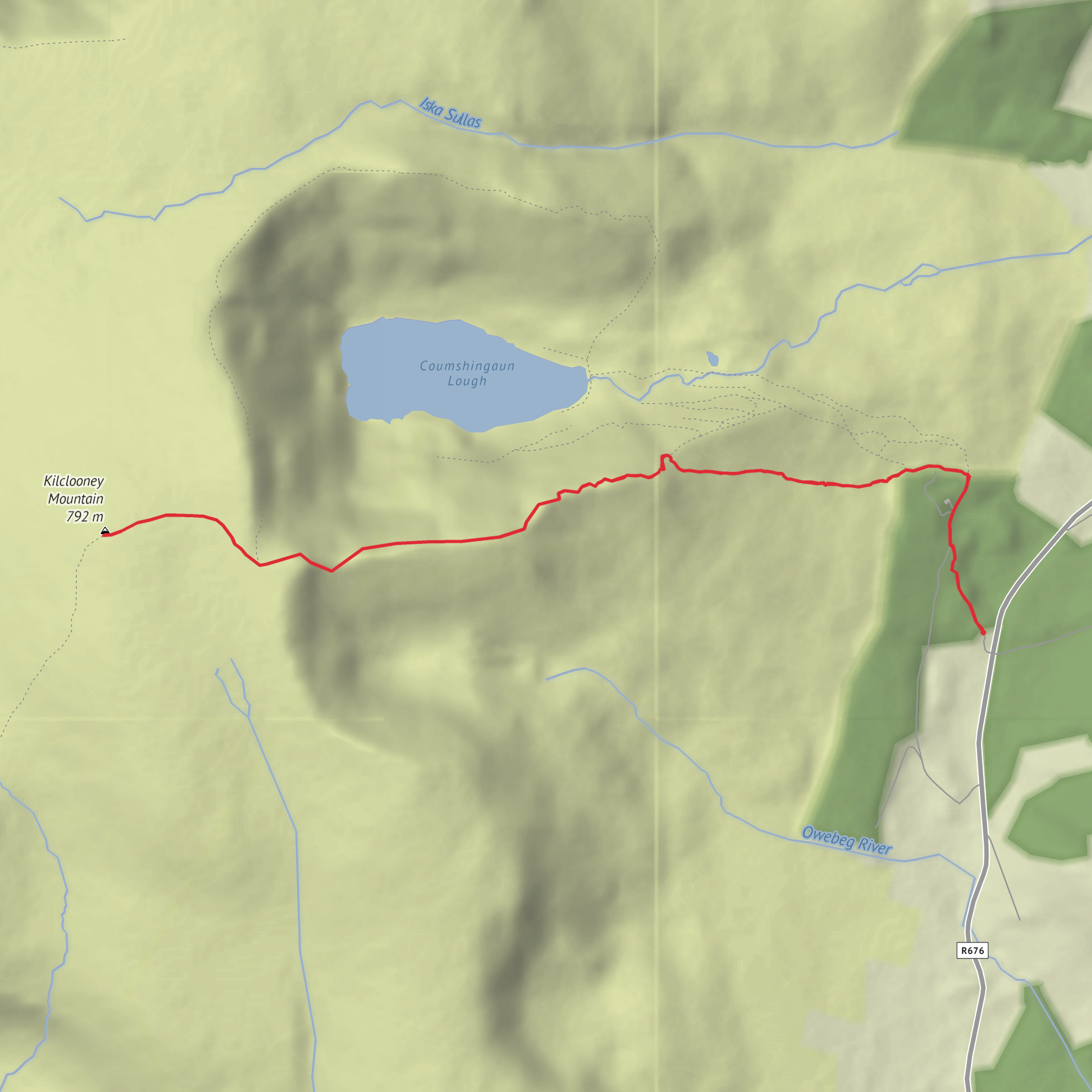
This is a short but demanding mountain outing of about 6 km / 3.7 miles with roughly 600 m / 1,970 ft of ascent, so it packs a lot of climbing into a relatively small distance. Expect a steep, sustained effort rather than a long day on easy gradients. The route is associated with Kilclooney Mountain in the Comeragh Mountains, County Waterford, and the usual access point is the Kilclooney Wood / Mahon Falls area near Kilmacthomas, Co. Waterford. Coillte identifies Kilclooney as a recreation site on the lower slopes of the Comeraghs, about 15 km south of Carrick-on-Suir, and it is widely used as a gateway for tougher mountain walks in this range. (coillte.ie)
Hikers should prepare for a route that feels serious for its length. A difficult rating is appropriate because the ascent is concentrated, the ground can be rough and wet, and mountain weather in the Comeraghs can change quickly. Even on a clear day, sections can be boggy, slippery, or uneven underfoot, especially after rain. Good waterproof footwear, full rain gear, warm layers, food, and water are sensible basics, and route-finding should be planned in advance using HiiKER. (funtler.ie)
What the route is like
From the Kilclooney Wood / Mahon Falls side, the early part of the outing is usually the most straightforward, with access from the parking area and lower approach tracks before the climb steepens decisively onto open mountain terrain. The gradient builds quickly, and much of the elevation gain comes in the middle part of the hike. On a 6 km / 3.7 mile route with 600 m / 1,970 ft of ascent, there is very little flat recovery ground, so pacing matters from the start. (funtler.ie)
As height is gained, the landscape becomes more exposed and more dramatic. This part of the Comeraghs is known for broad upland views, rocky slopes, wet ground, and the kind of open mountain terrain where wind can become a major factor. In poor visibility, the route can feel much more committing than the mileage suggests, so hikers should not rely on obvious tread alone. (funtler.ie)
Landmarks, scenery, and terrain
One of the major scenic draws in this area is Mahon Falls, a well-known waterfall on the northern side of the Comeragh Mountains, and many routes toward Kilclooney Mountain use that area as a visual and practical reference point. The wider landscape is shaped by old glacial processes, with steep-sided mountain forms and dramatic corrie scenery nearby. The Comeraghs are especially valued for their rugged upland character, and the views can extend across County Waterford on a clear day. (alltrails.com)
Nearby, Coumshingaun Lough is one of the best-known glacial corrie lakes in Ireland, and while not every short Kilclooney outing circles it, the broader Kilclooney area is closely associated with access to that spectacular mountain basin. The presence of these corries and steep enclosing slopes is part of what gives the region its wild feel. (funtler.ie)
Underfoot, expect a mix of forest approach, rough mountain path, open hillside, and potentially saturated ground. In wet or windy conditions, the descent can be as tiring as the climb, particularly where grass, mud, or rock become slick. Trekking poles can help on the way down, but the key preparation point is to expect mountain terrain rather than a simple waymarked stroll. (funtler.ie)
Nature and wildlife
The lower slopes around Kilclooney include managed woodland and upland edge habitat, while higher ground transitions into more exposed mountain vegetation. In the woods and lower margins, hikers may encounter common Irish woodland birds and small mammals; Coillte highlights the area as habitat for native wildlife, including mammals found in Irish forests. Higher up, the environment becomes more open and quieter, with heath, grasses, and blanket-bog type conditions typical of Irish uplands. (coillte.ie)
Because this is a wet mountain environment, conditions underfoot also support mosses, sedges, and heather communities, especially away from the more trodden lines. That means the route can be ecologically sensitive as well as physically demanding, so sticking to durable ground where possible helps reduce erosion. This is particularly important on steep sections where informal shortcuts can quickly scar the hillside. (coillte.ie)
Historical significance of the region
The Comeragh Mountains are part of one of the most distinctive upland landscapes in southeast Ireland, and their character is deeply tied to glaciation, older rural land use, and long-standing patterns
Surfaces
Unpaved
Unknown
Comments and Reviews
User comments, reviews and discussions about the Kilcooney Mountain via Fauscoum, Ireland.
average rating out of 5
0 rating(s)
