
Download
3D Flyover
Add to list
More
4.3 km
~1 hrs 21 min
300 m
Out and Back
“A steep, boggy climb leads into Coumduala’s haunting glacial hollow, where wild solitude rewards prepared walkers.”
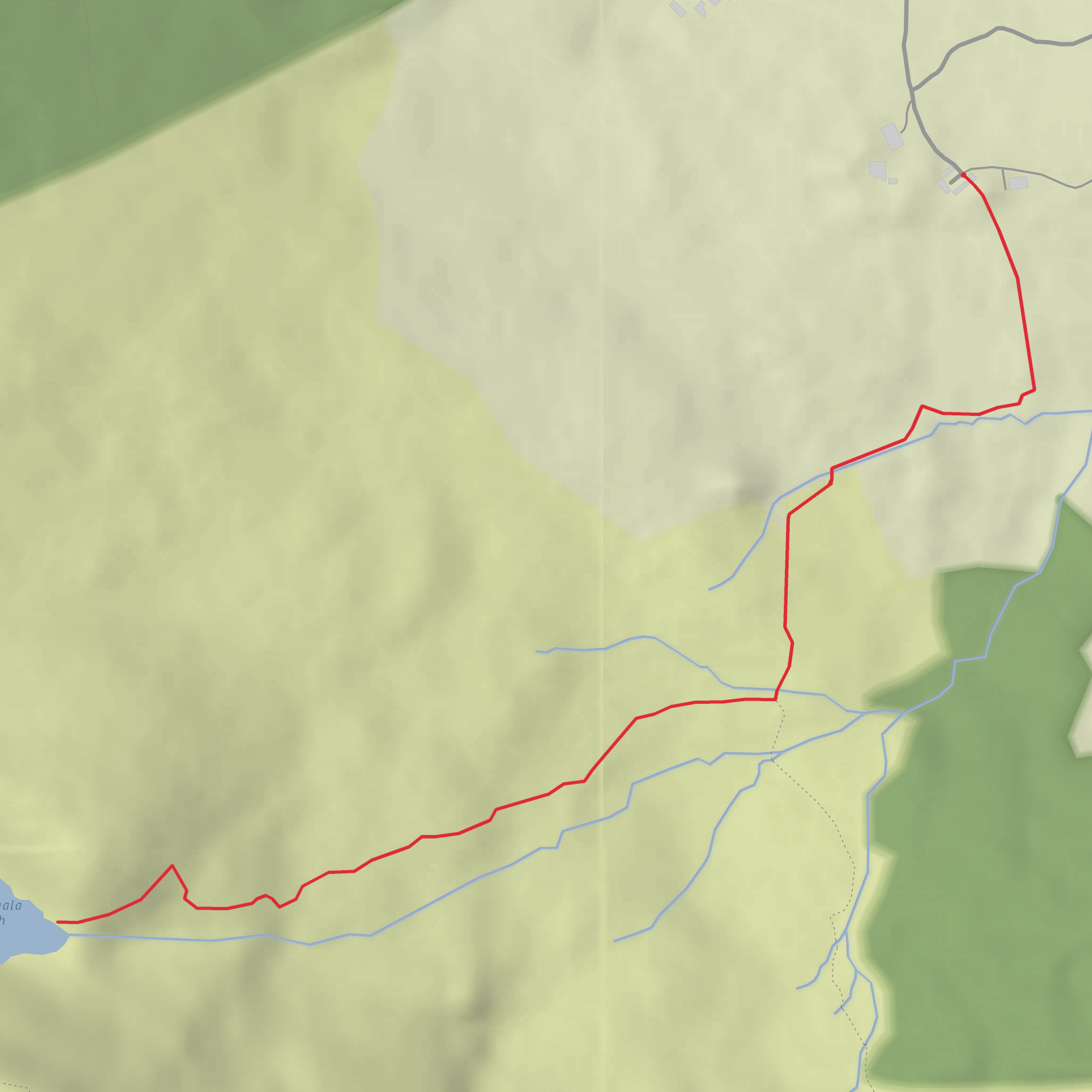
This is a short but quite demanding mountain outing to Coumduala Lough in the Comeragh Mountains, County Waterford, with roughly 4 km / 2.5 miles of walking and about 300 m / 985 ft of ascent. Even at that modest distance, it should be treated as a difficult hike because the ground is often rough, wet, and uneven, and the climb into the coum is steep in places. The setting is remote and exposed, with the lake tucked into one of the Comeraghs’ dramatic glacial hollows. The nearest practical start point is the Curraheen trailhead near Rathgormack, reached by following the R678 west from Rathgormack to Clondonnell Cross, then turning left and continuing about 3 km / 1.9 miles to the sharp right-hand bend at Curraheen, where parking is available near the old farmyard trailhead. Rathgormack is the nearest village, and Ballymacarbry is the nearest town named on the official Nire Valley trail listing. (visitwaterford.com)
From the start, expect a quiet approach through a pastoral edge-of-mountain landscape before the route begins to feel wilder and more enclosed. The lower section is usually the easiest underfoot, but once the track narrows and the climb begins, the terrain becomes more serious: stony patches, boggy ground, wet grass, and mountain paths that can be slippery after rain. On a route of this length, the ascent comes quickly, so it can feel tougher than the numbers suggest. Good waterproof footwear is important, and gaiters are useful if conditions are wet. Because the area is open mountain country, wind, mist, and low cloud can make navigation harder than expected, so checking the route carefully on HiiKER before setting out is sensible. (sportireland.ie)
What to expect on the climb
The main reward is the approach to Coumduala Lough, a corrie lake set beneath the slopes of Knockanaffrin Ridge. “Coum” refers to the steep-sided glacial basin itself, and this landscape is one of the defining features of the Comeraghs. As you gain height, the views open behind you across the Nire Valley side of the mountains, while ahead the ground rises toward the dark, amphitheatre-like hollow holding the lake. The scenery is more rugged than the short distance might imply, with a strong sense of isolation once you leave the road and farm edge behind. Sources describing the wider trail network here also note views toward The Gap and the surrounding Comeragh high ground. (sportireland.ie)
Near the lake, take extra care around steep slopes, wet rock, and any unfenced edges. In poor visibility, the corrie rim and upper mountain ground can be disorienting, and route-finding errors are more likely where paths fade into open hillside. This is also sheep country, and official trail information for the area notes restrictions on dogs along some of these routes. Access is across private land by permission on parts of the local trail system, so sticking to the marked line and leaving gates as found matters. (sportireland.ie)
Nature, wildlife, and landscape character
The Comeraghs are known for their glacial landforms, and Coumduala is one of several notable corries in this part of Waterford. The lake itself sits in a basin carved by ice, with steep enclosing slopes and a distinctly wild mountain feel. Around the route, expect blanket bog, heath, rushy ground, and upland grasses rather than woodland walking. In warmer months, heather and other moorland plants add color, while wetter sections support mosses and sedges typical of Irish uplands. (visitwaterford.com)
Wildlife is usually subtle rather than showy, but hikers may notice sheep, upland birds, and the usual mix of small songbirds around the lower fields and hedgerows. In the more open mountain sections, keep an eye out for raptors or corvids using the updrafts, especially on breezy days. The
Surfaces
Unpaved
Unknown
Comments and Reviews
User comments, reviews and discussions about the Coumduala Lough, Ireland.
average rating out of 5
0 rating(s)

