
Download
3D Flyover
Add to list
More
9.2 km
~2 hrs 28 min
384 m
Out and Back
“A wild Comeragh ramble reveals bead-like loughs, towering glacial walls, and deceptively testing ground.”
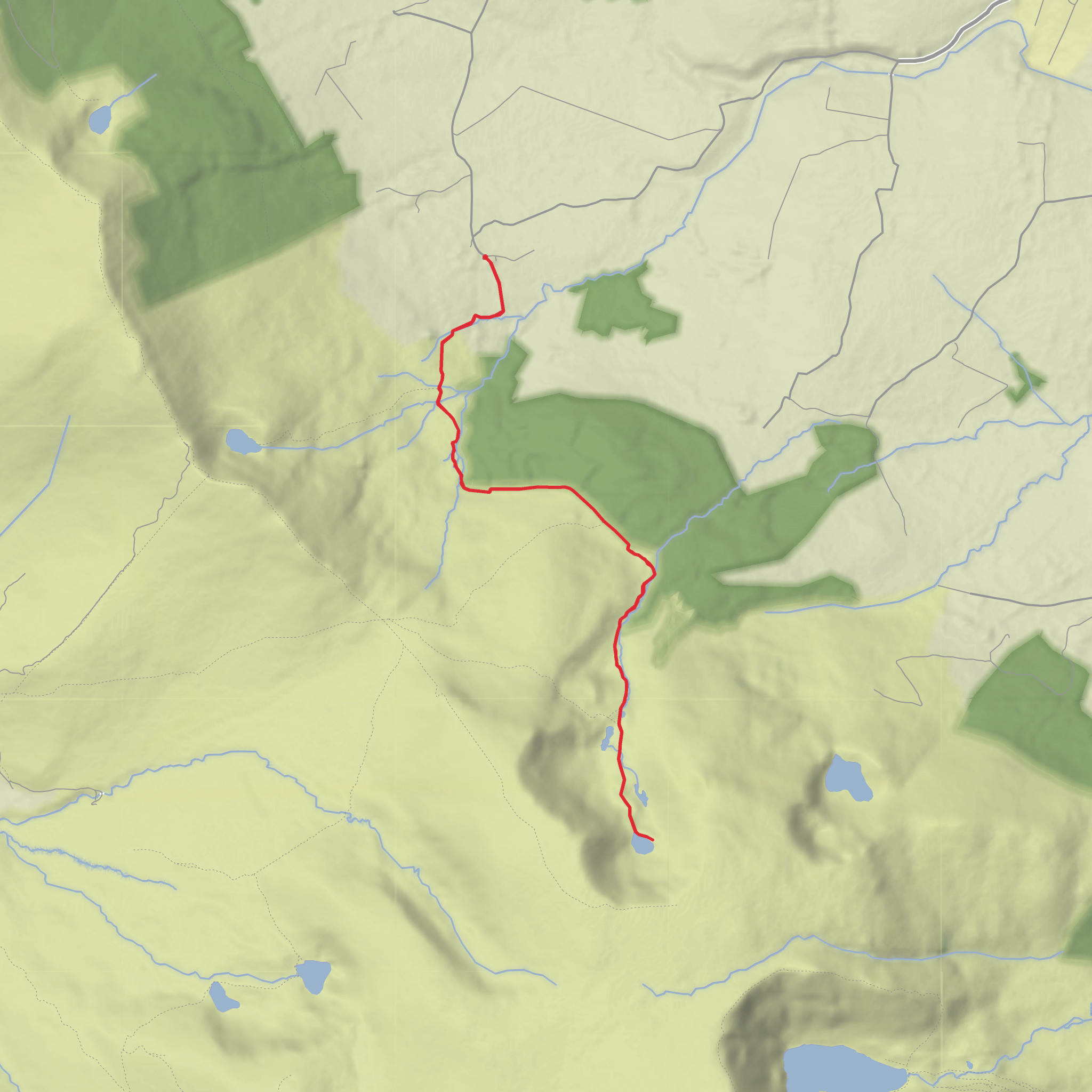
This is a compact but rewarding mountain outing of about 9 km / 5.6 miles with roughly 400 m / 1,312 ft of ascent, set in the Comeragh Mountains of County Waterford. The route explores the dramatic basin of Coum Larthar Loughs—also called “The Boolas” locally—where a chain of mountain lakes sits beneath steep glacial walls. The terrain is typically a mix of minor road or access track at the start, then open mountain ground with wet patches, rough grass, peat, rock, and uneven slopes, so even though the distance is moderate, the footing can make it feel more serious than the numbers suggest. The area is generally rated medium, but in poor visibility it can feel harder because the upland landscape is broad and exposed. (visitwaterford.com)
The nearest practical start point is around Rathgormack, County Waterford, with the walk associated with the Boolas/Coum Larthar area above the village. A useful nearby landmark is Boola Bridge / Buaile Bridge on the upland road network south-west of Rathgormack, with The Gap and Graigavalla also appearing as key local reference points on walking maps for this area. Rathgormack is the main settlement to aim for by road, and from there the mountain access roads lead toward the upland start used for the local loop walks. (visitwaterford.com)
By car, the simplest approach is to drive to Rathgormack first, then continue on the local mountain roads toward the Boolas/Coum Larthar side of the Comeraghs. Parking in this kind of upland access area is usually limited and informal rather than a large serviced trailhead, so arrive early, park carefully without blocking gates or farm access, and be prepared for narrow roads. Public transport is more limited: the best strategy is usually to travel by bus or rail to Clonmel or Waterford City, then continue by local taxi to Rathgormack, as direct service to the mountain start is not typically available. Because rural timetables can change, it is worth checking current connections in advance and plotting the route carefully in HiiKER before setting out. (visitwaterford.com)
What the route is like
The opening section is usually the gentlest part of the day, giving you a chance to settle in before the climb begins in earnest. As you leave the lower access area and gain height, the landscape opens quickly and the character changes from pastoral edge-of-mountain scenery to a much wilder upland setting. The ascent is steady rather than relentlessly steep, but there are sections where boggy ground, loose stone, or slick rock can slow progress, especially after rain.
As height is gained, the main attraction comes into view: the long glacial hollow of Coum Larthar. This corrie is one of the standout landforms in the Comeraghs and is noted as the longest coum at about 1 km / 0.6 miles, containing a string of lakes linked by a stream. Geologists describe these as paternoster lakes, a sequence of small lakes arranged like beads. The backwall of the corrie rises sharply, with near-vertical rock faces reaching up to around 200 m / 656 ft in places, giving the basin a much bigger feel than the route statistics suggest. (gsi.geodata.gov.ie)
Expect the most memorable views around the loughs themselves. In calm weather, the water and dark sandstone slopes create a stark, almost amphitheatre-like scene. In mist, the same ground becomes atmospheric but much more committing from a navigation point of view. If the route circles or skirts the basin edge, take extra care near steep drops and avoid wandering too close to corniced or unstable edges in winter conditions.
Landmarks, geology, and mountain character
The defining landmark is the chain of Coum Larthar Loughs / Locha Chom Larthair, set in a glacial corrie carved into Devonian Old Red Sandstone during the Quaternary Ice Age. The Comeraghs are famous for these corries, and Coum Larthar is one of the clearest examples of how ice sculpted deep armchair-shaped hollows into the plateau edge. The stepped rock and lake sequence are part of what makes this walk so distinctive. (gsi.geodata.gov.ie)
Another important nearby landmark is The Gap, described in local walking material as the highest mountain
Surfaces
Unpaved
Ground
Unknown
Comments and Reviews
User comments, reviews and discussions about the Coum Larthar Loughs, Ireland.
average rating out of 5
0 rating(s)
