
Download
3D Flyover
Add to list
More
3.1 km
~44 min
77 m
Loop
“A short but stirring loop above Sruwaddacon Bay blends wild bog, big views, and layered history.”
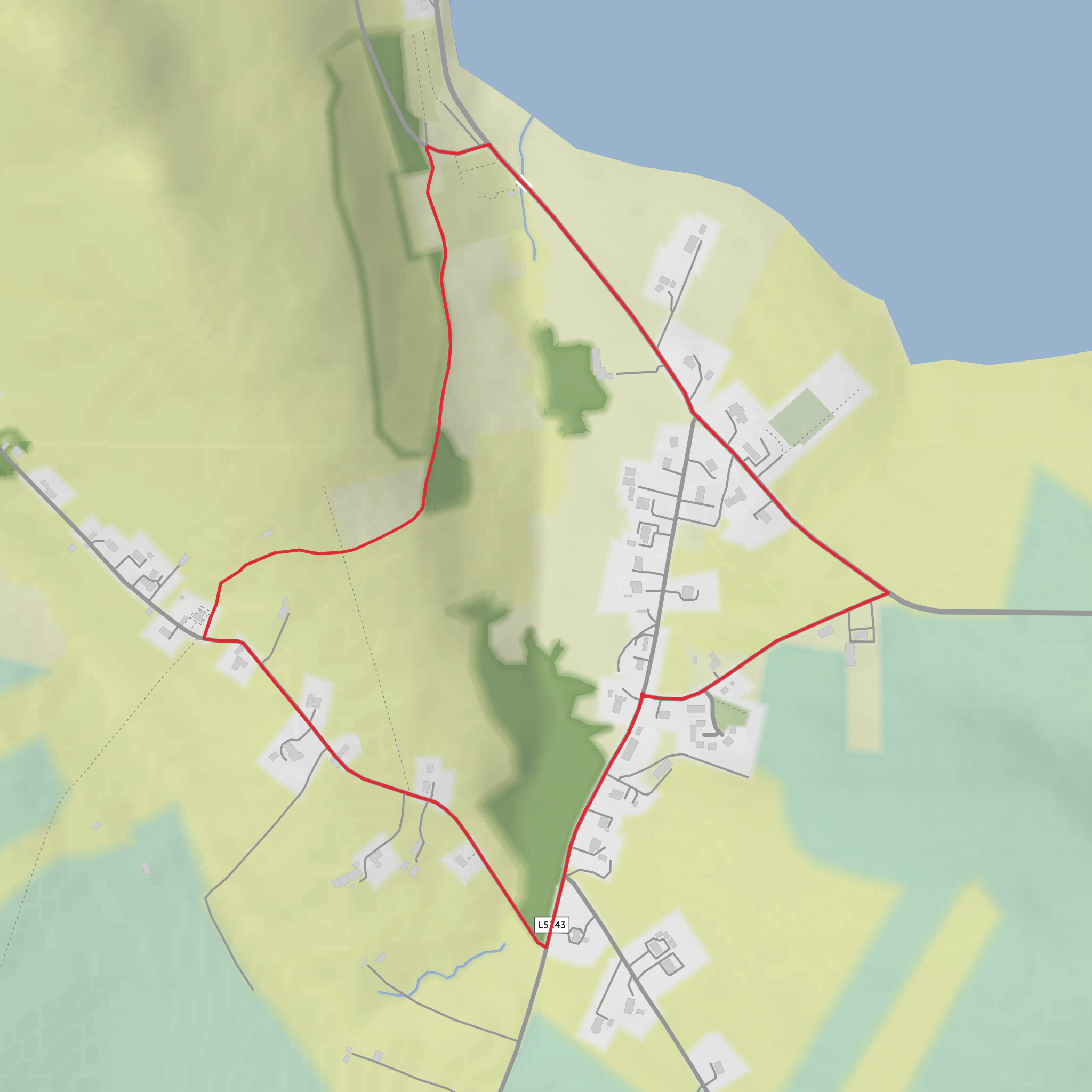
This short coastal loop above Sruwaddacon Bay packs a surprising amount into about 3.1 km / 1.9 miles, with roughly 94 m / 308 ft of ascent and a high point near 103 m / 338 ft. It starts across the road from McGuire’s Valley Inn Bar in Pullathomas, a small Gaeltacht village in northwest County Mayo, and follows a mix of rough track, quiet country road, and paved road. Although the distance is modest, the route is not completely gentle: there is a short, steep climb near the beginning that quickly earns the trail’s medium feel for many walkers. (irp.cdn-website.com)
The setting is one of the main reasons to come. Pullathomas sits where Sruwaddacon Bay narrows toward Broadhaven Bay, and the loop rises just enough to open broad views over water, bog, and low hills. Expect a landscape that feels exposed to Atlantic weather even when the village itself seems sheltered. Underfoot, the rougher sections can be wet or uneven, especially after rain, so sturdy footwear is more than a formality here. Part of the route is also shared with vehicles, which means you should stay alert on the road sections, especially in poor visibility or if walking with children. (irp.cdn-website.com)
What to expect on the route
From the trailhead, the walk begins with the sharpest effort of the day. That early pull gains most of the route’s elevation in a short burst, and it is the section most likely to leave casual walkers breathing harder than expected. Once above the village, the gradient eases and the character of the walk becomes more scenic than strenuous, with the bay below and open bogland around you. The terrain changes enough to keep it interesting: rough track gives the walk a slightly wild edge, while the road sections make navigation straightforward when visibility is good. Official waymarking is on black posts with green arrows, and if you want a digital backup, HiiKER is the navigation tool to use. (irp.cdn-website.com)
Because the route is only around an hour for many walkers, it works well as a short outing, but it is best approached with the same care you would give a longer coastal walk. Wind can be strong, rain can move in quickly, and the boggy ground nearby can stay saturated. In autumn and winter especially, waterproof layers are important, and extra caution is sensible after prolonged heavy rain. (irp.cdn-website.com)
Landmarks, nature, and local character
One of the most significant nearby landmarks is the old churchyard at Pullathomas, associated with St Coman, from whom Kilcommon parish takes its name. The cemetery climbs the hillside above the bay and remains an important historic feature of the village. Nearby as well is the Dooncarton stone circle, a Bronze Age monument with seven surviving stones and wide views over Broadhaven Bay. Even if the loop itself is short, the surrounding area carries a deep sense of time, with prehistoric remains, early Christian associations, and old field systems all contributing to the atmosphere. (irelandme.com)
The region’s more recent history is also impossible to ignore. On 19 September 2003, after intense rainfall, around thirty peat slides came down from Dooncarton Mountain between Pullathomas and Glengad. A corner of the old graveyard was struck and graves were swept into the sea. That event remains one of the defining modern stories of the area, and it is part of why the local bog landscape should be treated with respect, especially in very wet conditions. (irelandme.com)
Wildlife is typical of Mayo’s coastal bog and bay environment. Depending on season and tide, walkers may notice seabirds and shorebirds around the water, along with common upland and farmland species in the surrounding open ground. The vegetation is part of the appeal too: blanket bog, grasses, heather, and weather-shaped coastal growth give the route a distinctly western Irish feel. Sheep and farm activity are also part of the landscape, so gates should be respected and dogs, if allowed locally, should be kept under close control around livestock. The official trail guidance also emphasizes respecting wildlife and farm stock. (irp.cdn-website.com)
Planning and access
The trailhead is at the start/finish point across from McGuire’s Valley Inn Bar, Pullathomas, County Mayo, using the published coordinates 54.26210, -9.80083. That places the start by the village road near the inn, the primary school, Kilcommon Hostel
Surfaces
Asphalt
Ground
Comments and Reviews
User comments, reviews and discussions about the Pullathomas Loop, Ireland.
average rating out of 5
0 rating(s)
