
Download
3D Flyover
Add to list
More
12.8 km
~3 hrs 19 min
451 m
Out and Back
“A wild Atlantic loop of soaring cliffs, lonely bog, and hard-won views that demand respect.”
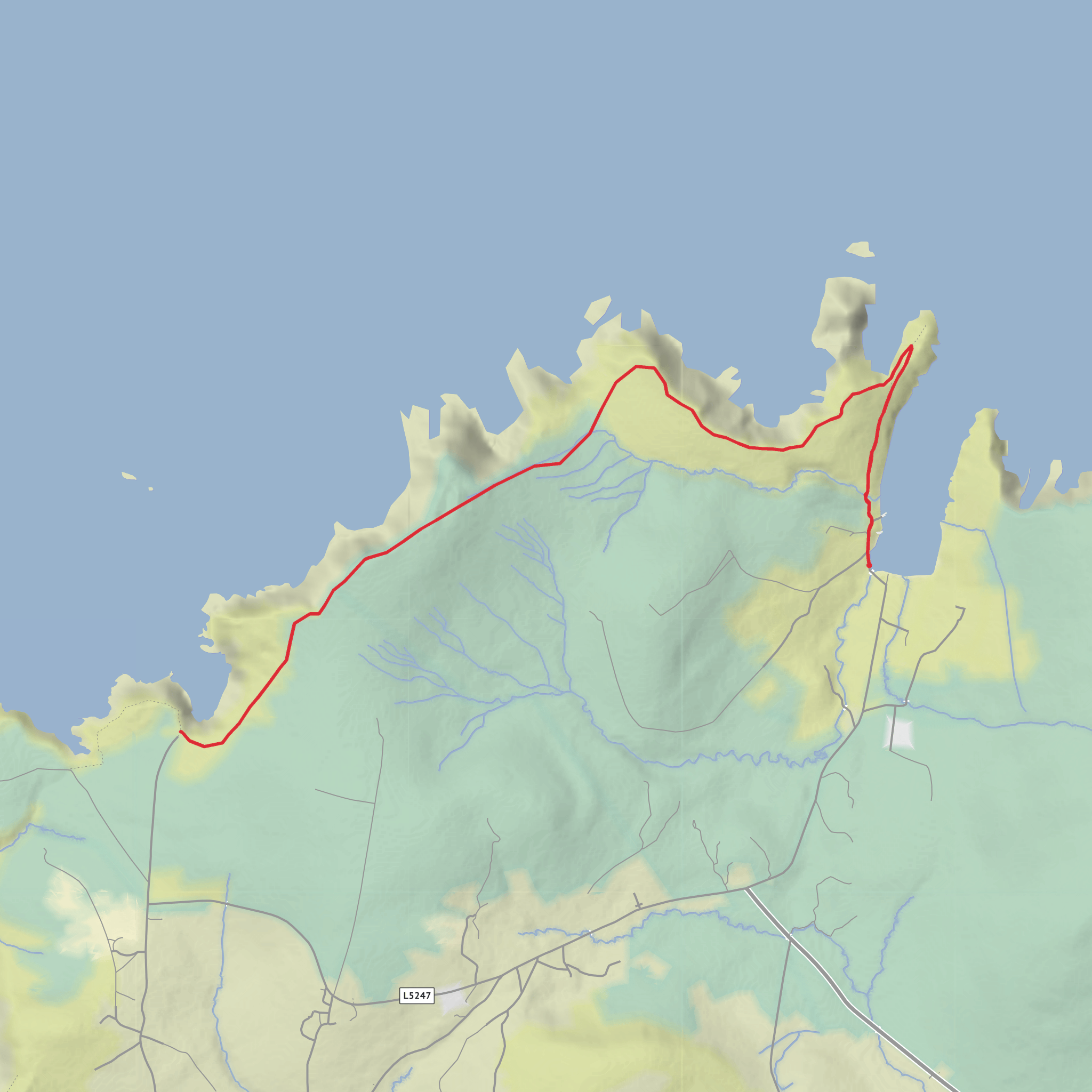
This coastal loop on the far north Mayo coast is a serious outing despite the “medium” estimate. Expect roughly 13 km / 8.1 miles with about 500 m / 1,640 ft of climbing overall, though official trail listings vary a bit and commonly put it closer to 11.3–12.9 km with 383 m of ascent. Either way, it is a committing half-day walk on exposed Atlantic terrain, and most hikers should plan for around 4 to 5 hours depending on weather, ground conditions, and how long they linger at the viewpoints. (sportireland.ie)
The route starts in or just beside Carrowteige Village, County Mayo, in the Gaeltacht area of Ceathrú Thaidhg, with the trailhead described as opposite the village shop. The nearest practical landmark for the start is Carrowteige Village / Ceathrú Thaidhg, near the village shop, and one official listing gives the start coordinates as 54.31314, -9.81323, while another places the trailhead at F26, Cnoc an Daimh, Mayo, Ireland. (sportireland.ie)
By car, the usual approach is from Glenamoy on the R314, between Ballycastle and Belmullet. From Glenamoy, head toward Belmullet for about 2 km / 1.2 miles, turn right at the junction signposted for Ross Port, then continue for about 12 km / 7.5 miles, staying straight at the Ross Port turnoff, to reach Carrowteige. Parking is limited, so arrive early in good weather or on weekends. Some local information also notes a small parking area near the Children of Lir sculpture, which can serve as a starting point for shorter cliffside explorations toward Benwee Head. (mayotrails.com)
Public transport is the weak point here. One official trail listing states none for public transportation to the trail. In practice, hikers without a car usually need to arrange a taxi from Belmullet or another larger town in Erris. (sportireland.ie)
What the walk is like
The route is a loop over bog track, open bogland, grassy paths, sheep trails, and cliff-top ground. Underfoot is often described as relatively dry peat by local trail sources, but that should not be taken to mean easy footing. Peat can still be soft, uneven, and energy-sapping, especially after rain. There are no big mountain gradients, but the repeated rises and dips, rough ground, and exposure make the walk feel harder than the raw numbers suggest. (sportireland.ie)
Waymarking is typically purple arrows on a white background, and this is one of those walks where staying attentive matters. In mist, the open bog sections can feel featureless, and near the cliffs you need to be disciplined about line choice. If you are using digital navigation, use HiiKER alongside the waymarks and do not rely on a faint path alone. (sportireland.ie)
The opening section eases you out of the village and into a broad, treeless coastal landscape. The sense of remoteness builds quickly. This is not a woodland or mountain-valley walk; it is an exposed headland route where the Atlantic dominates the experience. As the loop progresses, the terrain becomes more dramatic, with the route working toward the high coastal edge around Benwee Head.
Cliffs, landmarks, and standout scenery
Benwee Head is the main objective and the visual payoff is enormous. Mayo County Council describes cliffs here as more than 250 m / 820 ft high above the Atlantic, while other local sources note the route reaches around 255 m / 837 ft above sea level. From the headland, hikers can expect towering sea cliffs, offshore stacks, rocky arches, and a huge sweep of ocean and coastline. (mayo.ie)
One of the most memorable nearby features is Kid Island, visible from the higher ground, and on a clear day there are reported views toward Slieve League on the Donegal coast. The broader setting also includes views over Broadhaven Bay and the Stags of Broadhaven, giving the walk a huge sense of scale. (discoverireland.ie)
A notable landmark on or near the route is the Children of Lir sculpture, associated with the dramatic cliff scenery around An Príosún / “the Prison,” a cove area tied to local legend and storytelling. This adds a cultural layer to what is already one of the most
Surfaces
Unknown
Grass
Comments and Reviews
User comments, reviews and discussions about the Benwee Head Walk, Ireland.
average rating out of 5
0 rating(s)

