
Download
3D Flyover
Add to list
More
8.9 km
~2 hrs
136 m
Loop
“A gentle Laois ramble unfolds through hedgerows, old townlands, and wide pastoral views beneath Dysart Church.”
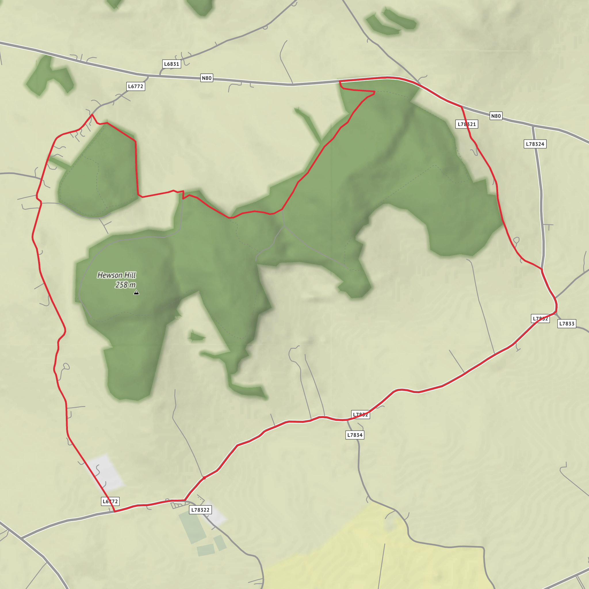
This easy loop of about 9 km (5.6 miles) with roughly 100 m (328 ft) of climbing explores the quiet rural landscape around the townlands of Dysart, Grange Upper, and Coolnacarrick in County Laois, Ireland. The terrain is generally gentle, so it suits walkers looking for a relaxed half-day outing rather than a strenuous hill day. Expect a mix of minor country roads, farm-lined lanes, and open countryside with broad views over the Laois lowlands. The climbing is modest and tends to come in short, gradual rises rather than any long sustained ascent, so the route is usually manageable for most walkers with a basic level of fitness.
The start is best understood as being near Dysart Church and graveyard, close to Ratheniska, County Laois, which is a more useful landmark than the townland name alone. The surrounding place names can feel quite local and scattered, so using HiiKER before setting out is the simplest way to confirm the exact line of the loop and any turns at rural junctions. (laois.ie)
What the route feels like
From the opening stretch, the walk has a distinctly pastoral character. You are moving through an old agricultural district where fields, hedgerows, quiet lanes, and small rises define the landscape. Because the route links several townlands rather than following a single enclosed woodland or mountain path, it feels spacious and open, with changing views rather than one continuous feature. The easy grading is consistent with this kind of outing: the route is more about steady walking and local atmosphere than technical footing or steep ground. (laois.ie)
Around the first few kilometres, expect gentle undulations and long hedgerow sections where visibility can open suddenly across farmland. In clear weather, these low ridges and folds in the land give the walk more visual interest than the modest elevation figures might suggest. Road walking likely forms part of the route, so it is worth staying alert for occasional local traffic, especially on bends and at farm entrances. Waterproof footwear is still useful, as roadside verges and field-edge sections in rural Laois can remain damp after rain.
Landmarks, landscape, and wildlife
The most significant landmark in the area is Dysart Church, an old church site on elevated ground that has long been noted as a picturesque feature in the parish. A 19th-century topographical account specifically described the church with its square tower as standing on one of the Dysart hills, making it both a visual anchor and a reminder that this landscape has been settled and used for centuries. (libraryireland.com)
The route also passes through townlands with deep historical roots. Dysart, Grange Upper, and Coolnacarrick all appear in older civil and census records for the parish of Dysartenos, showing how long this patchwork of farms and settlements has been established. That gives the walk a strong sense of continuity: even when the scenery seems simple, you are moving through a landscape shaped by generations of farming, parish life, and local road networks. (from-ireland.net)
Wildlife is likely to be typical of the Irish midlands countryside. Hedgerows and field margins can support small songbirds, while open pasture may attract rooks, crows, swallows in season, and birds of prey scanning for movement. In wetter patches and ditches, you may notice frogs, insects, and the dense plant growth that thrives in lowland farmland. The Laois habitat surveys confirm that these townlands were included in county habitat work, which suggests ecological variety even in what appears to be ordinary agricultural country. (laois.ie)
Historical significance of the area
Surfaces
Unknown
Asphalt
Gravel
Comments and Reviews
User comments, reviews and discussions about the Dysart, Grange Upper and Coolnacarrick Loop, Ireland.
average rating out of 5
0 rating(s)
