
Download
3D Flyover
Add to list
More
4.6 km
~54 min
0 m
Out and Back
“A gentle River Nore stroll through wild meadows, weirs, and echoes of Kilkenny’s past.”
This easy riverside walk follows one of the most pleasant sections of Kilkenny’s River Nore Linear Park, with roughly 5 km / 3.1 miles of mostly flat walking and only negligible ascent—about 0 m / 0 ft overall. It suits families, casual walkers, runners, and anyone looking for a gentle outing with long river views, open meadow scenery, and a strong sense of Kilkenny’s natural and industrial past. The route is part of a wider network of paths on both banks of the River Nore through the city. (kilkennycoco.ie)
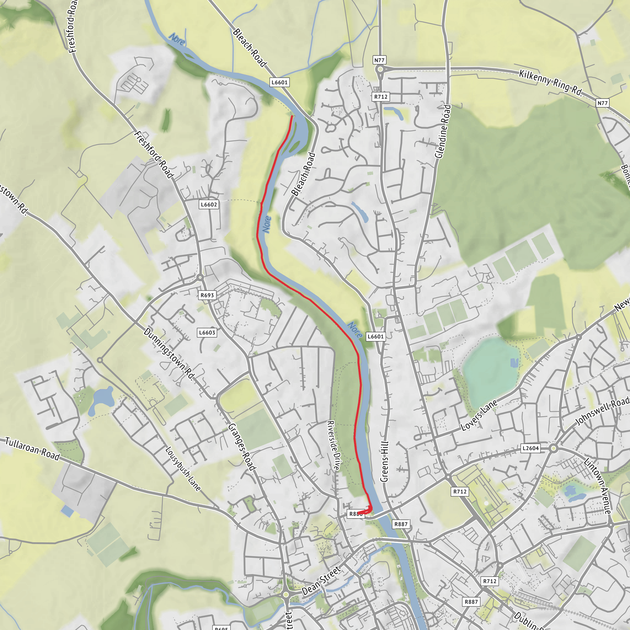
The walk is generally associated with Bishop’s Meadows on the north side of Kilkenny City, and the nearest practical landmark for the trail area is Riverside Drive, Bishopsmeadows, Kilkenny. A useful reference point is the Bishop’s Meadows section of the River Nore Linear Park near the riverside access from the residential area and parkland there. Online route references also place this section at Riverside Drive, Bishopsmeadows, which is the clearest nearby address-style location for planning purposes. (wanderlog.com)
Expect a broad, easy-going outing rather than a mountain trail. The terrain is low-lying and riverside, so the walking is typically straightforward underfoot, with long level stretches beside meadow grassland and the River Nore. Because the route sits in a floodplain landscape, conditions can feel exposed in wet or windy weather, and after rain some sections may be soft or damp even though the elevation profile is gentle. The easy rating is well deserved, but waterproof footwear is still a sensible choice outside dry summer spells.
What the route feels like
From the Bishop’s Meadows side, the walk begins in open riverside meadowland where the city quickly gives way to a quieter green corridor. One of the first notable features is the horseshoe weir, installed as part of the Kilkenny City Flood Relief Scheme in 2002. This is both a visual landmark and a reminder that the river here is carefully managed; the flood-relief works continue for about 5 km downstream from this point. (kilkennycoco.ie)
As the route continues, the character shifts between open grassland, riverbank path, and more enclosed stretches where the river draws closer. The meadows are a defining feature of this walk, giving it a spacious feel that is quite different from a wooded greenway. Kilkenny County Council has noted meadow-style management along the linear park, including reduced cutting to support pollinators, so depending on the season you may find taller grasses, wildflowers, and a more natural look than in a formal urban park. (kilkennycoco.ie)
Farther along, the walk extends toward Talbot’s Inch, a picturesque historic area on the river. This section adds more heritage interest to the outing, especially for walkers who enjoy noticing how the river shaped settlement, transport, and industry around Kilkenny. At the far end of the Bishop’s Meadows Walk is the Bleach Road Weir, another important riverside landmark linked to the area’s milling past. (kilkennycoco.ie)
Landmarks, history, and local character
This is a short walk, but it carries a surprising amount of historical depth. The River Nore itself has long been central to Kilkenny’s development, and the wider linear park was created to open up access to the river corridor through the city. Planning documents describe the River Nore as the principal river flowing through Kilkenny and emphasize the strategic value of connected riverside open space for recreation and the city’s identity. (ourplan.kilkenny.ie)
The Talbot’s Inch Village section is especially significant. According to Kilkenny County Council, the village was built by Lady Desart in the early 1900s on the western bank of the river. She also had a pedestrian bridge built in 1906 to connect the village with mills on the eastern bank. That bridge was destroyed in the great flood of 1947, but remnants are still visible, giving walkers a tangible link to the area’s social and industrial history. (kilkennycoco.ie)
The route also sits within a broader story of river engineering and transport. On the wider River Nore Linear Park, the nearby Canal Walk traces an 18th-century attempt to make the Nore navigable between Kilkenny and Inistioge. Although that navigation project did not fully succeed, it left behind one of Kilkenny’s best-loved walking
Surfaces
Asphalt
Paved
Unknown
Wood
Comments and Reviews
User comments, reviews and discussions about the River Nore Linear Park - Bishopsmeadows Walk, Ireland.
average rating out of 5
0 rating(s)
