
Download
3D Flyover
Add to list
More
16.9 km
~3 hrs 56 min
340 m
Point to Point
“A gentle valley ramble from historic Camp to Annascaul, framed by ridges, hedgerows, and shifting mountain light.”
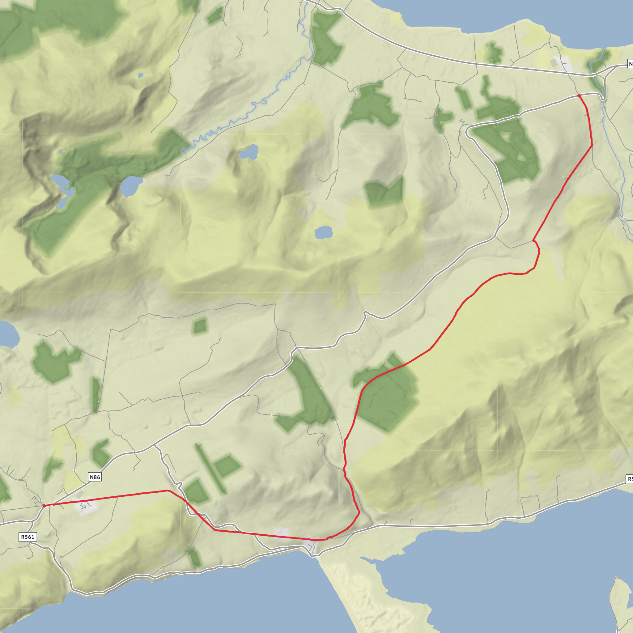
This 17 km / 10.6 mile stage from Camp to Annascaul is one of the more approachable days on the Dingle Way, but it still asks for steady pacing and good preparation. With roughly 300 m / 985 ft of ascent, it is best thought of as a medium-grade day of rolling country walking rather than a hard mountain outing. Much of the route uses quiet minor roads and lanes, with a gradual climb out of Camp before the trail trends across open countryside and eventually drops toward Annascaul. The official Dingle Way material describes this section as easier-going than the previous stage, largely because it follows very lightly used roads through the valley between the surrounding ridges. (dingleway.com)
Camp is a small village in County Kerry on the northern side of the Dingle Peninsula, and it serves as the practical start point for this stage. The village itself is closely tied to the old Tralee–Dingle railway era; the line served the area until 1953, and that transport history still lingers in local place identity, including the Railway Tavern and the old rail heritage remembered in the village. (dingleway.com)
Getting to the start is fairly straightforward by Kerry standards. By public transport, Bus Éireann Route 275 runs between Tralee and Dingle via Camp, and Camp is also listed on Route 273 services from the Tralee side on certain schedules. Annascaul is also served on Route 275, which makes this a convenient linear walk if you want to leave a car at one end or return by bus. If arriving by car, most walkers approach Camp from Tralee on the N86 and use informal village parking or accommodation parking where permitted; because Camp is small and spread out rather than centered on a single large trailhead, it is worth arranging parking with a guesthouse, pub, or other local business if staying overnight. (buseireann.ie)
The route begins near Camp village, the nearest clear landmark being the village itself on the N86 corridor rather than a formal standalone trailhead. From there, the walking quickly settles into the character of this stage: narrow rural roads, hedgebanks, scattered farms, and broad views shaped by the Slieve Mish range. Early on, the route leaves behind the busier road corridor and moves into quieter country where the walking is more rhythmic than technical. Expect a gentle to moderate climb over the first part of the day, with the ascent spread out rather than concentrated in one punishing pull. (dingleway.com)
What the route feels like
For the first several kilometres, the trail works its way south and southwest on minor roads through a wide valley landscape. The Dingle Way’s own description places the route between the long ridges of Moanlaur and Knockmore on one side and the main Tralee–Dingle road on the other, which helps explain the sense of walking through a broad natural corridor rather than directly along the coast. (dingleway.com)
Although the total ascent is only around 300 m / 985 ft, the route has enough undulation to keep it interesting. A useful expectation is that the first half feels like a gradual build, while the latter half becomes more about maintaining momentum and then enjoying the descent into Annascaul. Some itineraries list this stage at about 17 to 18 km with around 340 m of ascent, so small differences in recorded totals usually come down to mapping choices and exactly where accommodation starts and ends are measured. (dingleway.com)
Underfoot, this is generally a simpler day than boggier or rougher upland sections elsewhere in Kerry. That does not mean it is effortless: road walking can be tiring in its own way, especially in wet or windy weather, and even quiet lanes require attention for the occasional vehicle. Good waterproofs, visible clothing in dull conditions, and comfortable footwear with enough cushioning for hard surfaces are all worthwhile. Because waymarking on the Dingle Way can vary in visibility depending on weather and roadside clutter, carrying the route in HiiKER is a sensible backup.
Landmarks, scenery, and natural interest
One of the pleasures of this stage is the changing relationship between mountain and lowland scenery. Camp sits with views toward Tralee Bay and beneath the influence of the Slieve Mish Mountains, and as the route progresses the landscape opens into a mix of pasture, stone boundaries, hedgerows, and long views toward the interior of the peninsula. (dingleway.com)
The surrounding hills are part of the larger mountain framework that shapes the Dingle Peninsula, and even on a relatively moderate day like this
Surfaces
Asphalt
Unknown
Grass
Unpaved
Concrete
Comments and Reviews
User comments, reviews and discussions about the Camp to Annascaul via Dingle Way, Ireland.
average rating out of 5
0 rating(s)
