
Download
3D Flyover
Add to list
More
17.0 km
~4 hrs 27 min
640 m
Out and Back
“A wild crossing from Annascaul Lake to Glenahoo, rich in glacial drama, old paths, and moody skies.”
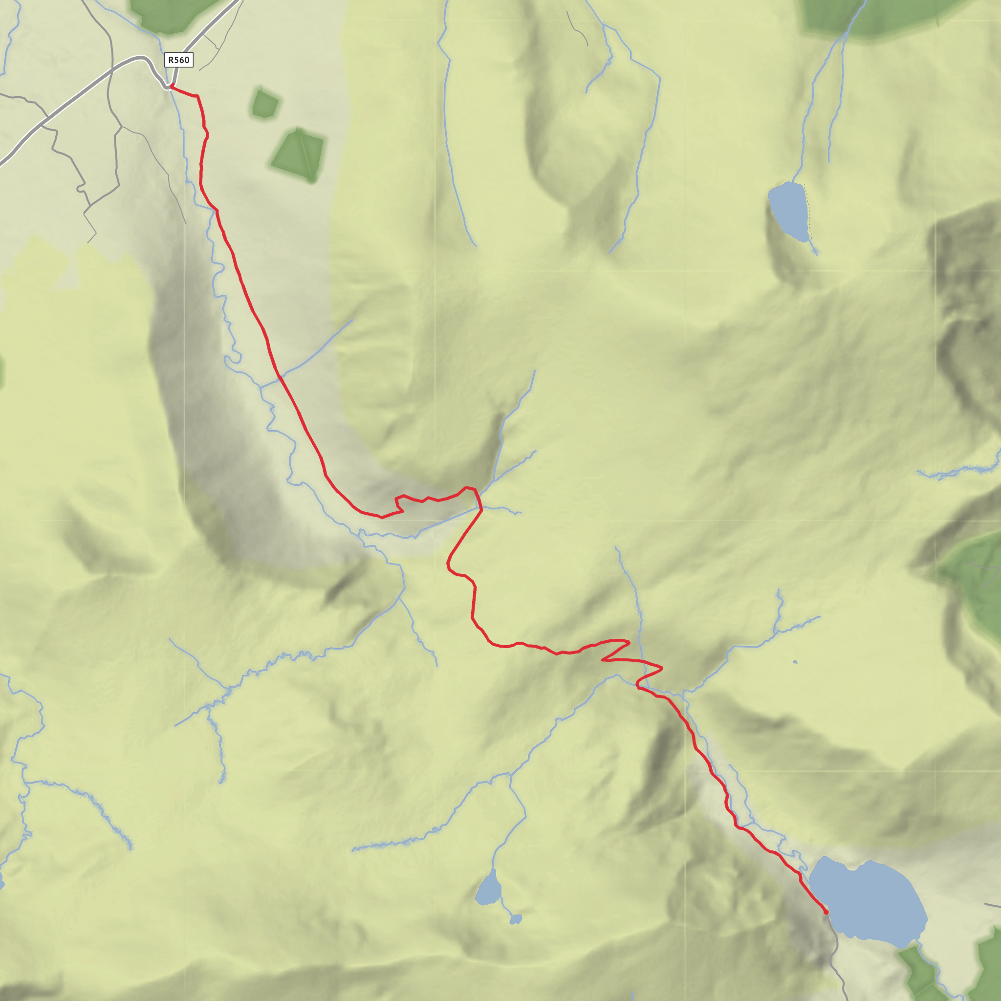
This point-to-point walk links the glacial basin of Annascaul Lake with the upland valley of Glenahoo on the north side of the Dingle Peninsula, covering about 17 km / 10.6 miles with roughly 600 m / 1,970 ft of ascent. It is generally a medium-grade day hike: long enough to require steady fitness, but on a route that is better known for exposed mountain scenery, old trackways, and changing weather than for technical ground. Local trail material lists this route as “Annascaul Lake – Glenahoo” at about 17 km, and the broader valley crossing is also associated with the historic Macha na Bó route between Annascaul and Glenahoo. (annascaul.wordpress.com)
The start is best understood as the Annascaul Lake area above Annascaul village, County Kerry, on the Dingle Peninsula. Since the hike head you provided is incomplete, the nearest practical landmark for most walkers is Annascaul village / Annascaul Bridge, then the road leading inland toward Annascaul Lake (Lough Anscaul) in the steep-sided U-shaped valley above the village. Annascaul itself is a well-known village on the peninsula, and the lake sits inland above it. (dingle-peninsula.ie)
By car, most hikers approach via the N86 through Annascaul village, then continue toward the lake on the local road into the valley. If you are arranging a one-way walk, it is much easier to use two vehicles or pre-book a taxi transfer because Glenahoo is a remote finish. By public transport, the simplest access is usually to reach Tralee first, then continue to Annascaul village by local bus or community transport; Annascaul village has two bus stops, and Tralee is the main regional hub for onward rail and bus connections. Public transport to the Glenahoo side is much more limited, so this route is usually more practical with a car shuttle. (annascaul.ie)
Expect the day to begin gently enough near the lake, with the landscape immediately setting the tone: a broad glacial trough hemmed in by steep mountain sides, open water, rough pasture, and a sense of leaving the settled peninsula behind. The first few kilometres are often the easiest psychologically, as the route draws you deeper into the valley before the more serious climbing begins. Even when gradients are moderate at first, the ground can feel committing because the terrain is open and the weather can move in quickly from the Atlantic side of Kerry. The Dingle Way guidance for this mountain country specifically warns that poor visibility can make the high ground a serious undertaking. (annascaul.ie)
Terrain and ascent
From the lake side, the route trends into higher ground on old mountain tracks and rough upland paths, climbing toward the pass that leads into Glenahoo. Around 600 m / 1,970 ft of ascent over 17 km / 10.6 miles means this is not a flat valley stroll; the effort is concentrated in the middle part of the day, where the route steepens and the views begin to open behind you toward Annascaul, Dingle Bay, and the surrounding mountain systems. Event and route descriptions for this crossing note a notably harsher ascent on the Glenahoo side when done in reverse, which also tells you that one side of the pass is distinctly steeper than the other. (dinglewaychallenge.ie)
Underfoot, hikers should be ready for a mix of minor road approach, farm track, stony mountain path, wet patches, and potentially boggy or eroded sections after rain. Good waterproof footwear is the minimum; trekking poles are useful on the longer climbs and especially on descent if the ground is slick. Because this is upland Kerry, wind exposure can be significant even on a day that feels calm in the village. Carry full waterproofs, warm layers, food for a full day, and enough water to be self-sufficient. If using digital navigation, rely on HiiKER and download the route offline before setting out, as signal can be unreliable in the valleys and on the pass.
Landmarks, scenery, and what to watch for
Annascaul Lake is one of the standout natural features of the day. It sits in a classic glacial landscape, and the valley around it has the broad, carved shape that gives this section of the peninsula such a dramatic feel. As height is gained, the scenery shifts from enclosed lake basin to wider mountain panoramas, with long views across the Slieve Mish range and, in clear weather, out toward the coast and Dingle Bay. Annascaul’s walking literature repeatedly highlights the area’s mountain, river, lake, glaciated valley, and sea views, which is exactly the combination that makes this route memorable. (dingle-peninsula.ie)
Wildlife is typical of open Irish upland and rough grazing country. H
Surfaces
Dirt
Unknown
Asphalt
Comments and Reviews
User comments, reviews and discussions about the Annascaul Lake to Glenahoo, Ireland.
average rating out of 5
0 rating(s)
