Download
3D Flyover
Add to list
More
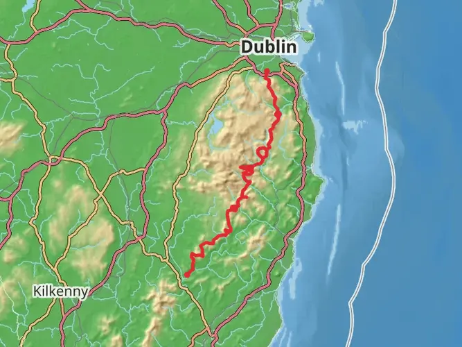
63.1 km
~3 days
2038 m
Multi-Day
“Traverse the historic and scenic Wicklow Way, a medium-difficulty trek offering a tapestry of Irish landscapes and heritage.”
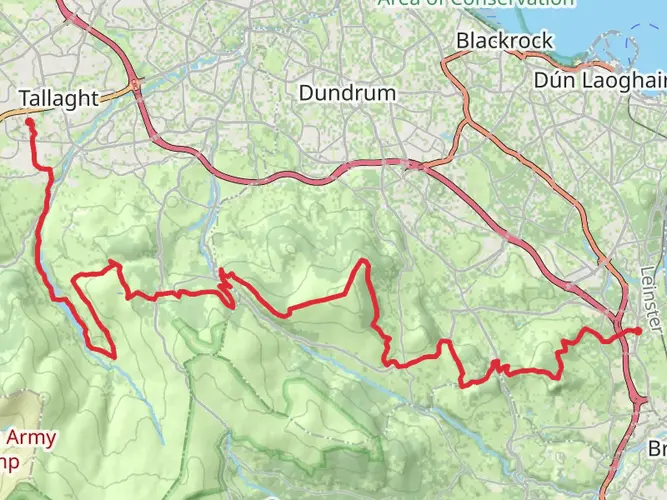
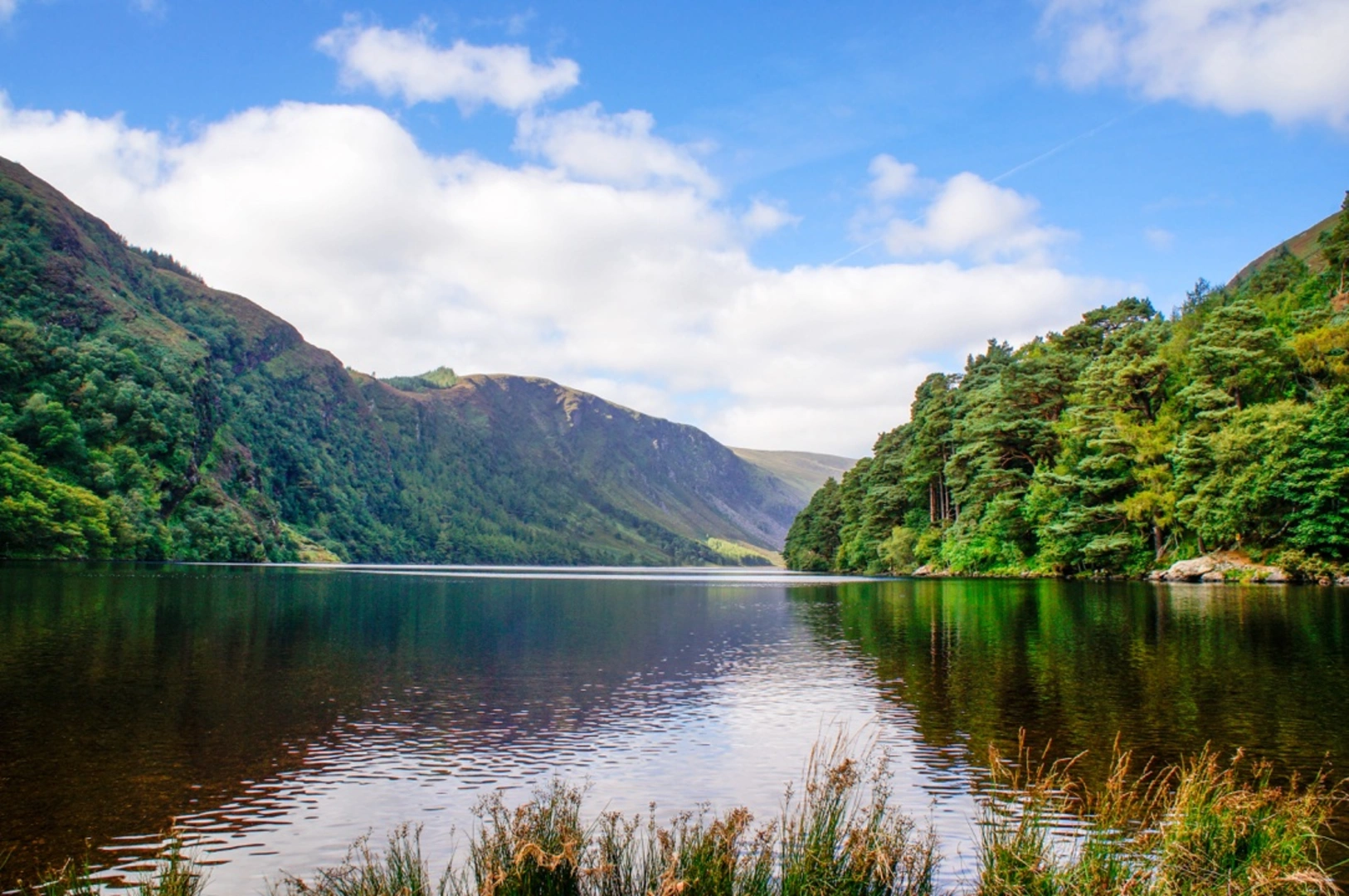
Embarking on the Wicklow Way from Dublin to Glenmalure, hikers will traverse approximately 63 kilometers (about 39 miles) of varied landscapes, with an elevation gain of around 2000 meters (approximately 6560 feet). This point-to-point trail is a medium difficulty trek that offers a blend of historical sites, lush woodlands, and panoramic mountain views.
Getting to the Trailhead
The journey begins near Marlay Park in County Dublin, which is easily accessible by public transport or car. From Dublin city center, hikers can take the Dublin Bus to the park entrance. For those driving, parking is available at Marlay Park.
Marlay Park to Knockree
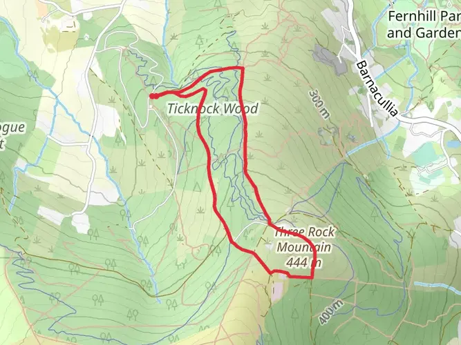
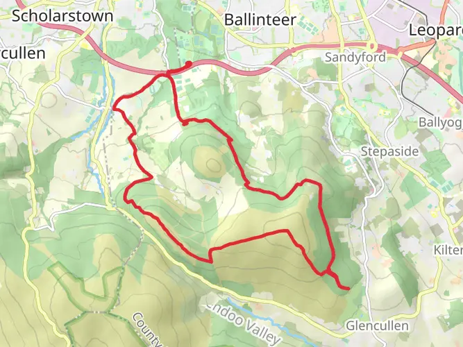
The first section of the trail takes you through Marlay Park and into the Dublin Mountains, passing through Tibradden Wood and Ticknock forest. The path here is well-marked, with a mix of forest trails and open moorland. As you ascend, you'll be rewarded with views of Dublin city and Dublin Bay. This section is approximately 21 kilometers (13 miles) with an elevation gain of 600 meters (1968 feet).
Historical Significance and Landmarks
The Wicklow Way is steeped in history, with landmarks such as the Glencullen Dolmen, an ancient burial site, and the remnants of early 19th-century lead mines near Glendalough. The trail also passes by Powerscourt Waterfall, Ireland's highest waterfall, which is a short detour from the main path.
Glendalough to Glenmalure
Continuing from the monastic city of Glendalough, a historic site founded by St. Kevin in the 6th century, the trail winds through the valley before ascending the steep slopes of Lugduff Mountain. This section is rich in wildlife, with opportunities to spot deer, birds of prey, and other native species. The path then descends into the remote and scenic Glenmalure Valley. This stretch covers roughly 18 kilometers (11 miles) and includes an elevation gain of 400 meters (1312 feet).
Navigating the Trail
Hikers can use the HiiKER app to navigate the trail, ensuring they stay on the correct path and can easily locate points of interest and camping spots. The app provides detailed maps and trail information that are invaluable for planning rest stops and overnight stays.
Preparing for the Hike
The Irish weather can be unpredictable, so it's essential to pack waterproof gear and layers to accommodate changing conditions. Sturdy hiking boots are a must, as the terrain can be rocky and uneven in places. It's also advisable to carry a first aid kit, sufficient water, and snacks for energy.
Wildlife and Nature
The Wicklow Way offers a chance to immerse oneself in the natural beauty of Ireland. The trail passes through a variety of habitats, from dense forests to open heathland, each supporting a diverse range of flora and fauna. Keep an eye out for the native red squirrel, the elusive pine marten, and a variety of bird species.
Conclusion
The Wicklow Way from Dublin to Glenmalure is a journey that combines natural beauty, wildlife encounters, and a rich tapestry of Irish history. With careful planning and a spirit of adventure, hikers will find this trail to be a rewarding experience that showcases the very best of Ireland's landscapes.

What to expect?
Activity types
Comments and Reviews
User comments, reviews and discussions about the Wicklow Way - 4 Day Dublin to Glenmalure, Ireland.
4.64
average rating out of 5
42 rating(s)