Download
3D Flyover
Add to list
More
8.3 km
~2 hrs 4 min
242 m
Loop
“From shadowy forest to windswept Ravens Rock, this loop unfolds in vivid layers and far-reaching views.”
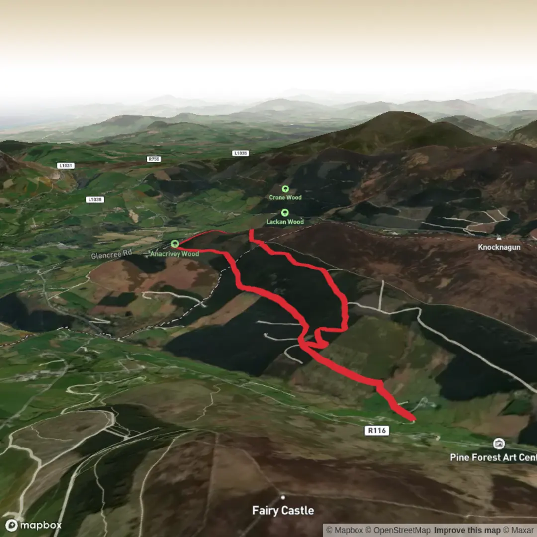
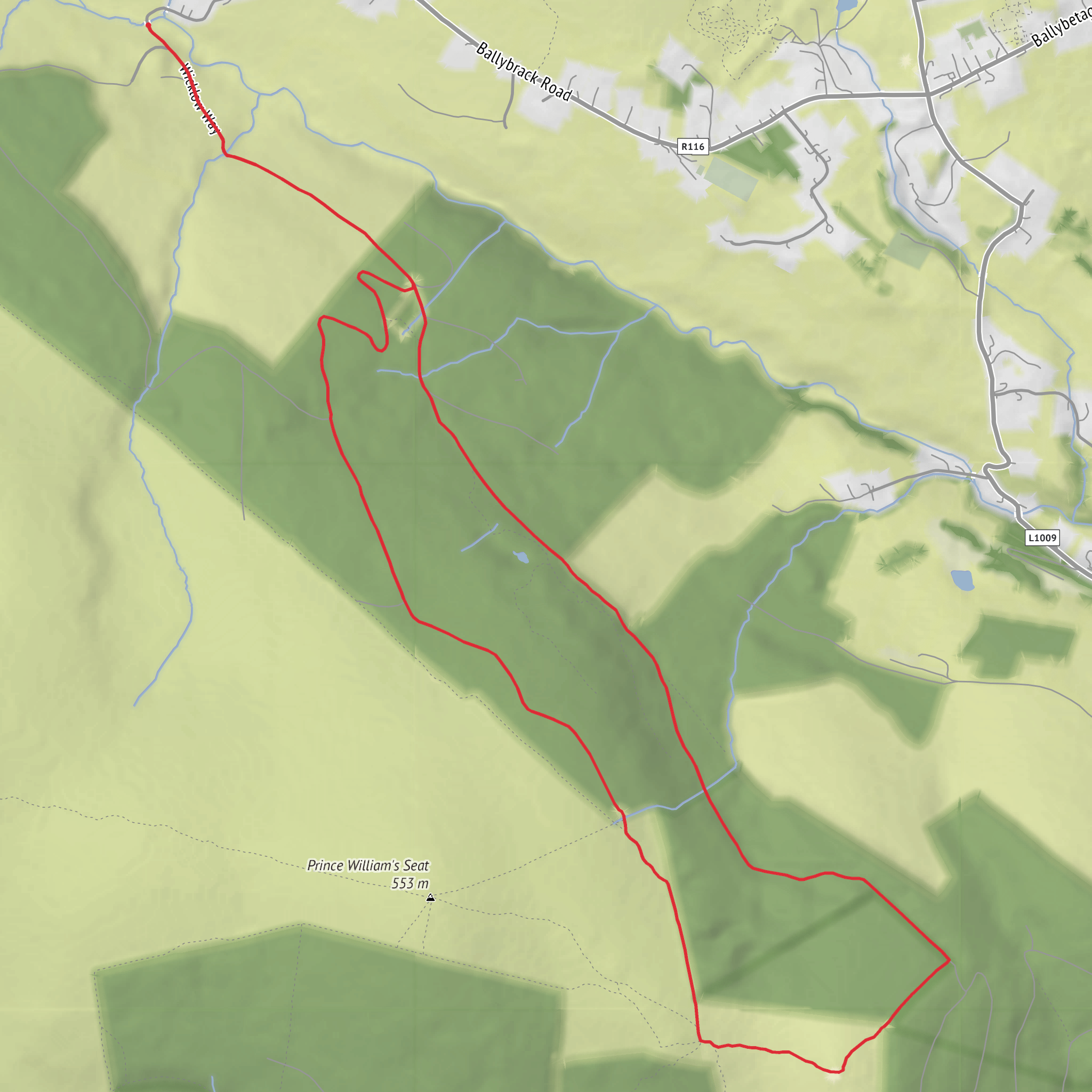
This medium-grade loop in the Dublin Mountains packs a lot into roughly 8 km (5 miles), with about 200 metres (656 feet) of climbing. Expect a route that mixes forest tracks, open hillside, and broad viewpoints, with the high point around Ravens Rock giving the walk its main sense of drama. The terrain is varied rather than extreme, so it suits hikers who are comfortable on uneven ground and short climbs but do not necessarily want a full mountain day.
The start is best identified near Glencullen Adventure Park, Ballybrack Road, Glencullen, Dublin 18, D18 Y673, a useful landmark on the edge of the village area. That is the clearest nearby address for planning by car or taxi. Glencullen itself sits in the Dublin Mountains south of the city, and nearby landmarks often used for orientation include Johnnie Fox’s Pub and the wider Dublin Mountains Way network. (visitdublin.com)
By car, the trailhead area is typically reached from Dublin via the R116/Glencullen Road, with the drive taking roughly 35 to 45 minutes from the city depending on traffic. Parking options in this area are limited and can fill quickly on fine weekends, so an early start is wise. If using public transport, the most practical option is usually a Dublin Bus service to Glencullen village, with the commonly referenced stop near Johnnie Fox’s Pub, followed by a short walk to the start area. Because rural-edge bus service patterns can change, it is sensible to confirm the latest timetable before setting out. (hiiker.app)
What the route feels like
The walk usually begins gently, giving you time to settle in before the climbing becomes more noticeable. Early sections are often on firm forest road or broad trail, but that should not be mistaken for an entirely easy surface. In wet weather, mud can build up quickly, and some stretches can become slick with leaf litter, loose grit, or exposed stone. As the route gains height, the track tends to feel more open and rougher underfoot, with the kind of short, punchy rises that account for most of the 200 metres of ascent.
For an 8 km loop, many hikers should allow around 2.5 to 3.5 hours, depending on pace, stops, and ground conditions. The route is not especially long, but the combination of climbing, uneven footing, and time spent at viewpoints can make it feel more substantial than the distance suggests.
Landmarks and views
Ravens Rock is the standout feature. This rocky viewpoint looks out across a broad sweep of upland and lowland scenery, and on a clear day the views extend across the Dublin Mountains toward the city and coast. The appeal of this section is the contrast: one moment you are enclosed by trees and mountain vegetation, and the next the landscape opens into a much wider panorama.
The surrounding hills form part of a larger recreational landscape linked by established walking routes, including the Dublin Mountains Way, a waymarked route crossing the range from Shankill to Tallaght. That wider setting helps explain why this loop feels bigger than a local woodland walk: even on a moderate outing, you are moving through a mountain corridor with long sightlines and a strong sense of exposure once you leave the shelter of the trees. (alltrails.com)
Terrain, weather, and navigation
Although the difficulty is moderate, hikers should prepare for a few common challenges. The route can include muddy woodland sections, stony patches, and uneven mountain trail where footing needs attention. Wind exposure increases noticeably near open ground and rocky viewpoints, and low cloud can reduce visibility even when conditions seem reasonable lower down. Waterproof footwear with decent grip is a good choice for most of the year.
Because paths in the Dublin Mountains can intersect with biking trails, forestry roads, and longer-distance walking routes, it is worth checking the route carefully before setting off and carrying the route on HiiKER. Signage in the wider area can sometimes be inconsistent enough that a mapped track is useful, especially where multiple trail options branch away from the main line. (alltrails.com)
Nature and wildlife
This area combines planted woodland, scrub, heath, and open mountain ground, so the scenery changes steadily over a short distance. In the forested sections, expect conifers mixed with mossy banks, ferns, and damp ground vegetation. Higher up, the landscape becomes more typical of upland Dublin and Wicklow margins, with heather, grasses, and low shrubs shaping the hillsides. Late summer and early autumn are especially attractive when the heathland color is strongest.
Wildlife is usually subtle rather than spectacular, but hikers should keep an eye out for small woodland birds, raptors using the upland air currents, and mammals such as foxes or rabbits in quieter sections. Sheep may also be present on open ground, so dogs should be kept under close control where permitted and local access
Surfaces
Gravel
Unknown
Asphalt
Comments and Reviews
User comments, reviews and discussions about the Glencullen Mountain and Ravens Rock Loop, Ireland.
average rating out of 5
0 rating(s)
