
Download
3D Flyover
Add to list
More
652.3 km
34 days
6479 m
Multi Day
“From windswept Mount Leinster to Bangor’s shore, this pilgrimage threads history, fields, canals, and changing skies.”
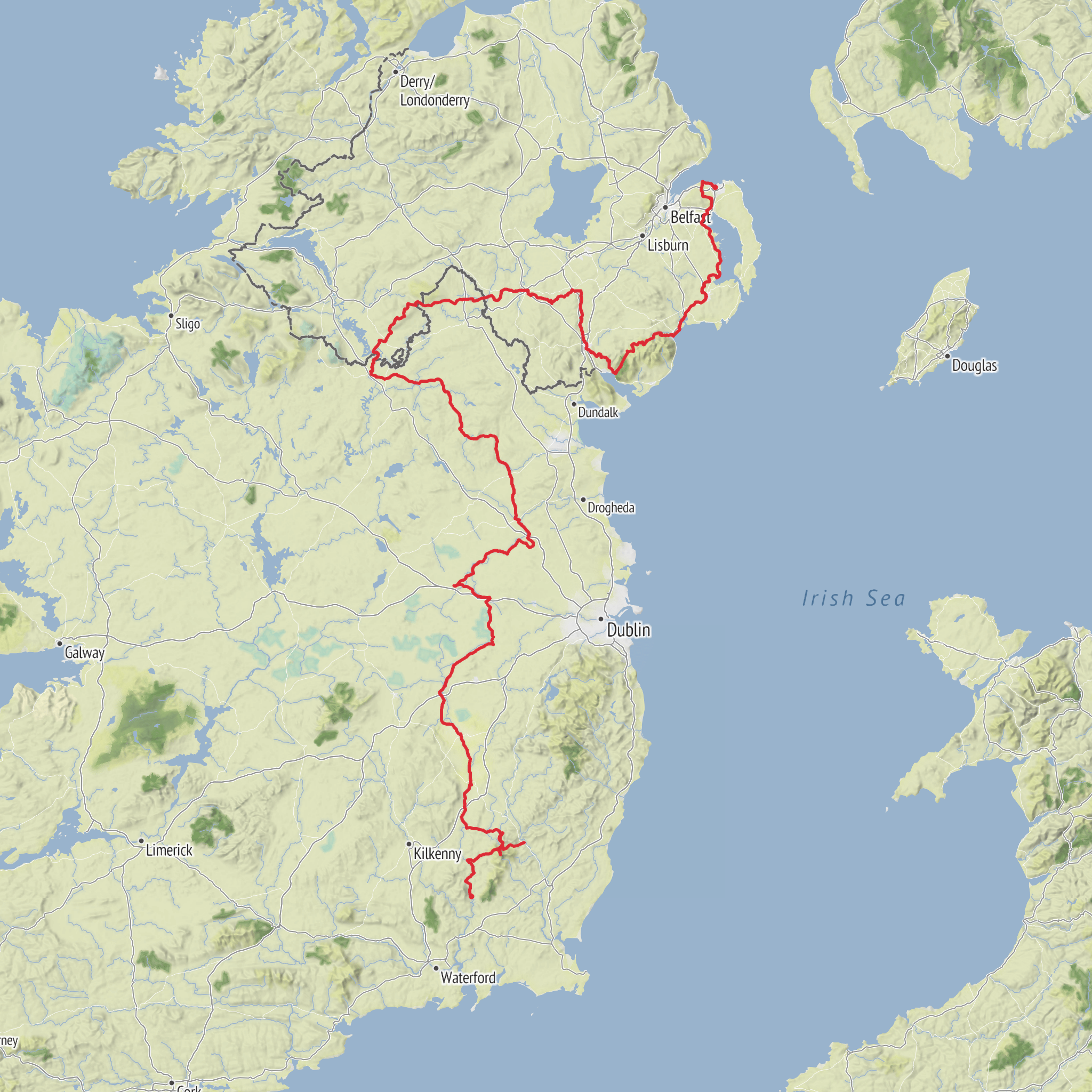
This long cross-island pilgrimage follows the Irish life and legacy of St Columbanus, running for about 651 km / 405 miles with roughly 6,600 metres / 21,650 feet of ascent. The route is generally considered medium difficulty, but that rating hides how varied it is: some days are gentle canal, riverside, or farmland walking, while others involve exposed upland ground, long road sections, and the cumulative fatigue that comes with several weeks on foot. The official Irish itinerary describes the route from Mount Leinster in County Carlow to Bangor in County Down, with two southern approach options that reach Myshall: one from St Mullins via Borris and one from Bunclody via Mount Leinster. It also notes that parts of the route are still a work in progress, so hikers should expect occasional changes and should check the latest line on HiiKER before setting out. (thecolumbanway.org)
The southern start is best understood as the Mount Leinster / Nine Stones area above Myshall, a well-known upland landmark in the Blackstairs Mountains rather than an urban trailhead. One of the local route boards states that the Columban Way begins at the Nine Stones area near Mount Leinster and descends through Corrabut Gap toward Myshall, with broad views across County Carlow. That makes the nearest practical start landmark the Nine Stones car park on the Mount Leinster road, near Myshall, County Carlow. If you are using the Bunclody approach, Bunclody is the nearest significant town on the southeastern side; if using the longer southern approach, St Mullins is the other recognized starting community. (carlowtourism.com)
What the walk feels like
Expect a route defined more by cultural landscape than by continuous mountain trail. In County Carlow the walk begins with the most dramatic upland scenery, where the Blackstairs and Mount Leinster country gives you open views, wind exposure, and a stronger sense of pilgrimage departure. From there the route settles into a long northbound progression through river valleys, agricultural country, market towns, canal corridors, monastic sites, and rolling drumlin landscapes before reaching the loughs and low hills of Ulster and finally the coast at Bangor. The official stage list shows many moderate daily distances, commonly around 14 to 27 km / 9 to 17 miles, which suits a multi-week itinerary rather than a fastpacking route. (thecolumbanway.org)
Because the route crosses so many settled areas, surfaces are mixed. You can expect a combination of minor roads, town streets, farm access lanes, towpaths, tracks, and selected hill sections. One of the Carlow route boards specifically warns that significant parts of at least that section are on quiet public roads and that walkers need to take care around traffic and junctions; that is good advice for much of the Irish route as a whole. Road walking is part of the character here, so footwear should balance comfort on pavement with enough grip for wet grass, muddy verges, and upland sections. (carlowtourism.com)
Landmarks, landscapes, and notable sections
The opening around Mount Leinster is one of the most memorable parts of the entire walk. The route board at the start highlights the descent past Corrabut Gap to Myshall and the commanding views over County Carlow. This is where the pilgrimage has its strongest sense of elevation and exposure, and it is also where weather can change fastest. Low cloud, strong wind, and rain can make a moderate day feel much more serious, especially if visibility drops on open ground. (carlowtourism.com)
From Myshall the route heads through Leighlinbridge and Carlow, then on to Athy, Monasterevin, Robertstown, Johnstown Bridge, Clonard, Trim, Dalgan, Wilkinstown, Kingscourt, Bailieborough, Cootehill, Redhills, Belturbet, and onward through Ulster to Comber and Bangor. That sequence gives a good sense of the trail’s rhythm: historic villages, river and canal country, monastic associations, and a gradual transition from the southeast into the midlands and border counties
Surfaces
Unknown
Asphalt
Gravel
Grass
Unpaved
Dirt
Paved
Concrete
Wood
Sand
Ground
Cobblestone
Comments and Reviews
User comments, reviews and discussions about the The Columban Way - Ireland, Ireland.
average rating out of 5
0 rating(s)



