Download
3D Flyover
Add to list
More
89.2 km
~3 days
222 m
Multi-Day
“Embark on a serene 55-mile historical hike through Southern Illinois' diverse landscapes on the Tunnel Hill State Trail.”
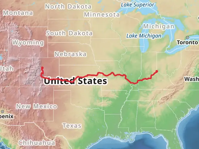
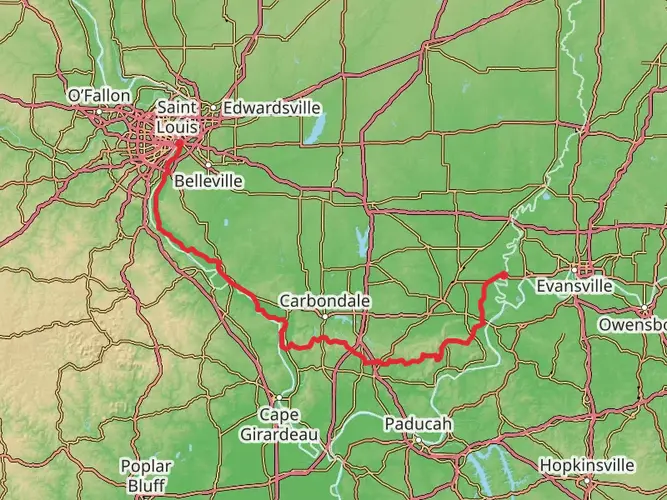
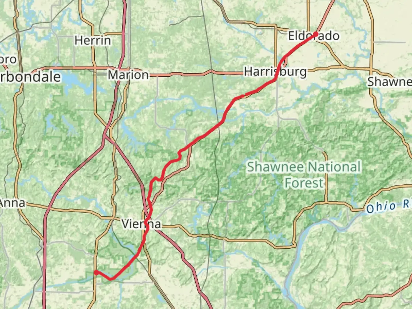
Spanning approximately 55 miles (around 89 kilometers) with an elevation gain of around 656 feet (200 meters), the Tunnel Hill State Trail is a point-to-point route that offers a serene and historically rich hiking experience. The trailhead is situated near Johnson County, Illinois, where hikers can embark on a journey through a landscape that was once dominated by the coal mining industry.
Getting to the Trailhead
To reach the starting point of the Tunnel Hill State Trail, hikers can drive to the northeastern terminus near the town of Harrisburg, Illinois. For those relying on public transportation, the nearest significant city with bus and train services is Carbondale, Illinois. From Carbondale, one can rent a car or use local shuttle services to reach the trailhead.
Trail Experience
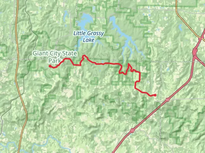
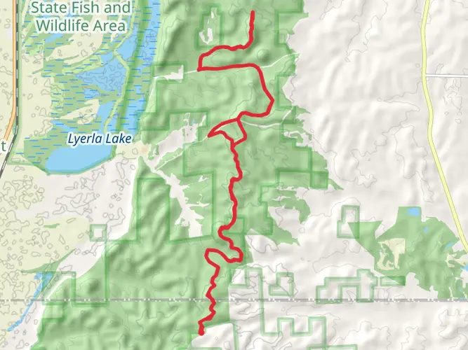
As you set out from the northern trailhead, the path will lead you through a variety of landscapes including dense forests, wetlands, and open prairies. The trail surface is primarily crushed limestone, making it suitable for both hiking and biking. The gentle grade and smooth surface are a result of the trail's history as a former railroad bed, which ensures a relatively easy hike despite its length.
Historical Significance and Landmarks
The Tunnel Hill State Trail is steeped in history, with several landmarks that hikers will encounter along the way. One of the most notable features is the namesake Tunnel Hill, where a 543-foot long tunnel, constructed in the late 1800s, cuts through the hill. This engineering feat is a testament to the region's railroad past.
Further along the trail, hikers will come across the remnants of old coal mines, a reminder of the area's mining heritage. Interpretive signs along the route provide context and stories about the communities that once thrived here due to the coal industry.
Nature and Wildlife
The trail offers an excellent opportunity to observe Southern Illinois' diverse wildlife. It is not uncommon to spot deer, foxes, and a variety of bird species, including hawks and songbirds. The trail also passes through several ecological areas, such as the Cache River State Natural Area, which is home to cypress swamps and a rich array of plant life.
Navigation and Preparation
For navigation purposes, HiiKER is an excellent tool to use while traversing the Tunnel Hill State Trail. It will help you keep track of your progress and identify key points of interest along the way. Given the trail's length, it's advisable to plan for multiple days of hiking if you intend to complete the entire route. Ensure you have adequate water, food, and gear for the journey, and be prepared for changes in weather.
Accessibility
The trail is accessible year-round and offers various entry points, allowing hikers to choose shorter segments if they are not up for the full distance. Restrooms and picnic areas are available at certain points along the trail, providing convenient spots for breaks.
Remember, the Tunnel Hill State Trail is a shared-use path, so be courteous to cyclists and other users you may encounter. With its rich history, diverse ecosystems, and well-maintained path, the Tunnel Hill State Trail is a journey through the heart of Southern Illinois that offers something for every hiker.

Frequently asked questions
How long does it take to hike the Tunnel Hill State Trail end to end?
The Tunnel Hill State Trail is about 89.2 km, or roughly 55 miles, from the Harrisburg area to Karnak. Most hikers treat it as a multi-day route rather than a single-day walk because the grade is gentle but the mileage is long. A strong pace can cover it in 2 to 4 days, depending on daily distance and shuttle logistics.
Where are the main trailheads and parking areas for the Tunnel Hill State Trail?
The Tunnel Hill State Trail has access points in Harrisburg, Carrier Mills, Stonefort, New Burnside, Tunnel Hill, Vienna, Belknap, and Karnak. The Illinois Department of Natural Resources identifies the route as running between Harrisburg and Karnak, with the official southern end at Karnak and the Harrisburg end at Feazel Street. Parking is commonly used at towns such as Vienna and Tunnel Hill for shorter out-and-back hikes.
What is the surface like on the Tunnel Hill State Trail, and is it easy for walking?
The Tunnel Hill State Trail follows a former railroad bed, so the grade is mild and the route is considered easy despite its length. Much of the trail is compacted crushed limestone, with bridges and some mixed surface sections near access areas. That makes it one of the more approachable long-distance walks in southern Illinois for steady, low-grade mileage.
How long is the tunnel on the Tunnel Hill State Trail, and where is it?
The trail’s signature landmark is the railroad tunnel at Tunnel Hill, and the remaining tunnel is 543 feet long. It sits near the town of Tunnel Hill, which is also the high point of the route. Because the interior is dark and cool even in daylight, many hikers carry a light when passing through.
Is the Tunnel Hill State Trail good for a multi-day hike, or is it better as a day hike?
The Tunnel Hill State Trail works well for both, but its 89.2 km length makes it especially well suited to a multi-day trip. Many hikers break it into shorter sections using access towns such as Vienna, Tunnel Hill, and Karnak. For a day hike, the tunnel area and the trestle sections are among the most popular stretches.
What towns does the Tunnel Hill State Trail pass through in southern Illinois?
The Tunnel Hill State Trail passes through or connects with Harrisburg, Carrier Mills, Stonefort, New Burnside, Tunnel Hill, Vienna, Belknap, and Karnak. Those communities are useful for planning section hikes, parking, and arranging point-to-point pickups. Vienna and Harrisburg are among the better-known service hubs along the corridor.
Is the Tunnel Hill State Trail flat, and how much climbing is there?
The Tunnel Hill State Trail is mostly flat by hiking standards, with only about 222 m of total elevation gain over the full route. The old rail corridor rises gradually toward Tunnel Hill and then descends gently toward Karnak. That easy profile is a big reason the trail is popular for long-distance walking and biking.
Comments and Reviews
User comments, reviews and discussions about the Tunnel Hill State Trail, Illinois.
4.47
average rating out of 5
15 rating(s)