Download
3D Flyover
Add to list
More
47.1 km
~2 days
80 m
Multi-Day
“Discover the Illinois Prairie Path, a scenic and historic flat trail welcoming to diverse hikers and cyclists.”
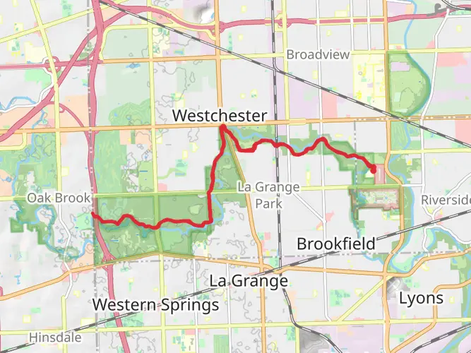
The Illinois Prairie Path is a multi-use trail that spans approximately 47 kilometers (about 29 miles) and is primarily flat, with an elevation gain close to zero meters, making it accessible for hikers of various skill levels. The trailhead is situated near Cook County, Illinois, and the path stretches out in a point-to-point fashion, offering a medium difficulty rating due to its length rather than its terrain.
Getting to the Trailhead
To reach the starting point of the Illinois Prairie Path, hikers can either drive or use public transportation. For those driving, the trailhead is accessible via several major roads and there is parking available in the vicinity. Public transportation users can take advantage of the local train and bus services that connect to the trail's starting area. It's advisable to check the latest schedules and routes on the local transit website or use HiiKER to plan your journey to the trailhead.
Trail Experience
As you embark on the Illinois Prairie Path, you'll find yourself traversing a trail rich in natural beauty and historical significance. The path itself was one of the first rail-to-trail conversions in the United States, repurposing the former right-of-way of the Chicago Aurora and Elgin Railroad into a recreational trail. This historical transformation is a testament to the conservation efforts that have preserved the area for public enjoyment.
The trail is well-maintained and primarily consists of crushed limestone, making it suitable for walking, jogging, and cycling. Along the way, hikers can expect to encounter a variety of landscapes, including prairie restorations, woodlands, and picturesque streams. The path is lined with a diverse array of flora and fauna, offering opportunities to spot local wildlife and enjoy the changing seasons' colors.
Landmarks and Points of Interest
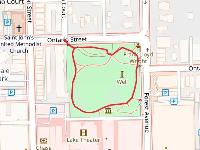
As you progress along the path, you'll come across several towns and communities, each providing amenities such as restrooms, water fountains, and places to rest or grab a bite to eat. Notable landmarks include the Pioneer Park in Elmhurst, which is roughly 6.4 kilometers (4 miles) from the trailhead, and the Wheaton College campus, located about 19 kilometers (12 miles) into the hike.
The trail also intersects with other regional trails, offering hikers the chance to extend their journey or explore different areas. These connections include the Great Western Trail and the Fox River Trail, both of which provide additional scenic views and hiking opportunities.
Wildlife and Nature
Nature enthusiasts will appreciate the Illinois Prairie Path for its ecological diversity. The trail is home to a variety of bird species, making it a popular spot for birdwatching. Additionally, the prairie sections of the path support an array of wildflowers and grasses, particularly in the spring and summer months when they are in full bloom.
Preparation and Planning
Before setting out on the Illinois Prairie Path, hikers should prepare for the journey by packing sufficient water, snacks, and sun protection. While the trail is relatively flat, its length can be challenging for some, so it's important to plan your hike according to your fitness level. HiiKER can be used to map out the trail, identify points of interest, and track your progress.
Remember to check the weather forecast and dress appropriately, as the open prairie can expose you to the elements. Lastly, always practice Leave No Trace principles to help preserve the trail's natural beauty for future visitors.

What to expect?
Frequently asked questions
How long is the Illinois Prairie Path and how many miles is it in Cook County, Illinois?
The Illinois Prairie Path route listed here is 47.15 kilometers, which is about 29.3 miles. It is a long, easy multi-day outing with only around 80 meters of total elevation gain, so the challenge comes more from distance and time on trail than from steep climbing.
Is the Illinois Prairie Path difficult for beginners or casual walkers?
The Illinois Prairie Path is generally considered easy because it is very flat, with about 80 meters of elevation gain over the full 47.15-kilometer route. For most hikers, the main consideration is endurance rather than terrain, especially if attempting the full point-to-point distance in one push.
What is the surface like on the Illinois Prairie Path?
Much of the Illinois Prairie Path is a limestone trail, including sections through DuPage County preserves and nature-preserve areas where users are required to stay on the limestone tread. That makes the route relatively smooth and approachable for walking, but conditions can still vary after rain and at road crossings.
Are dogs allowed on the Illinois Prairie Path?
Dogs are generally allowed on Illinois Prairie Path sections that pass through DuPage County forest preserves, but they must be leashed. DuPage County rules require pets to stay on a leash no longer than 10 feet, and in protected nature-preserve sections pets must remain on the limestone trail.
Where can you park for the Illinois Prairie Path?
Parking is available at multiple access points rather than one single lot. Official Illinois Prairie Path maps list trailheads such as Maywood Trailhead, South Elgin Trailhead, Prairie Path Park, Volunteer Park, Founders Park, and connections near preserves like Timber Ridge, so parking depends on which branch or segment is being hiked.
Can you reach the Illinois Prairie Path by public transportation?
Yes. The Illinois Prairie Path has access points in built-up suburbs west of Chicago, and official trail information notes trailheads such as Maywood plus stops near towns like Villa Park and Wheaton, which are served by commuter-rail corridors in the area. That makes shorter one-way walks possible without needing to return to the same parking lot.
What are some landmarks and notable places along the Illinois Prairie Path?
Named places along the Illinois Prairie Path include Lincoln Marsh Wetlands, Kline Creek Farm, St. James Farm, Warrenville Town Park, Reed Keppler Park, Prairie Path Park, and the Fox River Path connection. The route also passes through or alongside preserves such as Pratt’s Wayne Woods and Springbrook Prairie, giving it a mix of suburban access and open-space scenery.
Comments and Reviews
User comments, reviews and discussions about the Illinois Prairie Path, Illinois.
4.56
average rating out of 5
18 rating(s)