Download
3D Flyover
Add to list
More
45.4 km
~2 days
1222 m
Out and Back
“Experience Idaho's wilderness on a trail rich with scenic landscapes, wildlife, and historical intrigue.”
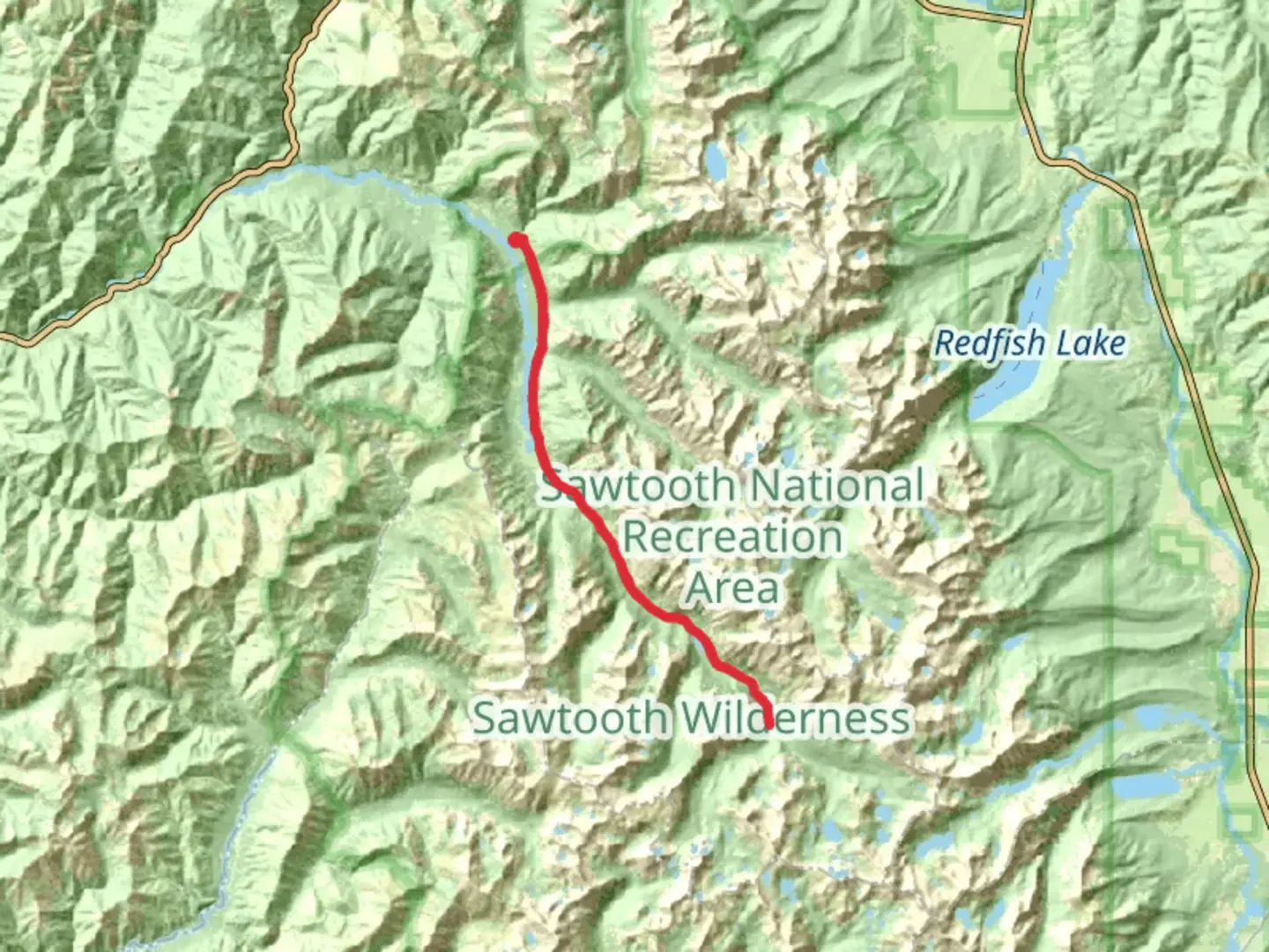
Nestled in the heart of Idaho's stunning wilderness, the South Fork Payette River Trail - Grandjean offers a captivating journey through diverse landscapes and rich history. This out-and-back trail stretches approximately 45 kilometers (about 28 miles) with an elevation gain of around 1,200 meters (approximately 3,937 feet), making it a moderately challenging adventure for hikers.
Getting There
The trailhead is conveniently located near Boise County, Idaho. For those traveling by car, head towards the small community of Grandjean, which serves as a gateway to the Sawtooth Wilderness. From Boise, it's about a two-hour drive northeast via ID-21. Public transport options are limited, so driving is the most practical way to reach the trailhead. Parking is available near the trail's start, but it's advisable to arrive early, especially during peak hiking seasons.
Trail Highlights
Scenic Landscapes
As you embark on the trail, you'll be greeted by the serene beauty of the South Fork Payette River. The trail meanders alongside the river, offering picturesque views of its clear, rushing waters. Dense forests of pine and fir provide shade and a sense of tranquility, while occasional clearings reveal breathtaking vistas of the surrounding mountains.
Wildlife and Flora
The area is teeming with wildlife, so keep your eyes peeled for deer, elk, and possibly even black bears. Birdwatchers will delight in spotting various species, including eagles and hawks soaring above. The trail is also a botanist's dream, with wildflowers dotting the landscape in vibrant colors during the spring and summer months.
Historical Significance
The region holds historical significance, as it was once traversed by Native American tribes and later by early settlers and miners. The trail offers a glimpse into the past, with remnants of old mining operations occasionally visible along the route. These historical markers serve as a reminder of the area's rich cultural heritage.
Navigational Tips
Given the trail's moderate difficulty, it's essential to be well-prepared. The path is generally well-marked, but carrying a reliable navigation tool like HiiKER is recommended to ensure you stay on track. The trail's elevation gain is gradual, but there are sections with steeper inclines that require careful footing.
Points of Interest
Around the halfway point, approximately 22.5 kilometers (14 miles) in, you'll encounter a natural hot spring, a perfect spot to relax and soak in the warm waters while enjoying the surrounding scenery. This is a popular rest stop for hikers, so plan your timing accordingly to avoid crowds.
As you approach the trail's end, the landscape opens up to reveal expansive views of the Sawtooth Range, a sight that is sure to leave a lasting impression. The turnaround point offers a perfect spot for a picnic before retracing your steps back to the trailhead.
Preparation and Safety
Ensure you pack sufficient water, snacks, and layers of clothing to accommodate changing weather conditions. The trail can be accessed year-round, but the best times to hike are late spring through early fall when the weather is most favorable. Always check local conditions and advisories before setting out, and be mindful of wildlife, maintaining a safe distance at all times.
The South Fork Payette River Trail - Grandjean is a rewarding hike that combines natural beauty, wildlife encounters, and a touch of history, making it a must-visit for outdoor enthusiasts exploring Idaho's wilderness.

What to expect?
Activity types
Comments and Reviews
User comments, reviews and discussions about the South Fork Payette River Trail - Grandjean, Idaho.
average rating out of 5
0 rating(s)