Download
3D Flyover
Add to list
More
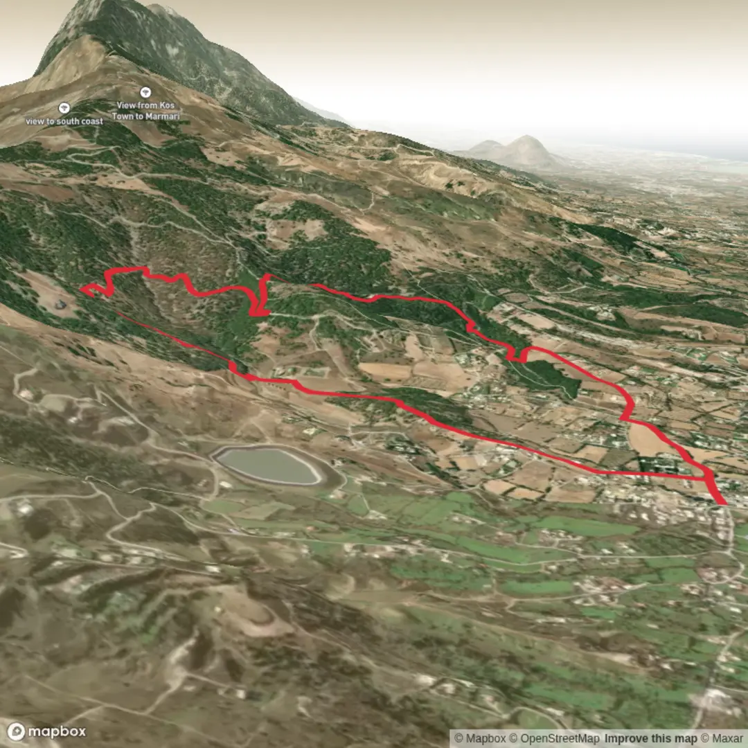
6.9 km
~1 hrs 39 min
172 m
Loop
“A compact loop from Agios Nektarios into Tsoukalaria’s pines, with airy clearings and punchy climbs.”
This medium loop is a compact, varied walk of about 7 km (4.3 mi) with roughly 200 m (656 ft) of climbing—long enough to feel like a proper outing, but short enough to fit into a half-day. Expect a mix of quiet paved approach, forest track, and narrower footpath through Tsoukalaria Forest, with frequent openings that give you a sense of the surrounding hills and valleys.
Because the start point is listed only as “near,” the most reliable way to pin it down is to navigate to Agios Nektarios (Saint Nektarios) Church/Chapel in the area and use that as your trailhead landmark. In Greece, “Agios Nektarios” commonly refers to a local church or small monastery site; on HiiKER, the route name typically indicates the loop begins and ends close to that church. If you share the coordinates (or a HiiKER link), I can convert them to the nearest named place/landmark and tailor the directions precisely.
Getting to the start (car + public transport)
By car - Aim for the nearest drivable access to Agios Nektarios Church/Chapel (search that exact name in your maps app, then cross-check the trailhead on HiiKER so you’re parking at the correct Agios Nektarios—there are many across Greece). - Parking is usually informal roadside pull-offs near the church or at a small gravel apron. Arrive early on weekends or religious feast days, when local visitors may fill the limited space.
By public transport - Public transport access depends heavily on which municipality this Agios Nektarios is in. The typical pattern is: - Intercity bus (KTEL) to the nearest town/village hub, then - a local bus or taxi to the church/forest edge. - If you provide the nearest town name (or coordinates), I can suggest the most realistic KTEL hub and the likely last-mile options.
What the route feels like underfoot
From the church area, the loop usually eases you in with a gentler grade—often a track or quiet lane—before you commit to the forest. Over the full 7 km (4.3 mi), the 200 m (656 ft) gain tends to come in a few short climbs rather than one sustained ascent.
- 0–1.5 km (0–0.9 mi): Settling in. Often a wide track or lane with low stone walls, scattered olives, and the first shade from pines as you approach the forest boundary. Minimal elevation change at first (think 0–50 m / 0–164 ft of gain).
- 1.5–3.5 km (0.9–2.2 mi): The main climb. This is where you’ll likely collect most of the day’s ascent—roughly 120–170 m (394–558 ft)—on a forest road or a narrower path that can be loose with pine needles and small stones. The grade is steady enough to raise your heart rate but not so steep that it becomes a scramble.
- 3.5–5.5 km (2.2–3.4 mi): Rolling forest traverse. Expect gentler undulations, occasional clearings, and a more “cruising” pace. This is often the most pleasant section for wildlife spotting and quiet walking.
- 5.5–7 km (3.4–4.3 mi): Descent and return. The loop typically drops back toward the church area. Descents here can feel sharper than the climb because of gravel, embedded rock, and dry needles—take smaller steps and watch footing.
Forest character, landmarks, and what to look for
Agios Nektarios site (start/finish landmark) - A small church or chapel is often a focal point for local devotion and community gatherings. Even modest chapels can have iconography, a shaded courtyard, or a spring/cistern nearby. Dress respectfully if you step inside, and expect occasional candles/incense.
Tsoukalaria Forest - “Forest” in many Greek hill regions often means Aleppo pine (Pinus halepensis) and/or Turkish pine (Pinus brutia), with kermes oak and dense Mediterranean scrub (maquis) beneath. In spring, you may see orchids and aromatic herbs (thyme, sage, rosemary) along sunnier edges. - After windy periods, you’ll often find fallen cones, small branches, and needle drifts that can hide rocks—especially on the downhill.
Viewpoints and clearings - The loop name suggests a forest circuit rather than a summit, so viewpoints are usually incidental openings: bends in the track, firebreaks, or thin stands of pine. These are great places to pause, hydrate, and confirm direction on HiiKER before re-entering denser trees.
Wildlife and seasonal notes
- Birdlife: You’re likely to hear (and sometimes see) jays, woodpeckers, and small raptors riding thermals over clearings. Early morning is best.
- Reptiles: In warm months, lizards and occasional snakes may bask on sunny track edges. Give them space; watch where you place hands if you step off-trail.
- Insects: Ticks can be present in scrubby margins; in late spring/summer, expect mosquitoes near any damp spots.
- Heat and fire risk: Mediterranean forests can be hot and dry. In summer, start early, carry more water than you think you need, and be mindful that access restrictions can occur during high fire danger days.

Surfaces
Ground
Unknown
Asphalt
Paved
Comments and Reviews
User comments, reviews and discussions about the Agios Nektarios - Tsoukalaria Forest Loop, Greece.
average rating out of 5
0 rating(s)