
Download
3D Flyover
Add to list
More
17.5 km
~4 hrs 32 min
626 m
Loop
“A demanding Skopelos loop weaves piney heights, mysterious tombs, and a wild, remote coast.”
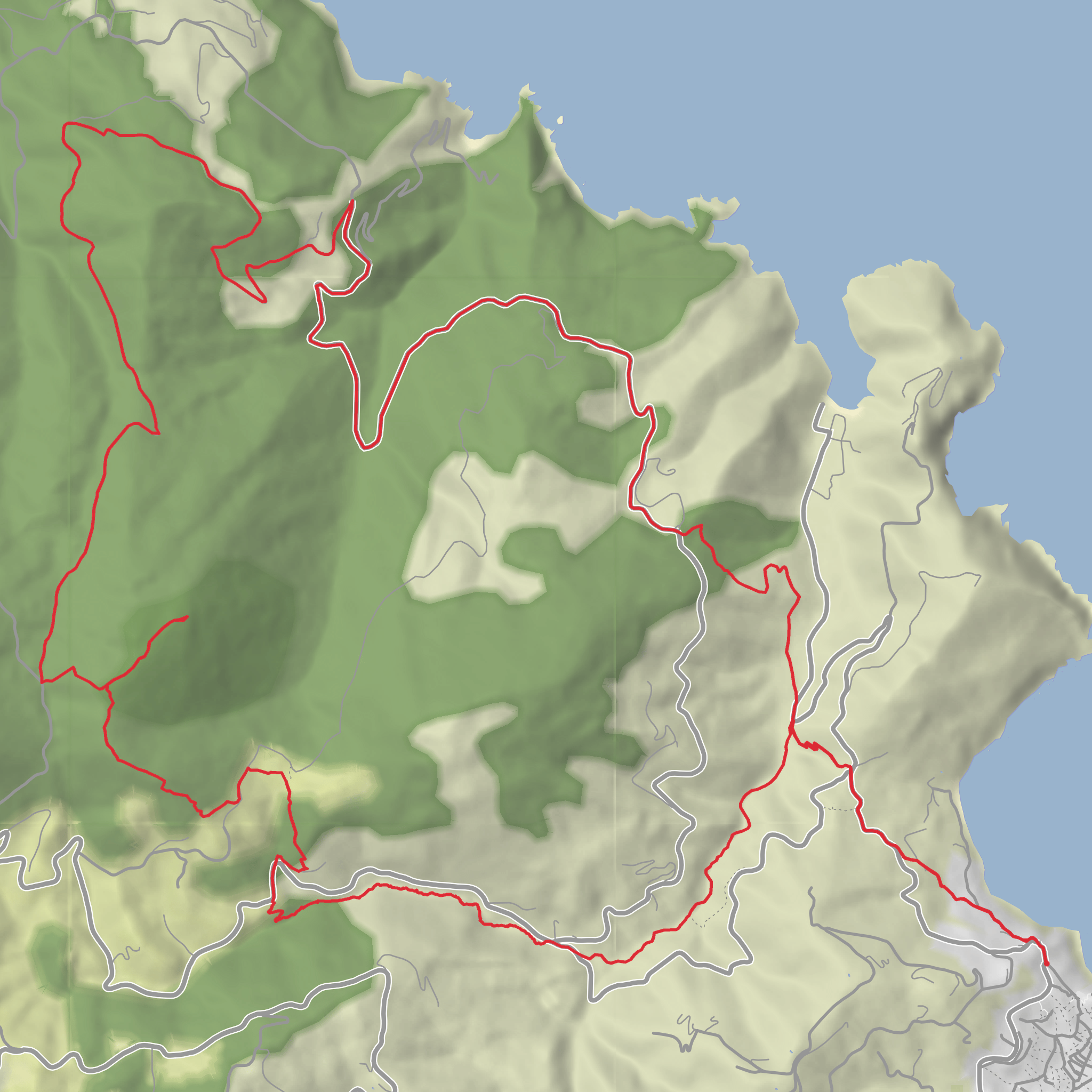
This medium-grade loop on Skopelos links the island’s inland high ground with one of its most intriguing archaeological sites and a remote stretch of coast, creating a full-day outing of roughly 17 km / 10.6 miles. Official trail information for Route 6 gives 17.2 km / 10.7 miles, about 7 hours 30 minutes, and a much bigger cumulative ascent of around 1,076 m / 3,530 ft, so even if your planning figure is closer to 600 m / 1,970 ft, it is wise to prepare for a tougher day with repeated climbs and descents. It is also described by the Skopelos trail network as the island’s longest and most demanding signed route. (skopelostrails.com)
The walk starts near Skopelos Town (Chora), the island’s main port and transport hub, which is the nearest clear landmark for the trailhead information provided. If you are navigating to the start, the practical reference point is the Skopelos port area / bus station in Skopelos Town, since local buses depart from near the port and most island services radiate from there. (skopelos.gr)
From town, the route heads inland through the greener, quieter heart of the island. Expect a steady transition from settled edges and old agricultural ground into pine-covered slopes, rougher tracks, and more exposed mountain terrain. Skopelos is known for dense woodland compared with many Greek islands, so this hike often alternates between shaded forest sections and open viewpoints over the Aegean. The long duration and cumulative climbing make pacing important from the outset. (skopelostrails.com)
Terrain and what to expect
The character of the loop is varied rather than uniform. Early sections are likely to feel more manageable underfoot, but the route becomes more demanding as it gains height and then drops toward the wilder coast near Kalogeros before turning back toward town. On a hike of this length, the main challenge is not just one climb but the combination of distance, heat exposure, and repeated elevation changes. The official route timing suggests a genuine all-day effort, so hikers should carry enough water, sun protection, and food for a long outing. (skopelostrails.com)
The inland ascent leads toward Mount Karya, above the Monastery of Agios Efstathios, where the famous Sentoukia rock-cut tombs sit in a dramatic panoramic position northwest of Skopelos Town. This is one of the route’s defining landmarks and one of the island’s most important archaeological sites. The tombs are rectangular chambers carved directly into the rock and are generally dated to the Roman or early Christian period; they were discovered in the late 19th century. Local imagination connected them with treasure chests and pirates, which is how they acquired the name “Sentoukia.” (visit.skopelos.gr)
Landmarks, history, and scenery
Sentoukia is the point where the hike becomes more than a scenic island walk. The site carries real historical weight, and its elevated setting adds to the atmosphere: the tombs are isolated, wind-exposed, and positioned with sweeping sea views that make the place feel both ceremonial and mysterious. Skopelos itself has deep roots stretching back through antiquity, when the island was known as Peparithos, and the Sentoukia graves are among the clearest surviving traces of that long past in the island interior. (visit.skopelos.gr)
Beyond the archaeological interest, the route showcases the island’s natural contrasts. Forested ridges, maquis shrubland, and coastal outlooks are all part of the day. In the pine woods and scrub, hikers may notice Aleppo pine, arbutus, and pistachia-type Mediterranean vegetation, especially on the drier slopes and transitional sections. Birdlife can be rewarding on quieter stretches, particularly where the trail opens to cliffs or sea-facing ridges, and the remoter northern and northeastern parts of Skopelos tend to feel much less developed than the beach corridors served by the main road. (wildflowersofskopelos.org.uk)
The Kalogeros section adds a more rugged coastal feel. Kalogeros is on the island’s steep northeastern side, an area noted for its remoteness and lack of a conventional
Surfaces
Unknown
Gravel
Ground
Paved
Asphalt
Comments and Reviews
User comments, reviews and discussions about the Skopelos, Sentoukia and Kalogeros Loop, Greece.
average rating out of 5
0 rating(s)
