
Download
3D Flyover
Add to list
More
5.8 km
~1 hrs 31 min
220 m
Loop
“A rugged Gerakas loop threads thyme-scented pastures, ruined shepherd paths, and wind-bright ridge views.”
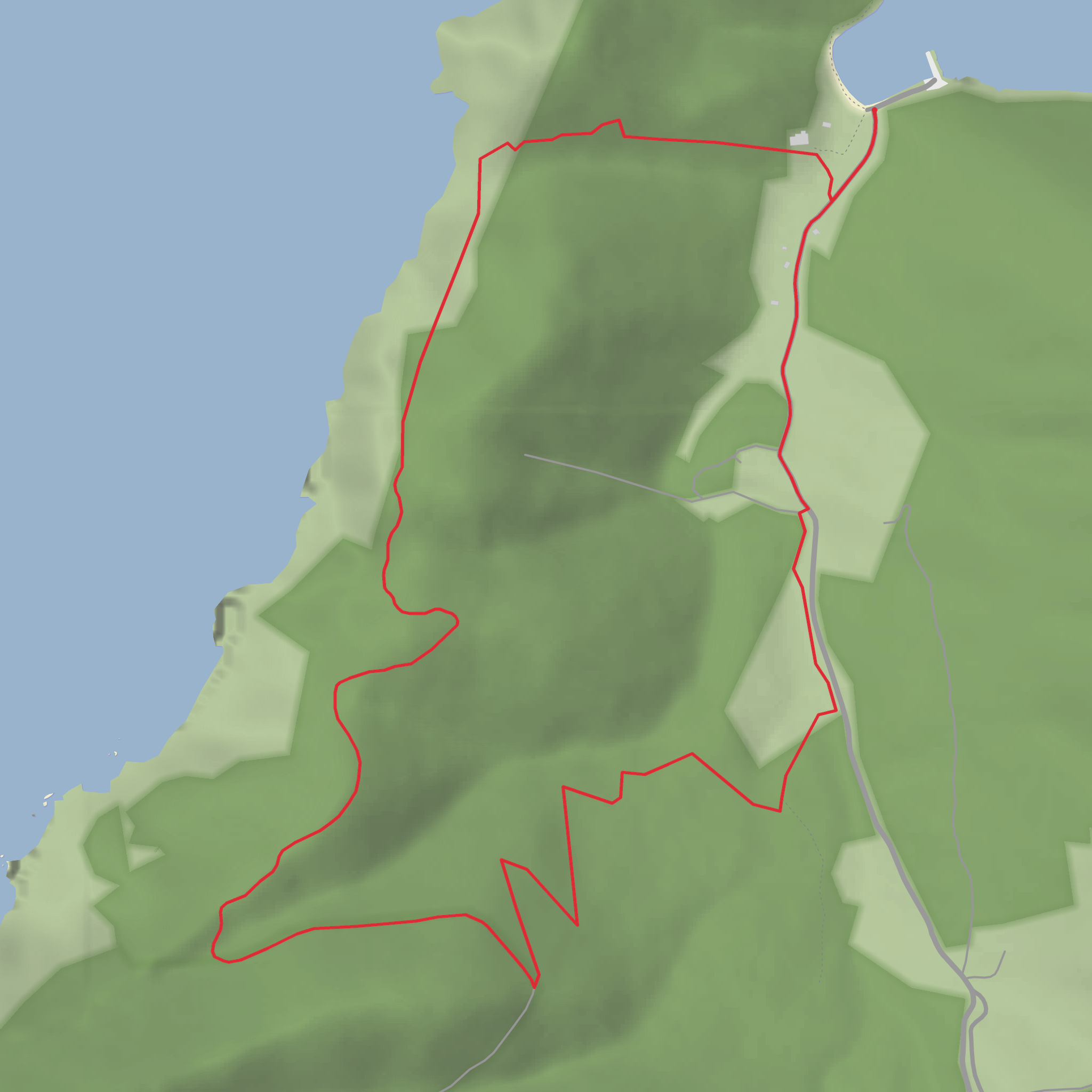
This medium-difficulty loop on Alonnisos covers about 5.8 to 6 km / 3.6 to 3.7 miles with roughly 200 m / 656 ft of ascent, starting near Gerakas at the end of the asphalt road by Gerakas harbour on the island’s northeastern side. The route is short enough for a half-day outing, but the terrain makes it feel more serious than the distance suggests: old alleys, rough livestock paths, rocky outcrops, and exposed ridge walking all feature along the way. The trail is also noted as having no waymarking, so route-finding matters here and it is wise to load the route in HiiKER before setting out. (alonnisosatyourfeet.gr)
The start is best understood as Gerakas Harbour, Alonnisos 370 05, Greece, at the end of the paved access road. From there, the route initially retraces the road briefly before turning onto a small dirt road and then climbing on an older stone-lined path toward the upland grazing area of Papi. (topoguide.gr)
What to expect on the route
The first section is a steady climb away from the coast, gaining much of the day’s elevation in the opening part of the loop. With around 200 m / 656 ft of ascent spread over a route of only about 6 km / 3.7 miles, expect a moderate gradient overall with a few steeper, rougher patches rather than a long gentle ramble. Underfoot, the trail can be stony and uneven, especially where old pastoral tracks fade into narrower footpaths. Good footwear is important, particularly if the limestone and rock are polished by use or damp from recent weather. (alonnisosatyourfeet.gr)
As the route reaches Papi, the landscape opens into a high, austere pastoral zone that was once valued as one of the better grazing areas in this otherwise rocky and arid part of Alonnisos. You pass through a terrain of small meadows, rocky shelves, and remnants of shepherd life, including ruined huts and old service tracks. This gives the walk a strong sense of cultural landscape as much as natural scenery: the route is shaped by generations of stock movement and seasonal use rather than by modern recreational trail building. (topoguide.gr)
One of the most memorable stretches follows the ridge through the Sfrigou area, described as the most hospitable pasture in the wider barren Gerakas uplands. Here the walking becomes more exposed, with broad views over Gerakas Bay and the rugged northern shoreline of the island. The scenery is dramatic rather than lush, and hikers should be prepared for sun, wind, and very little shelter. On a warm day, this can make the route feel harder than the mileage suggests. (topoguide.gr)
Landmarks, nature, and wildlife
The main landmarks are natural and pastoral rather than architectural: Gerakas Bay, the Papi upland pastures, the Sfrigou ridge, and the scattered remains of shepherd huts and livestock facilities. The route also passes a water tank and later trends back toward the Marine Park center area before returning to the start. These features help break the walk into logical stages if you are planning pacing or rest stops. (topoguide.gr)
Vegetation is typical of dry Aegean scrubland, with low shrubs and hardy plants adapted to summer drought and winter winds. Local route information highlights thyme, cistus, yellow asphodel, and other drought-tolerant species with extensive root systems that help stabilize the thin soils. In spring, this kind of terrain can be especially attractive, with more color and scent than the stark summer landscape suggests. (alonnisosatyourfeet.gr)
Birdlife is one of the area’s highlights. The route information specifically notes habitat important for raptors, including the kestrel, and also references black-headed and spotted eagles in the broader rocky and steep-sided zone. Hikers should keep an eye on the cliffs and thermals for soaring birds, especially in quieter hours of the day. (topoguide.gr)
Historical significance of the area
This is not a route defined by ancient ruins or major monuments, but it does have clear historical value as part of Alonnisos’s old rural network. The paths and tracks around Papi and Gerakas were created for grazing, access to huts, and movement through a difficult upland environment. The abandoned pastoral infrastructure—old roads, livestock paths, and ruined shelters—speaks to an earlier way of life when these hills were worked more intensively by shepherds and small
Surfaces
Unknown
Asphalt
Comments and Reviews
User comments, reviews and discussions about the Gerakas and Papi Loop, Greece.
average rating out of 5
0 rating(s)


