
Download
3D Flyover
Add to list
More
554.0 km
25 days
21491 m
Multi Day
“A rugged ribbon across Crete, weaving gorges, white mountains, and sun-struck villages into a demanding odyssey.”
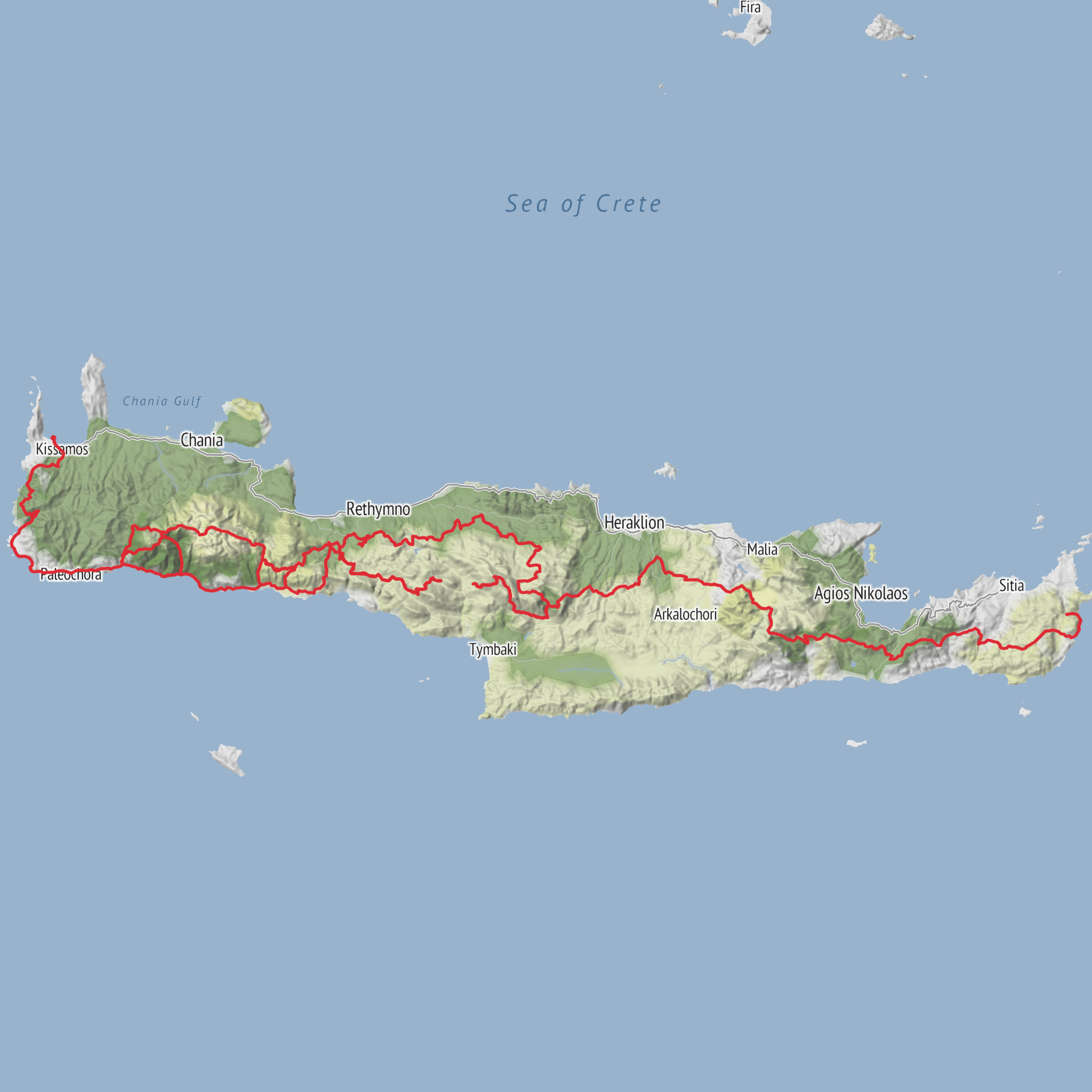
This long crossing of Crete follows the island’s section of the E4 from the Kissamos/Kastelli area in western Crete to Kato Zakros in the far east, covering roughly 554 km / 344 miles with about 21,500 m / 70,540 ft of ascent. It is a serious, island-spanning trek that links coastal paths, deep gorges, high mountain plateaus, shepherd country, remote villages, and long exposed ridgelines. The overall character is rugged rather than technical, but the scale, heat, remoteness, repeated climbs, and uneven footing make it a genuinely difficult undertaking. (trailpath.gr)
The western end is generally associated with Kissamos (also called Kastelli Kissamou), the town west of Chania that serves as the practical gateway to the route, while the eastern end is commonly given as Kato Zakros, the coastal village below the archaeological site of Zakros. If your source only says “near” for the trailhead, the nearest clear start landmark for planning purposes is Kissamos town center / Kastelli-Kissamos bus area on the west side of the island. (trailpath.gr)
Expect a route that changes personality constantly. In the west, the trail quickly introduces the wild limestone landscapes of Gramvousa, Rodopou, and the Lefka Ori (White Mountains). Farther on, it threads through or near famous gorge country including Samaria and Imbros, then continues across central Crete through the Psiloritis/Ida massif, and later into the eastern mountain systems around Dikti before finishing in the stark, dry, beautiful landscapes around Zakros. Some sections are alpine in feel, others are classic Mediterranean mule tracks above the Libyan Sea, and others are long rural connectors between villages and upland basins. (trailpath.gr)
Terrain, effort, and what the walking feels like
A hike of this length in Crete is less about one single crux and more about cumulative strain. Daily stages often involve repeated ascents and descents on rocky footpaths, loose scree, old kalderimi stone paths, dirt roads, goat tracks, and gorge beds. Even when the mileage looks moderate, progress can be slow. A 15 to 20 km day can feel much bigger when it includes rough limestone, heat reflection from bare rock, and long waterless stretches. The total ascent works out to an average of nearly 39 m of climbing per kilometer, which tells you this is not a gentle traverse. (trailpath.gr)
The hardest sections are usually in the White Mountains and the Psiloritis region, where weather exposure and route-finding matter more. In the White Mountains, the route can feel austere and high even when absolute elevations are not Himalayan by global standards. The terrain is broken, pale, dry, and often treeless, with sinkholes, stony basins, and long traverses between refuges or villages. In central Crete, the Psiloritis section adds broad uplands, shepherd terrain, and long mountain crossings that can be punishing in wind or summer sun. (destinationcrete.gr)
Summer heat is one of the biggest objective hazards. On lower and coastal sections, temperatures can turn a straightforward stage into an exhausting one, especially where shade is limited. Spring and autumn are usually the most practical seasons for a full crossing, while winter can bring snow, cold wind, and difficult mountain conditions on the higher inland sections. Gorge closures and fire-risk restrictions can also affect access in some periods. (honestcrete.com)
Landmarks, landscapes, and notable sections
One of the defining landmarks is Samaria Gorge, one of Crete’s most famous natural corridors and a protected area within the White Mountains. The through-walk in the gorge itself is about 16 km / 10 miles, and the broader E4-linked stage from Omalos to Agia Roumeli is about 18 km / 11.2 miles. This is one of the most dramatic parts of the island: towering walls, narrow passages, old ruins, springs, and a long descent from the Omalos plateau to the Libyan Sea. (destinationcrete.gr)
Another classic section is Imbros Gorge, around 11 km / 6.8 miles, narrower and usually less committing than Samaria but still scenic and historically important as an old passage between the Sfakia region and the north. It is part of the wider
Comments and Reviews
User comments, reviews and discussions about the E4 Trail - Crete, Greece.
average rating out of 5
0 rating(s)



