Download
3D Flyover
Add to list
More
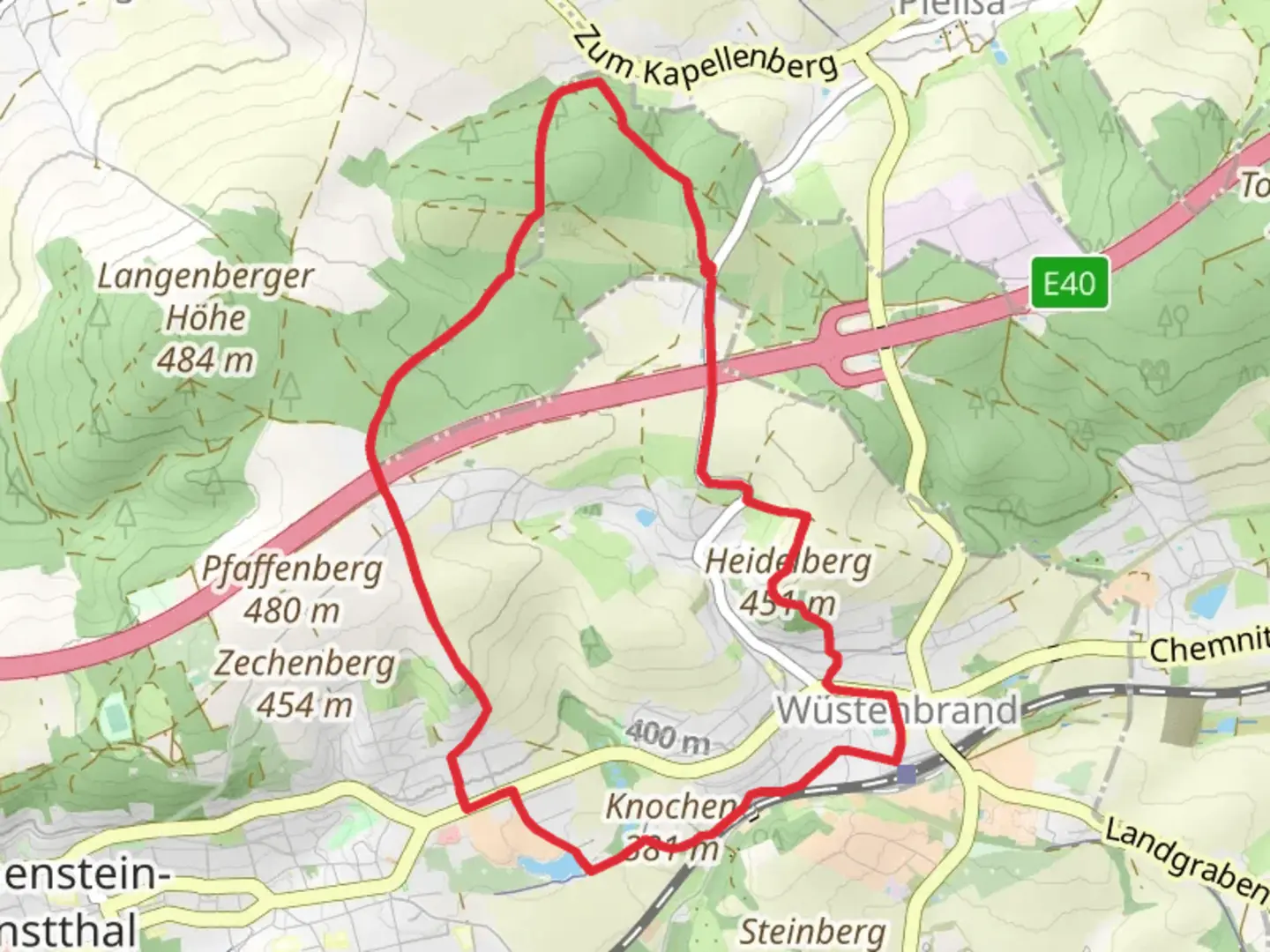
8.9 km
~2 hrs
136 m
Loop
“Explore the scenic, moderately challenging 9km Ziegeleiteich Rundweg Wuestenbrand trail, rich in nature and history.”
Starting near Zwickau, Germany, the Ziegeleiteich via Rundweg Wuestenbrand is a delightful loop trail that spans approximately 9 kilometers (5.6 miles) with an elevation gain of around 100 meters (328 feet). This trail is rated as medium difficulty, making it suitable for moderately experienced hikers.
Getting There
To reach the trailhead, you can either drive or use public transport. If driving, head towards the town of Wuestenbrand, which is easily accessible from Zwickau. For those using public transport, take a train or bus to Zwickau and then a local bus towards Wuestenbrand. The nearest significant landmark to the trailhead is the Wuestenbrand Train Station, which is a convenient starting point.
Trail Overview
The trail begins near the Wuestenbrand Train Station and quickly immerses you in the serene beauty of the German countryside. The path is well-marked and maintained, making navigation straightforward. For added assurance, consider using the HiiKER app to keep track of your progress and ensure you stay on course.
Key Landmarks and Points of Interest
Ziegeleiteich Pond
One of the first significant landmarks you'll encounter is the Ziegeleiteich Pond, located about 2 kilometers (1.2 miles) into the hike. This picturesque pond is a great spot for a short break, offering beautiful views and a chance to observe local wildlife, including various bird species and small mammals.
Forested Sections
As you continue, the trail meanders through dense forested areas, providing ample shade and a tranquil atmosphere. These sections are particularly beautiful in the autumn when the foliage turns vibrant shades of red and gold. The forest is home to a variety of flora and fauna, so keep an eye out for deer, foxes, and a plethora of bird species.
Historical Significance
Around the 5-kilometer (3.1 miles) mark, you'll come across remnants of old brickworks, which are a nod to the region's industrial past. These historical sites offer a glimpse into the area's history and are well worth a brief exploration. Informational plaques provide context and details about the significance of these structures.
Elevation and Terrain
The trail features a gentle elevation gain of around 100 meters (328 feet), spread out over the course of the hike. The terrain is varied, with sections of packed dirt, gravel, and occasional rocky patches. Good hiking boots are recommended to navigate these diverse surfaces comfortably.
Wildlife and Nature
The trail is rich in biodiversity. In addition to the common sightings of deer and foxes, you might also spot rare bird species such as the European Green Woodpecker or the Eurasian Jay. The flora is equally diverse, with a mix of deciduous and coniferous trees, wildflowers, and ferns.
Final Stretch
As you near the end of the loop, the trail opens up to more open fields and meadows, offering expansive views of the surrounding countryside. This final stretch is relatively flat and provides a relaxing end to your hike.
Practical Tips
- Navigation: Use the HiiKER app for real-time navigation and updates.
- Footwear: Wear sturdy hiking boots to handle the varied terrain.
- Weather: Check the weather forecast before heading out, as conditions can change rapidly.
- Supplies: Bring sufficient water and snacks, especially if you plan to take breaks at the various points of interest.
This trail offers a perfect blend of natural beauty, historical intrigue, and moderate physical challenge, making it a rewarding experience for any hiker.

What to expect?
Activity types
Comments and Reviews
User comments, reviews and discussions about the Ziegeleiteich via Rundweg Wuestenbrand, Germany.
average rating out of 5
0 rating(s)