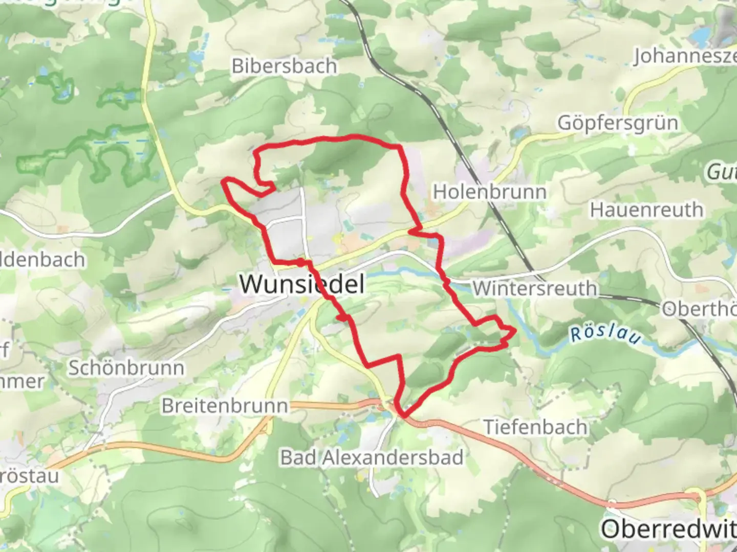
Wunsiedel Loop via Sonnenhof and Landschaftslehrofad Wunsiedel
Download
3D Flyover
Add to list
More
14.7 km
~3 hrs 27 min
310 m
Loop
“Embark on the captivating Wunsiedel Loop, blending nature, history, and education over a scenic 15 km trail.”
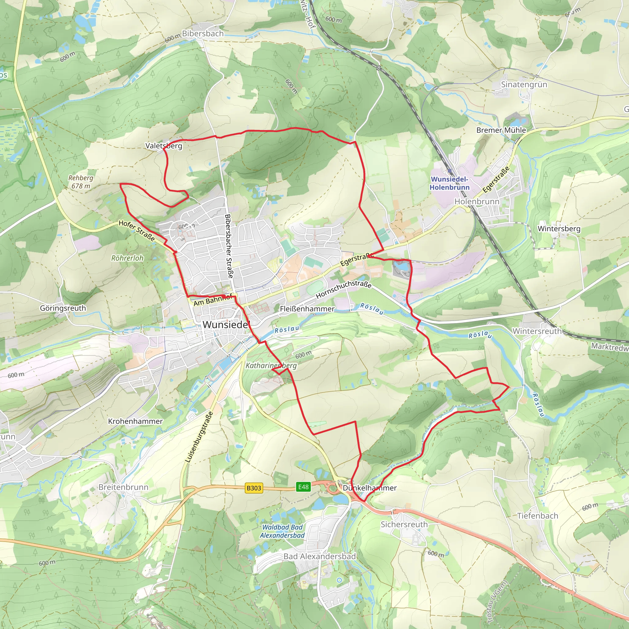
Starting your adventure near Wunsiedel im Fichtelgebirge, Germany, the Wunsiedel Loop via Sonnenhof and Landschaftslehrofad Wunsiedel is a captivating 15 km (approximately 9.3 miles) loop trail with an elevation gain of around 300 meters (about 984 feet). This medium-difficulty trail offers a blend of natural beauty, historical landmarks, and educational opportunities.
Getting There
To reach the trailhead, you can either drive or use public transport. If driving, set your GPS to Wunsiedel im Fichtelgebirge. There are parking facilities available near the trailhead. For those using public transport, take a train to Marktredwitz and then a bus to Wunsiedel. The nearest significant landmark to the trailhead is the Fichtelgebirgsmuseum, located in the heart of Wunsiedel.
Trail Overview
The trail begins near the Fichtelgebirgsmuseum, a great starting point to delve into the local history before you set off. As you embark on the loop, you'll first head towards Sonnenhof, a picturesque area known for its serene landscapes and traditional Bavarian architecture.
Sonnenhof to Landschaftslehrofad
From Sonnenhof, the trail meanders through lush forests and open meadows, offering a diverse range of flora and fauna. Keep an eye out for native wildlife such as deer, foxes, and a variety of bird species. The first 5 km (3.1 miles) of the trail are relatively gentle, with an elevation gain of about 100 meters (328 feet), making it a pleasant start to your hike.
Landschaftslehrofad Wunsiedel
As you approach the Landschaftslehrofad Wunsiedel, the trail becomes more educational. This section is designed as a nature and landscape learning path, featuring informative signs about the local ecosystem, geology, and conservation efforts. It's an excellent opportunity to learn about the natural history of the Fichtelgebirge region.
Historical Significance
The area around Wunsiedel has a rich history dating back to medieval times. The town itself is known for its well-preserved historical buildings and cobblestone streets. Along the trail, you may come across remnants of old fortifications and ancient stone markers, hinting at the region's storied past.
Elevation and Terrain
The trail's elevation gain is gradual, with the most significant climbs occurring in the latter half of the loop. After the initial 5 km, the next 5 km (3.1 miles) will see an elevation gain of approximately 150 meters (492 feet), leading you through more rugged terrain and offering stunning panoramic views of the surrounding countryside.
Final Stretch
The last 5 km of the trail bring you back towards Wunsiedel, descending gently through mixed forests and past small streams. This section is less strenuous, allowing you to enjoy the peaceful surroundings and reflect on the journey.
Navigation
For navigation, it's highly recommended to use the HiiKER app, which provides detailed maps and real-time updates to ensure you stay on track. The trail is well-marked, but having a reliable navigation tool can enhance your hiking experience.
Wildlife and Flora
Throughout the hike, you'll encounter a variety of plant species, from dense coniferous forests to open meadows filled with wildflowers. The diverse habitats support a range of wildlife, making it a rewarding experience for nature enthusiasts.
Practical Tips
- Wear sturdy hiking boots, as some sections of the trail can be rocky and uneven.
- Bring sufficient water and snacks, especially if you plan to take your time exploring the educational sections.
- Check the weather forecast before you go, as conditions can change rapidly in the Fichtelgebirge region.
This trail offers a perfect blend of natural beauty, historical intrigue, and educational value, making it a must-visit for hikers of all levels.
What to expect?
Activity types
Comments and Reviews
User comments, reviews and discussions about the Wunsiedel Loop via Sonnenhof and Landschaftslehrofad Wunsiedel, Germany.
average rating out of 5
0 rating(s)
