Download
3D Flyover
Add to list
More
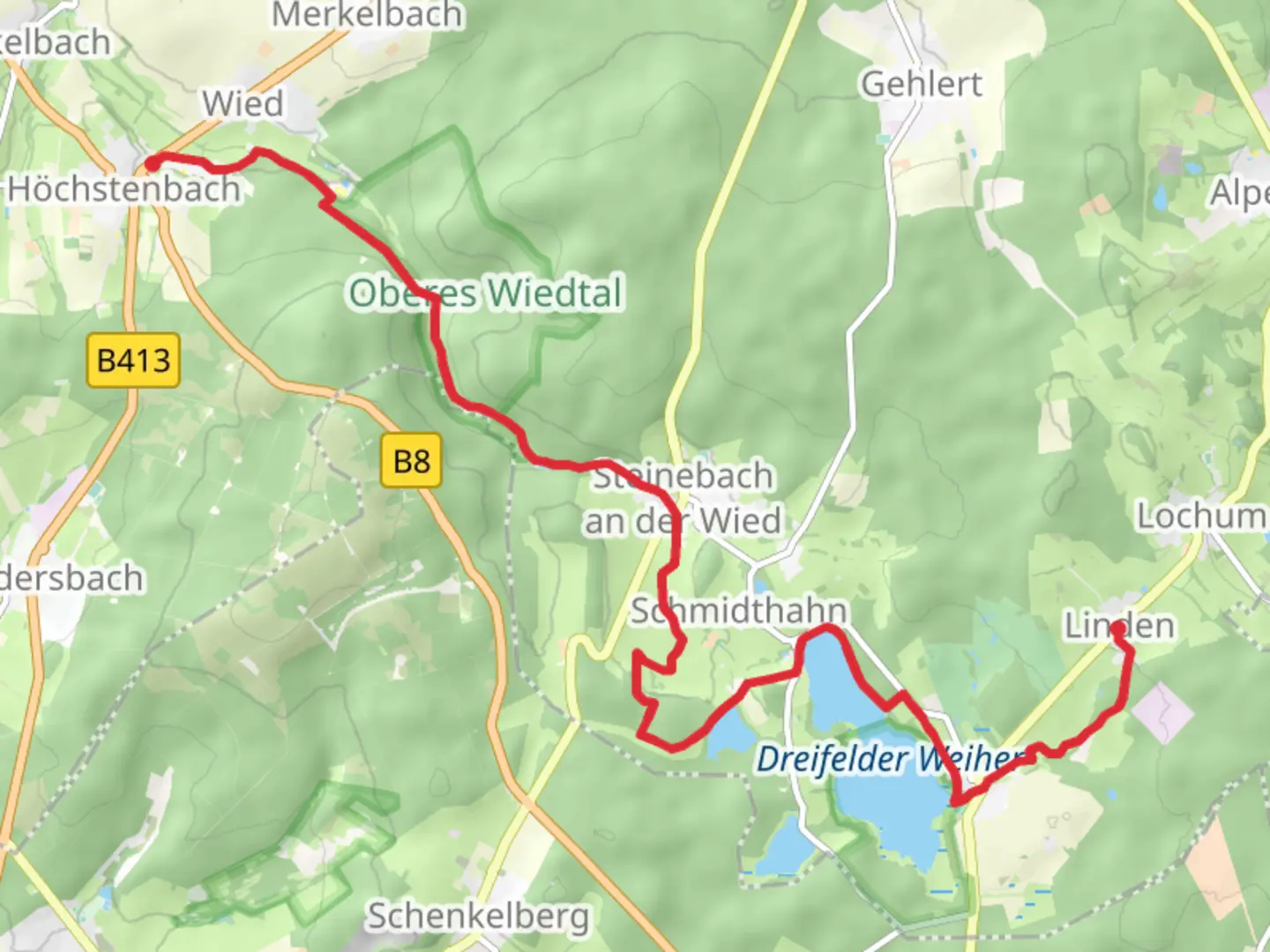
14.7 km
~3 hrs 8 min
114 m
Point-to-Point
“Explore serene landscapes, historic sites, and vibrant wildlife on the Linden to Hochstenbach Walk.”
Nestled in the picturesque Westerwald region of Germany, the Linden to Hochstenbach Walk via Dreifelder Weiher offers a serene escape into nature. This point-to-point trail stretches approximately 15 kilometers (around 9.3 miles) and is characterized by gentle terrain with an elevation gain of about 100 meters (328 feet), making it an accessible hike for most skill levels.
Getting There
The trailhead is conveniently located near Westerwaldkreis, Germany. For those traveling by car, you can reach the starting point by heading towards the village of Linden. Parking is typically available near the village center. If you prefer public transport, the nearest major town is Montabaur, which is well-connected by train. From Montabaur, local buses can take you closer to Linden, though a short taxi ride might be necessary to reach the exact trailhead.
Trail Highlights
Dreifelder Weiher
One of the most captivating features of this hike is the Dreifelder Weiher, a large lake that serves as a central point of interest. As you approach the lake, you'll be greeted by its tranquil waters and the surrounding lush greenery. This area is a haven for birdwatchers, with various species of waterfowl frequently spotted along the shores. The lake's serene environment provides an excellent opportunity for a peaceful break or a picnic.
Flora and Fauna
The trail meanders through a diverse landscape, including dense forests and open meadows. In spring and summer, the meadows burst into color with wildflowers, attracting butterflies and bees. The forested sections are home to a variety of wildlife, including deer and foxes, which you might catch a glimpse of if you're quiet and observant.
Historical Significance
The Westerwald region is steeped in history, and this trail offers a glimpse into its past. The area was historically significant for its iron ore mining and pottery production, with remnants of these industries still visible in some parts. As you hike, you may come across old stone structures and kilns, offering a tangible connection to the region's industrious past.
Navigation and Safety
While the trail is well-marked, it's always wise to have a reliable navigation tool. HiiKER is an excellent resource for detailed maps and real-time navigation assistance. The trail's easy rating means it's suitable for families and beginners, but always ensure you have adequate water, snacks, and weather-appropriate clothing.
Final Stretch to Hochstenbach
As you near the end of your hike, the trail gently descends towards the village of Hochstenbach. This charming village is a perfect place to conclude your journey, with its quaint streets and traditional German architecture. Consider exploring the local eateries or simply enjoying the peaceful ambiance before heading back.

Comments and Reviews
User comments, reviews and discussions about the Linden to Hochstenbach Walk via Dreifelder Weiher, Germany.
average rating out of 5
0 rating(s)