Download
3D Flyover
Add to list
More
8.6 km
~2 hrs 2 min
200 m
Loop
“The Gickelsweg Niederelbert Loop offers 9 km of lush forest, historic sites, and panoramic views for moderate hikers.”
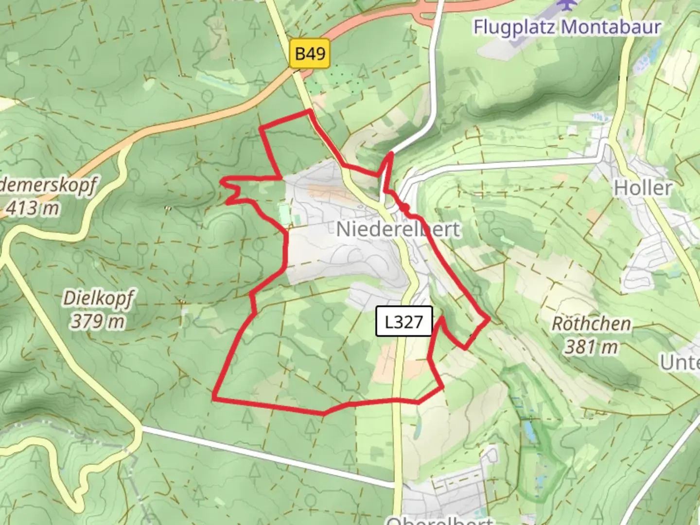
Starting near Westerwaldkreis, Germany, the Gickelsweg Niederelbert Loop is a delightful 9 km (approximately 5.6 miles) trail with an elevation gain of around 200 meters (656 feet). This loop trail is rated as medium difficulty, making it suitable for moderately experienced hikers.
Getting There
To reach the trailhead, you can drive or use public transport. If driving, set your GPS to Niederelbert, a small village in the Westerwaldkreis region. There is ample parking available near the village center. For those using public transport, take a train to Montabaur, which is the nearest major town. From Montabaur, you can catch a local bus to Niederelbert.
Trail Overview
The trail begins in the charming village of Niederelbert, known for its picturesque half-timbered houses and serene rural atmosphere. As you start your hike, you'll quickly find yourself immersed in the lush greenery of the Westerwald forest.
Key Landmarks and Points of Interest
- Niederelbert Village: The trailhead is located here. Take a moment to explore the village's quaint streets and historic buildings before you set off.
- Westerwald Forest: The majority of the trail winds through this dense forest, offering a peaceful and shaded hike. Keep an eye out for local wildlife such as deer, foxes, and a variety of bird species.
- Gickelsberg Hill: About 3 km (1.9 miles) into the hike, you'll begin your ascent up Gickelsberg Hill. The climb is gradual but steady, gaining approximately 100 meters (328 feet) in elevation over the next 2 km (1.2 miles). At the summit, you'll be rewarded with panoramic views of the surrounding countryside.
- Historical Sites: The region has a rich history dating back to the Roman era. Along the trail, you may come across remnants of ancient Roman roads and boundary stones. These historical markers offer a glimpse into the area's past and are well worth a pause to appreciate.
- Scenic Meadows: As you descend from Gickelsberg Hill, the trail opens up into expansive meadows. These areas are particularly beautiful in the spring and summer when wildflowers are in full bloom.
Navigation and Safety
The trail is well-marked with signs and blazes, but it's always a good idea to have a reliable navigation tool. HiiKER is an excellent app for this purpose, providing detailed maps and real-time GPS tracking to ensure you stay on course.
Flora and Fauna
The Westerwald forest is home to a diverse range of plant and animal life. In addition to the wildlife mentioned earlier, you might also encounter various species of mushrooms, ferns, and mosses. The forest canopy is dominated by beech and oak trees, creating a vibrant green tunnel during the warmer months and a stunning display of colors in the fall.
Practical Tips
- Footwear: Given the mixed terrain, sturdy hiking boots are recommended.
- Weather: The weather in this region can be unpredictable, so pack a rain jacket and dress in layers.
- Water and Snacks: There are no facilities along the trail, so bring enough water and snacks to sustain you for the duration of the hike.
- Leave No Trace: As always, practice Leave No Trace principles to keep the trail beautiful and pristine for future hikers.
This loop trail offers a perfect blend of natural beauty, historical intrigue, and moderate physical challenge, making it a rewarding experience for those who venture out to explore it.

What to expect?
Activity types
Comments and Reviews
User comments, reviews and discussions about the Gickelsweg Niederelbert Loop, Germany.
average rating out of 5
0 rating(s)