Download
3D Flyover
Add to list
More
198.4 km
11 days
4194 m
Multi Day
“Embark on the historic Altmühlthal Panoramaweg, a scenic Bavarian hike blending cultural landmarks with natural splendor.”
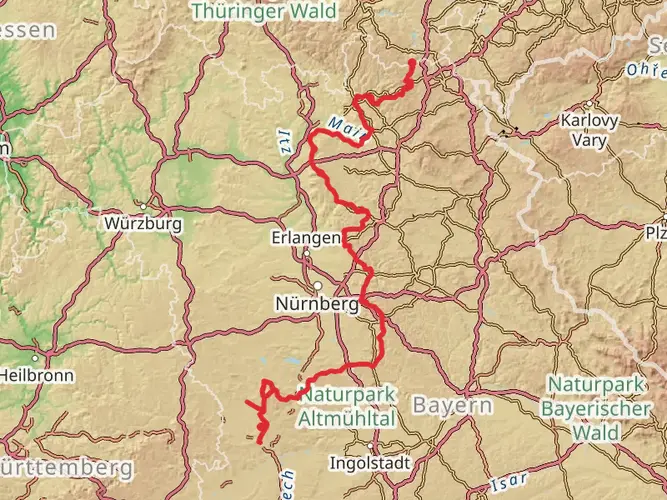
Spanning approximately 198 kilometers (123 miles) with an elevation gain of around 4100 meters (13,450 feet), the Altmühlthal Panoramaweg offers a medium-difficulty hiking experience through the heart of Bavaria's captivating landscapes. This point-to-point trail begins near Weißenburg-Gunzenhausen, a region rich in history and natural beauty.
Getting to the Trailhead
The starting point of the Altmühlthal Panoramaweg is accessible by public transportation or car. If you're arriving by train, the nearest station is in Gunzenhausen, from which you can take a taxi or a local bus to the trailhead. For those driving, parking is available near the starting point, which is conveniently located close to the town of Weißenburg.
Navigating the Trail
As you embark on your journey, it's advisable to use a reliable navigation tool like HiiKER to stay on track. The trail is well-marked, but having a digital map can be invaluable, especially in areas where the path may be less defined.
Historical Significance and Landmarks
The Altmühlthal Panoramaweg winds through a region steeped in history. You'll encounter numerous castles, ruins, and medieval towns that tell the story of the area's past. Notable historical landmarks include the imposing Pappenheim Castle, the charming town of Riedenburg with its crystal museum, and the Roman fort at Weißenburg.
Natural Wonders and Wildlife
The trail offers panoramic views of the Altmühl River Valley, with its dramatic limestone formations and dense forests. The Altmühltal Nature Park is known for its diverse flora and fauna, including rare orchids and birds of prey like the red kite. Keep an eye out for the famous "Twelve Apostles" – towering rock formations that are a highlight of the trail.
Trail Sections and Terrain
The trail can be divided into manageable sections, each offering a unique experience. The first section from Gunzenhausen to Treuchtlingen, about 30 kilometers (18.6 miles), features gentle hills and open fields. As you progress towards Eichstätt, the terrain becomes more challenging with steeper climbs and descents.
The stretch from Eichstätt to Beilngries, roughly 50 kilometers (31 miles), is characterized by its rugged valleys and the meandering Altmühl River. The final leg to Kelheim, about 70 kilometers (43.5 miles), presents the most dramatic landscapes, with the Danube River coming into view as you approach the trail's end.
Preparation and Planning
Given the trail's length and varied terrain, it's essential to plan your hike carefully. Consider the time of year, as spring and autumn offer cooler temperatures and vibrant foliage. Ensure you have appropriate gear for the weather, and plan your accommodation in advance, as the trail passes through several towns where guesthouses and hotels are available.
Conclusion
The Altmühlthal Panoramaweg is a journey through time and nature, offering hikers a chance to explore the rich cultural heritage and stunning landscapes of Bavaria. With proper preparation and an adventurous spirit, this trail promises an unforgettable experience.
AI Planner
Days planned around your pace, with somewhere to stay each night.

Comments and Reviews
User comments, reviews and discussions about the Altmülthal Panoramaweg, Germany.
4.6
average rating out of 5
5 rating(s)