Download
Preview
Add to list
More
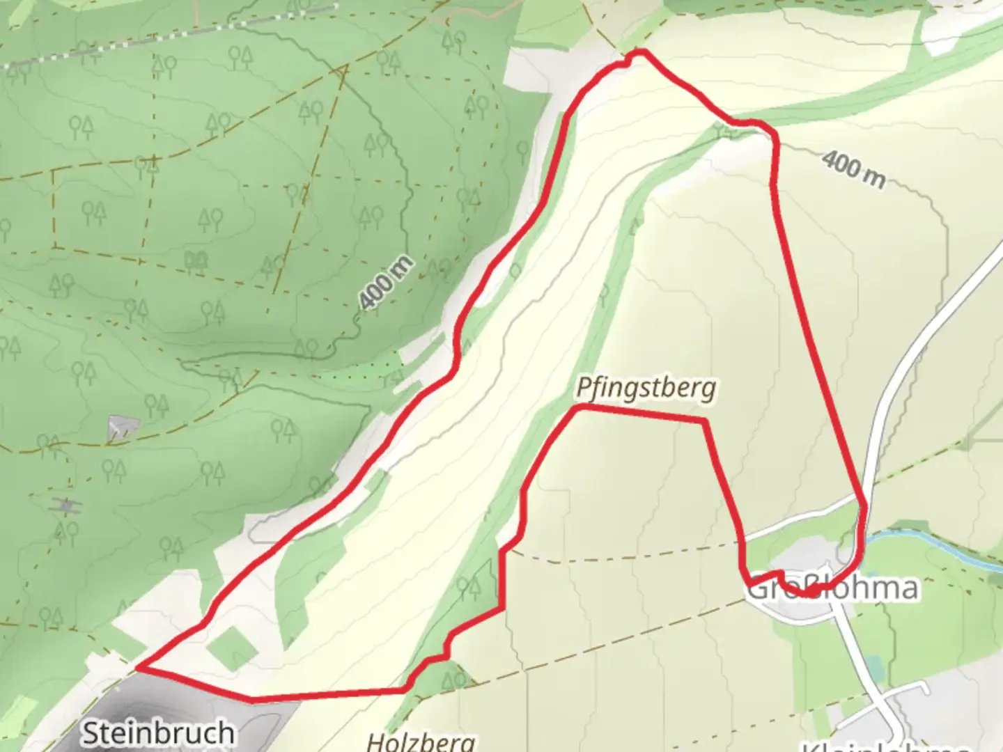
6.0 km
~1 hrs 23 min
107 m
Loop
“The Großlohma Loop is a scenic 6 km trail in Thuringia, featuring forests, meadows, and historical landmarks.”
Starting near Weimarer Land, Germany, the Großlohma Loop is a delightful 6 km (approximately 3.7 miles) trail that offers a moderate challenge with an elevation gain of around 100 meters (328 feet). This loop trail is perfect for those looking to immerse themselves in the serene beauty of the Thuringian countryside.
Getting There
To reach the trailhead, you can either drive or use public transport. If driving, set your GPS to Weimarer Land, and you will find parking options near the starting point. For those using public transport, take a train to Weimar and then a local bus towards Weimarer Land. The nearest significant landmark to the trailhead is the village of Großlohma, which is well-signposted and easy to locate.
Trail Overview
The Großlohma Loop begins with a gentle ascent through mixed forests, where you will be greeted by the soothing sounds of rustling leaves and chirping birds. The initial 1 km (0.6 miles) of the trail gains about 30 meters (98 feet) in elevation, making it a pleasant warm-up.
Flora and Fauna
As you progress, the trail opens up into a series of meadows. These meadows are particularly vibrant in spring and summer, adorned with wildflowers such as daisies, poppies, and cornflowers. Keep an eye out for local wildlife, including deer, foxes, and a variety of bird species like the European robin and the common blackbird.
Historical Significance
Around the 3 km (1.9 miles) mark, you will come across the remnants of an old stone structure. This is believed to be part of a medieval watchtower that once served as a lookout point for the surrounding area. The region has a rich history dating back to the Middle Ages, and this site offers a glimpse into its storied past.
Scenic Views
As you reach the halfway point, the trail offers panoramic views of the Thuringian Basin. This is an excellent spot to take a break, enjoy a snack, and soak in the breathtaking scenery. The elevation here is around 100 meters (328 feet) above the starting point, providing a vantage point that is both rewarding and picturesque.
Navigation
The trail is well-marked, but it's always a good idea to have a reliable navigation tool. HiiKER is highly recommended for this purpose, as it provides detailed maps and real-time updates to ensure you stay on track.
Final Stretch
The descent begins around the 4.5 km (2.8 miles) mark, leading you back through dense forest. This section can be a bit steep, so watch your footing, especially if the ground is wet. The final kilometer (0.6 miles) is a gentle walk back to the trailhead, passing through a charming village where you can stop for refreshments at a local café.
Practical Tips
- Wear sturdy hiking boots, as the trail can be uneven in places.
- Bring water and snacks, especially if you plan to take breaks and enjoy the scenery.
- Check the weather forecast before heading out, as conditions can change rapidly.
- Use HiiKER for navigation to ensure you stay on the correct path.
The Großlohma Loop offers a perfect blend of natural beauty, historical intrigue, and moderate physical challenge, making it an ideal choice for hikers of all levels.

What to expect?
Activity types
Comments and Reviews
User comments, reviews and discussions about the Großlohma Loop, Germany.
4.0
average rating out of 5
1 rating(s)