Download
Preview
Add to list
More
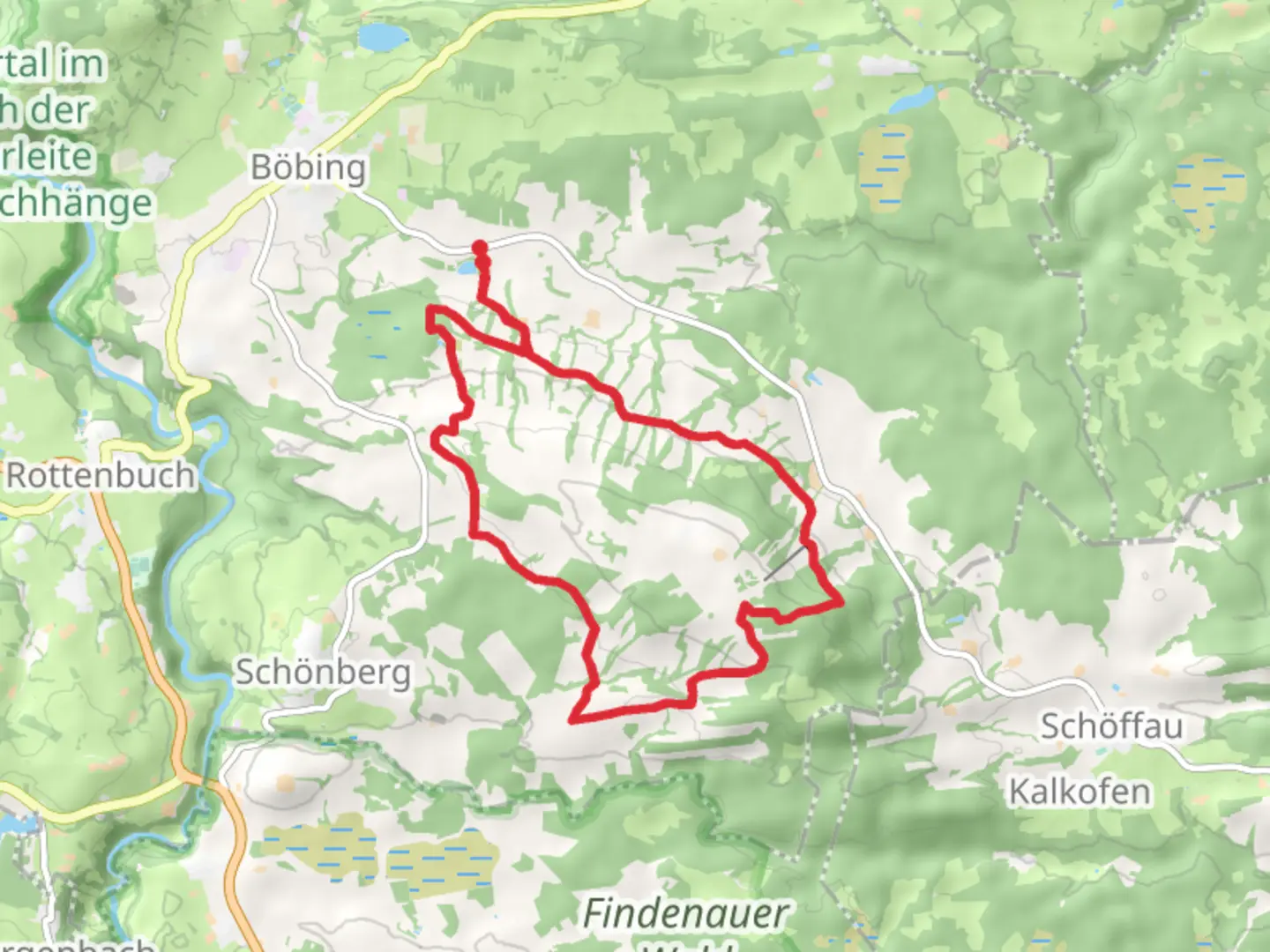
15.0 km
~3 hrs 39 min
387 m
Loop
“Explore a 15 km loop through Bavarian forests, streams, and historical landmarks with panoramic Alpine views.”
Starting near Weilheim-Schongau in Germany, this 15 km (approximately 9.3 miles) loop trail offers a moderate challenge with an elevation gain of around 300 meters (approximately 984 feet). The trailhead is easily accessible by car or public transport. If driving, you can park near the Weilheim-Schongau area. For those using public transport, take a train to Weilheim (Oberbay) station and then a local bus to the nearest stop, which is a short walk from the trailhead.
Trail Overview
The trail begins with a gentle ascent through mixed forests, where you can enjoy the serene atmosphere and the sound of the Ruhbach stream. The initial 3 km (1.9 miles) are relatively easy, making it a good warm-up for the more challenging sections ahead. As you continue, the path becomes steeper, leading you through dense woodland and offering occasional glimpses of the surrounding Bavarian countryside.
Significant Landmarks and Points of Interest
Around the 5 km (3.1 miles) mark, you'll come across a charming wooden bridge that crosses the Ruhbach stream. This is a great spot for a short break and some photos. Continuing on, you'll reach a small clearing with a panoramic view of the Ammergau Alps in the distance. This viewpoint is approximately 7 km (4.3 miles) into the hike and is one of the highlights of the trail.
Flora and Fauna
The trail is rich in biodiversity. In the spring and summer months, you'll find a variety of wildflowers, including orchids and gentians. The forested areas are home to deer, foxes, and a variety of bird species such as woodpeckers and owls. Keep an eye out for signs of wildlife, but remember to maintain a respectful distance.
Historical Significance
The region around Weilheim-Schongau has a rich history dating back to Roman times. Along the trail, you may notice remnants of old stone walls and ancient pathways that were once used by traders and pilgrims. The area was also significant during the medieval period, serving as a route for merchants traveling between Bavaria and the Tyrol region.
Navigation and Safety
Given the moderate difficulty of the trail, it's advisable to use a reliable navigation tool like HiiKER to ensure you stay on track. The trail is well-marked, but having a digital map can be very helpful, especially in the denser forest sections. Wear sturdy hiking boots and bring plenty of water, as there are limited sources along the way.
Final Stretch
The last 3 km (1.9 miles) of the trail are a gentle descent back to the starting point. This section takes you through open meadows and past a few traditional Bavarian farmhouses, offering a peaceful end to your hike. As you approach the trailhead, you'll pass by a small chapel, a perfect spot for reflection before concluding your journey.
This trail offers a balanced mix of natural beauty, historical intrigue, and moderate physical challenge, making it a rewarding experience for hikers of all levels.

What to expect?
Activity types
Comments and Reviews
User comments, reviews and discussions about the Ruhbach in Vorderkirnberg, Germany.
4.0
average rating out of 5
8 rating(s)