Download
3D Flyover
Add to list
More
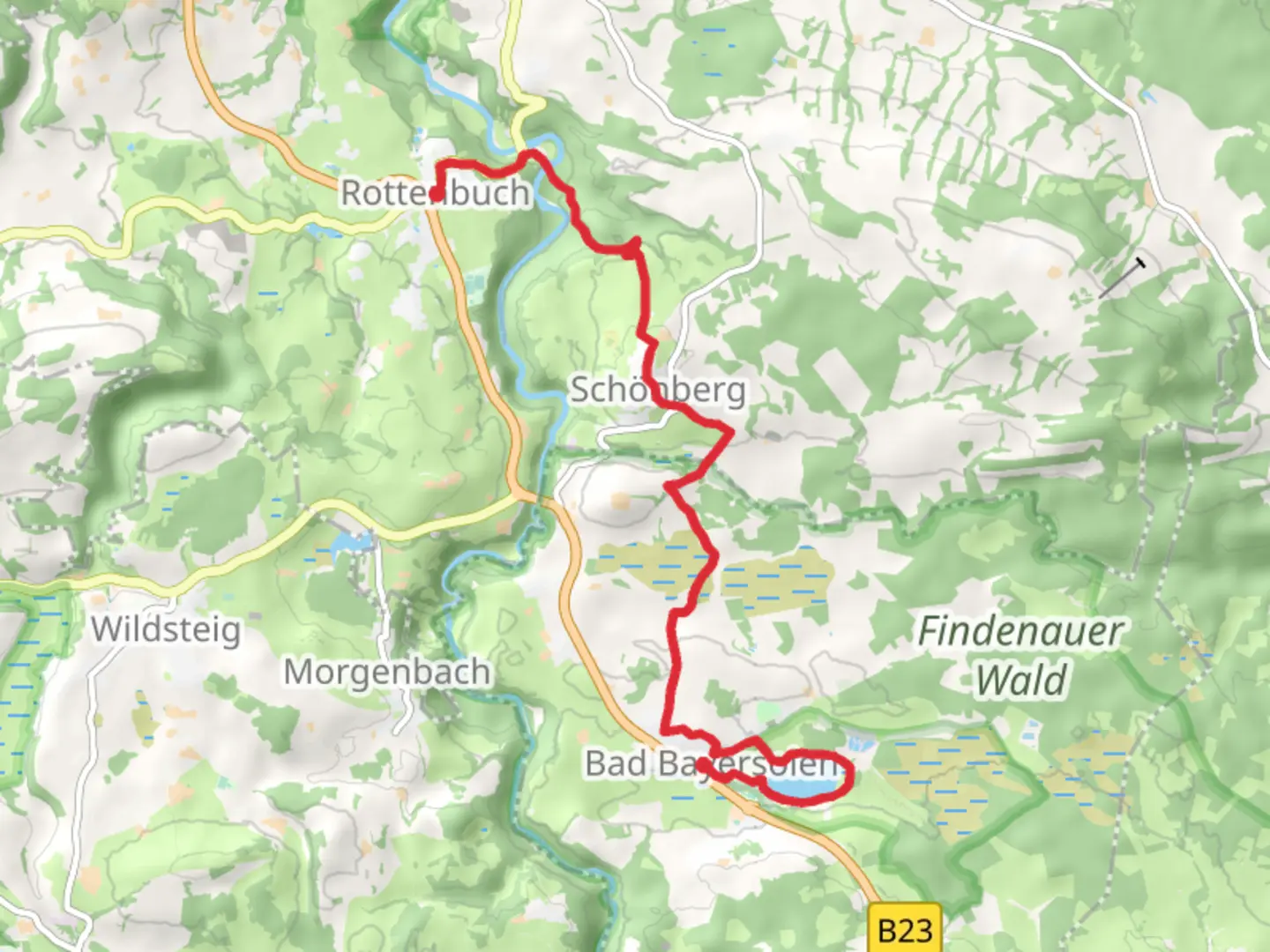
11.8 km
~2 hrs 50 min
286 m
Point-to-Point
“Explore Bavaria's lush landscapes and historic charm on this picturesque trail from Rottenbuch to Bad Bayersoier.”
Nestled in the picturesque region of Weilheim-Schongau, Germany, the trail from Rottenbuch to Bad Bayersoier via Soiener See offers a delightful journey through the Bavarian countryside. Spanning approximately 12 kilometers (about 7.5 miles) with an elevation gain of around 200 meters (approximately 656 feet), this point-to-point trail is estimated to be of medium difficulty, making it suitable for moderately experienced hikers.
Getting There
To reach the trailhead near Rottenbuch, travelers can opt for public transport or drive. If using public transport, take a train to Weilheim in Oberbayern, and from there, a local bus service can take you to Rottenbuch. For those driving, Rottenbuch is accessible via the B23 road, with parking available near the trailhead.
Trail Highlights
Soiener See: One of the most enchanting features of this hike is the Soiener See, a serene lake located roughly halfway along the trail. The lake is a perfect spot for a break, offering stunning reflections of the surrounding forested hills. Birdwatchers will find this area particularly rewarding, as it is home to a variety of bird species.
Scenic Views and Natural Beauty: As you traverse the trail, you'll be treated to sweeping views of the Ammergau Alps. The landscape is a harmonious blend of lush meadows, dense woodlands, and gentle hills. In spring and summer, the meadows burst into a riot of colors with wildflowers, while autumn paints the landscape in rich hues of gold and red.
Wildlife: The trail is part of a region known for its biodiversity. Hikers might spot deer, foxes, and a variety of birdlife. The forests are rich with flora, including beech and spruce trees, providing a habitat for numerous woodland creatures.
Historical Significance
The region around Rottenbuch and Bad Bayersoier is steeped in history. Rottenbuch itself is known for its Augustinian monastery, founded in the 11th century. Although the monastery is not directly on the trail, its historical influence permeates the area. The trail also passes through landscapes that have been shaped by centuries of agricultural practices, offering a glimpse into the rural heritage of Bavaria.
Navigation and Safety
Hikers are encouraged to use HiiKER for navigation, as it provides detailed maps and real-time updates. The trail is well-marked, but it's always wise to have a reliable navigation tool at hand. Weather in the region can be unpredictable, so it's advisable to check forecasts and prepare accordingly. Sturdy hiking boots, layered clothing, and sufficient water are recommended for a comfortable hike.
This trail offers a perfect blend of natural beauty, wildlife, and historical intrigue, making it a rewarding experience for those looking to explore the Bavarian countryside.

Comments and Reviews
User comments, reviews and discussions about the Rottenbuch to Bad Bayersoier via Soiener See, Germany.
4.0
average rating out of 5
1 rating(s)