Download
3D Flyover
Add to list
More
6.6 km
~1 hrs 21 min
31 m
Loop
“Explore lush meadows, moorlands, and dense forests on the educational and accessible 7 km Röthenbach trail.”
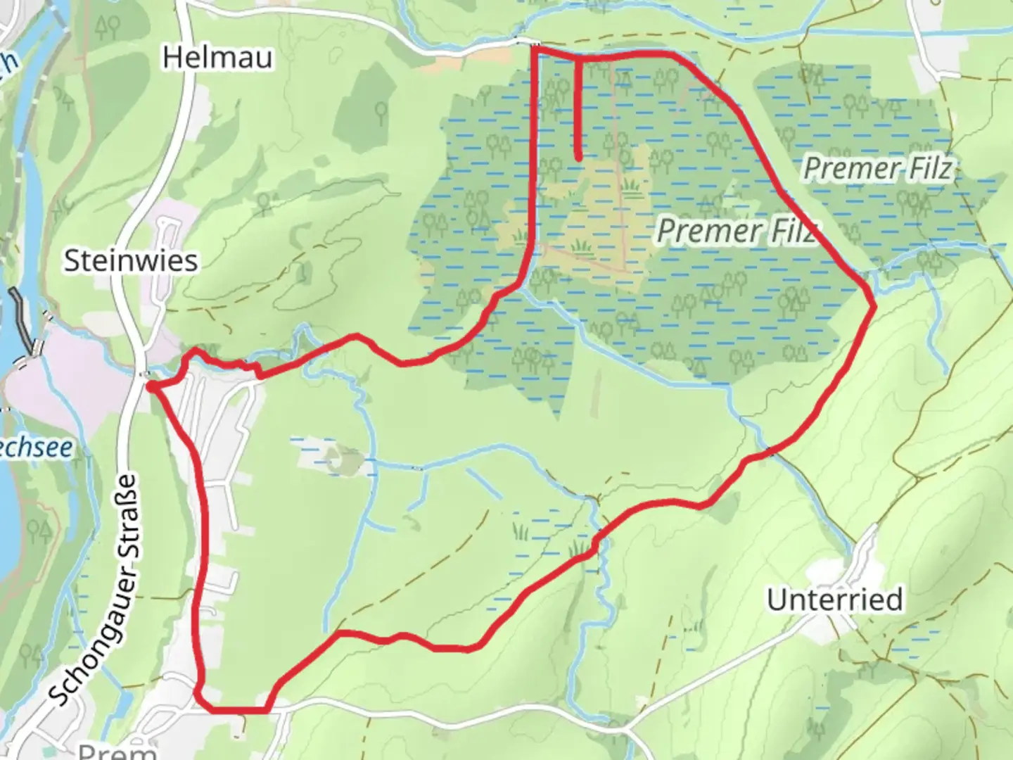
Starting near Weilheim-Schongau, Germany, the Röthenbach via Moorlehrpfad trail is a delightful 7 km (approximately 4.3 miles) loop with no significant elevation gain, making it accessible for a wide range of hikers. The trailhead is conveniently located near the town of Weilheim-Schongau, which can be reached by car or public transport. If you're driving, there are parking facilities available close to the trailhead. For those using public transport, Weilheim-Schongau is well-connected by regional trains and buses, making it easy to reach from major cities like Munich.
Trail Overview
The trail begins with a gentle walk through lush meadows and fields, offering a serene start to your hike. As you progress, you'll enter the Moorlehrpfad, or "Moor Educational Path," which is a highlight of this trail. This section is designed to educate hikers about the unique moorland ecosystem, featuring informative signs that explain the flora and fauna native to the area. Keep an eye out for rare plant species like sundews and cotton grass, which thrive in the acidic soil of the moor.
Wildlife and Nature
The moorland is a haven for birdwatchers. Species such as the Eurasian curlew and the common snipe are often spotted here. The trail also passes through dense forests where you might encounter deer, foxes, and a variety of woodland birds. The diversity of habitats along the trail—from open fields to dense woods and moorlands—ensures that there's always something interesting to see.
Historical Significance
The region around Weilheim-Schongau has a rich history dating back to Roman times. While the trail itself is primarily focused on natural beauty, the nearby town of Weilheim is worth a visit for its historical architecture and charming old town. The area was also significant during the medieval period, serving as a trade route and a center for agriculture.
Navigation and Landmarks
Using HiiKER for navigation is highly recommended, as the trail is well-marked but can be confusing at certain junctions. The app provides real-time GPS tracking and detailed maps, ensuring you stay on the right path. Significant landmarks along the trail include a picturesque wooden bridge about 3 km (1.9 miles) in, which offers a perfect spot for a short break and some photos. Another notable point is the observation tower located roughly 5 km (3.1 miles) into the hike, providing panoramic views of the surrounding moorland and forests.
Practical Information
Given the trail's moderate difficulty, it's advisable to wear sturdy hiking boots, especially if the weather has been wet, as parts of the moor can become quite muddy. Bring water and snacks, as there are no facilities along the trail. The loop nature of the trail means you'll end up back at your starting point, making logistics straightforward.
Whether you're a seasoned hiker or a nature enthusiast, the Röthenbach via Moorlehrpfad trail offers a unique blend of natural beauty and educational value, making it a rewarding experience for all.

Comments and Reviews
User comments, reviews and discussions about the Röthenbach via Moorlehrpfad, Germany.
4.0
average rating out of 5
2 rating(s)