Download
3D Flyover
Add to list
More
5.1 km
~1 hrs 20 min
197 m
Loop
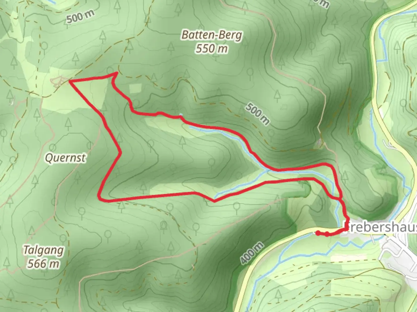
“Experience the Talgang Loop: a 5 km journey through forests, meadows, and medieval ruins near Waldeck-Frankenberg.”
Starting your hike near Waldeck-Frankenberg, Germany, the Talgang Loop offers a delightful 5 km (approximately 3.1 miles) journey with an elevation gain of around 100 meters (328 feet). This loop trail is estimated to be of medium difficulty, making it suitable for hikers with some experience.
Getting There
To reach the trailhead, you can drive or use public transport. If driving, set your GPS to Waldeck-Frankenberg, and look for parking near the town center. For those using public transport, take a train or bus to the nearest station in Waldeck-Frankenberg. From there, it's a short walk to the trailhead.
Trail Overview
The Talgang Loop begins with a gentle ascent, allowing you to ease into the hike. The initial part of the trail meanders through a mixed forest, where you can enjoy the shade and the sounds of local birdlife. Keep an eye out for European robins and blackbirds, which are common in this area.
Significant Landmarks
At approximately 1.5 km (0.9 miles) into the hike, you'll come across the ruins of an old watchtower. This historical landmark dates back to the medieval period and offers a glimpse into the region's past. The watchtower was part of a network used for communication and defense, providing a fascinating historical context to your hike.
Nature and Wildlife
As you continue, the trail opens up to a meadow around the 3 km (1.9 miles) mark. This area is rich in wildflowers during the spring and summer months, including species like the common daisy and the European goldenrod. The meadow is also a good spot to see butterflies and other pollinators.
Elevation Gain
The most significant elevation gain occurs between the 3 km (1.9 miles) and 4 km (2.5 miles) points. Here, the trail climbs steadily, offering panoramic views of the surrounding countryside. This section can be a bit challenging, so take your time and enjoy the scenery.
Final Stretch
The last kilometer (0.6 miles) of the trail descends back into the forest, leading you back to the starting point. This section is relatively easy, allowing you to cool down and reflect on the hike.
Navigation
For navigation, it's recommended to use HiiKER, which provides detailed maps and real-time tracking to ensure you stay on the right path.
Historical Significance
The region around Waldeck-Frankenberg has a rich history, with settlements dating back to the Roman era. The area was strategically important due to its location and natural resources, which is evident from the historical landmarks you'll encounter on the trail.
By preparing adequately and using reliable navigation tools like HiiKER, you can fully enjoy the natural beauty and historical richness of the Talgang Loop.

What to expect?
Activity types
Comments and Reviews
User comments, reviews and discussions about the Talgang Loop, Germany.
4.0
average rating out of 5
2 rating(s)