
Download
3D Flyover
Add to list
More
12.0 km
~2 hrs 55 min
313 m
Loop
“Embark on the Rengershausen Loop for 12 km of scenic beauty, history, and moderate hiking challenge.”
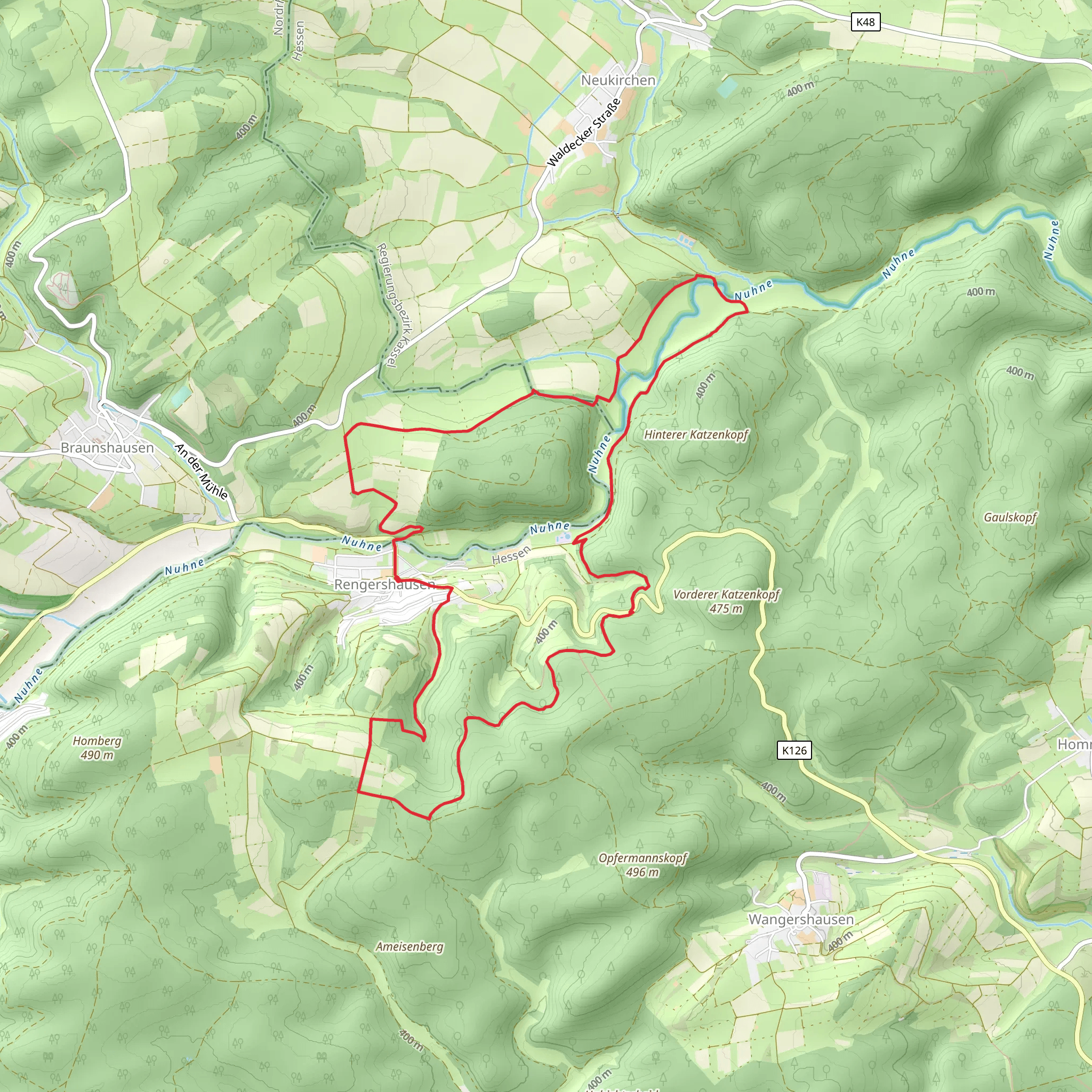
Starting your adventure near Waldeck-Frankenberg, Germany, the Rengershausen Loop via Lichtenfelser Panoramaweg offers a delightful 12 km (7.5 miles) journey with an elevation gain of approximately 300 meters (984 feet). This loop trail is rated medium in difficulty, making it suitable for moderately experienced hikers.
Getting There
To reach the trailhead, you can drive or use public transport. If driving, set your GPS to Rengershausen, a small village near Waldeck-Frankenberg. For those using public transport, take a train to the nearest major station, which is in Frankenberg (Eder). From there, you can catch a local bus to Rengershausen. The trailhead is conveniently located near the village center.
Trail Overview
The trail begins with a gentle ascent through lush forests, providing a serene start to your hike. As you progress, you'll encounter a mix of woodland paths and open meadows, offering a variety of landscapes to enjoy.
Key Landmarks and Points of Interest
Lichtenfelser Panoramaweg: Around the 3 km (1.9 miles) mark, you'll join the Lichtenfelser Panoramaweg. This section offers stunning panoramic views of the surrounding countryside, including the Eder River Valley. The vistas are particularly breathtaking in the early morning or late afternoon when the light casts a golden hue over the landscape.
Historical Significance: The region is steeped in history, with several points of interest along the way. Look out for the remnants of medieval fortifications and ancient farmsteads that dot the landscape. These historical markers provide a glimpse into the area's rich past.
Wildlife and Flora: The trail is home to a diverse range of wildlife. Keep an eye out for deer, foxes, and a variety of bird species. The flora is equally impressive, with seasonal wildflowers adding bursts of color to the trail. In spring and summer, the meadows are particularly vibrant.
Navigation and Safety
Using HiiKER for navigation is highly recommended. The app provides detailed maps and real-time updates, ensuring you stay on track. The trail is well-marked, but having a reliable navigation tool adds an extra layer of security.
Elevation and Terrain
The trail features a total elevation gain of around 300 meters (984 feet), with the most significant climbs occurring in the first half of the hike. The terrain varies from well-maintained paths to more rugged sections, so sturdy hiking boots are advisable. Poles can also be helpful, especially during the steeper ascents and descents.
Amenities and Facilities
There are several rest areas along the trail where you can take a break and enjoy the scenery. Make sure to carry enough water and snacks, as there are limited facilities once you leave the village. The trail loops back to Rengershausen, where you can find local eateries and shops to replenish your supplies.
Final Stretch
As you near the end of the loop, the trail descends gently back into the village of Rengershausen. This final section offers a peaceful conclusion to your hike, with the opportunity to reflect on the diverse landscapes and historical sites you've encountered.
Embarking on the Rengershausen Loop via Lichtenfelser Panoramaweg promises a rewarding experience filled with natural beauty, historical intrigue, and a moderate physical challenge.
What to expect?
Activity types
Comments and Reviews
User comments, reviews and discussions about the Rengershausen Loop via Lichtenfelser Panoramaweg, Germany.
5.0
average rating out of 5
1 rating(s)
