
Download
3D Flyover
Add to list
More
10.1 km
~2 hrs 23 min
220 m
Point to Point
“The Bad Arolsen Wanderweg trails offer scenic hikes with forested paths, historical landmarks, and panoramic views.”
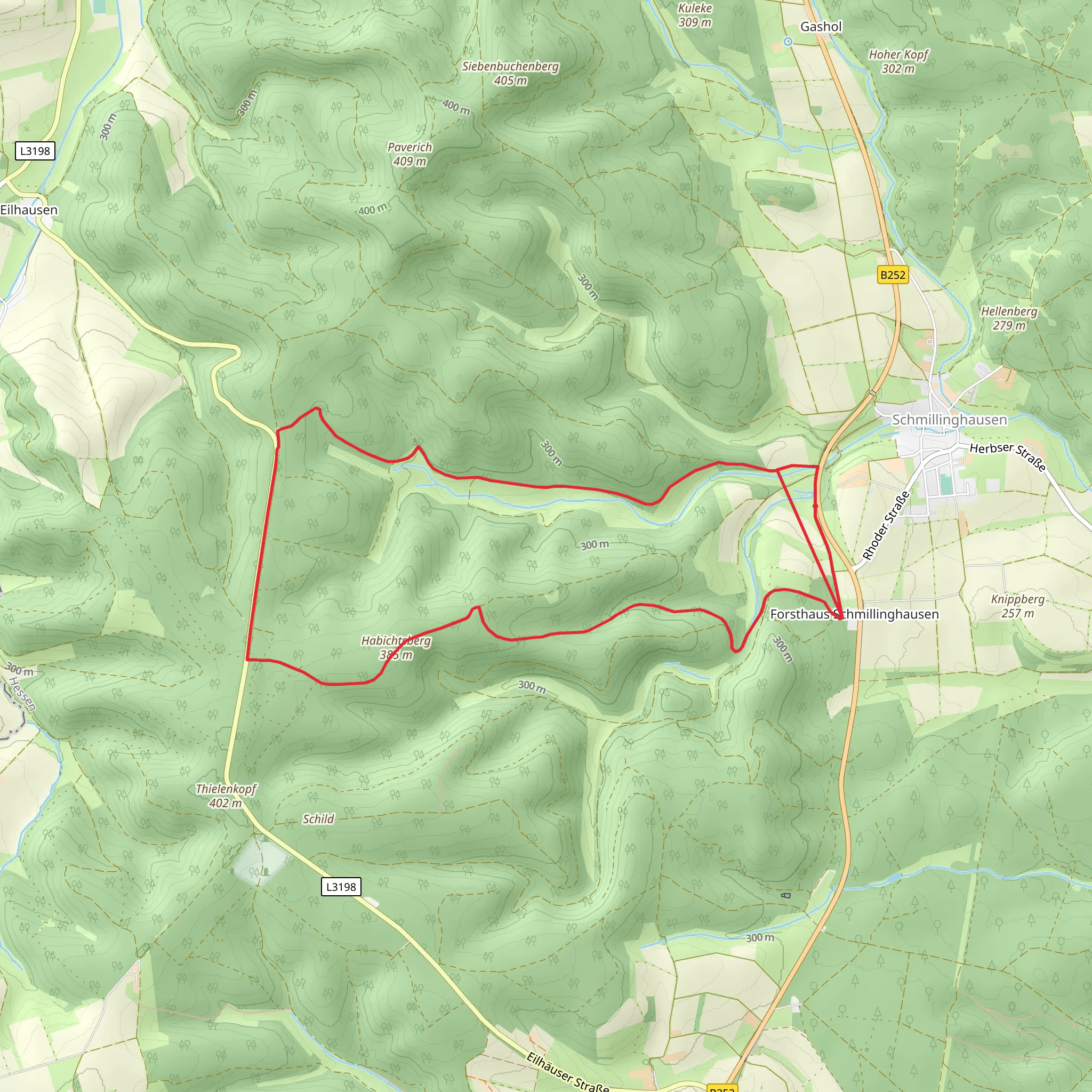
Starting near Waldeck-Frankenberg, Germany, the Bad Arolsen Wanderweg S1 and S2 trails offer a delightful hiking experience with a total distance of around 10 km (6.2 miles) and an elevation gain of approximately 200 meters (656 feet). These point-to-point trails are estimated to be of medium difficulty, making them suitable for moderately experienced hikers.
Getting There
To reach the trailhead, you can either drive or use public transport. If driving, set your GPS to Bad Arolsen, a charming town in the Waldeck-Frankenberg district. There are several parking options available near the starting point. For those using public transport, take a train to Bad Arolsen station. From there, local buses or a short taxi ride will get you to the trailhead.
Trail Overview
The trail begins near the historical town of Bad Arolsen, known for its baroque architecture and the stunning Arolsen Castle. As you start your hike, you'll be greeted by well-marked paths that guide you through a mix of dense forests and open meadows. The initial section is relatively flat, allowing you to ease into the hike while enjoying the serene surroundings.
Significant Landmarks and Nature
Around the 2 km (1.2 miles) mark, you'll come across the enchanting Twistesee Lake. This is a great spot to take a short break and enjoy the picturesque views. The lake is also home to various bird species, so keep your binoculars handy if you're a bird-watching enthusiast.
Continuing on, the trail gradually ascends, offering panoramic views of the surrounding countryside. At approximately 5 km (3.1 miles), you'll reach the highest point of the trail, which provides a perfect vantage point for photography. The elevation gain here is about 100 meters (328 feet) from the starting point.
Historical Significance
As you hike, you'll pass through areas rich in history. The region around Bad Arolsen has been inhabited since the medieval period, and remnants of old settlements can still be found. The trail itself meanders through ancient forests that have stood for centuries, adding a sense of timelessness to your journey.
Wildlife and Flora
The trail is home to a variety of wildlife, including deer, foxes, and numerous bird species. The flora is equally diverse, with oak, beech, and pine trees dominating the landscape. During spring and summer, the meadows are adorned with wildflowers, making the hike even more enjoyable.
Navigation
For navigation, it's highly recommended to use the HiiKER app, which provides detailed maps and real-time updates. The trail is well-marked, but having a reliable navigation tool ensures you stay on track and can explore any interesting detours without getting lost.
Final Stretch
As you approach the end of the trail, the path descends gently, leading you back towards civilization. The final 2 km (1.2 miles) offer a mix of forested areas and open fields, providing a relaxing end to your hike. The trail concludes near another accessible point in the Waldeck-Frankenberg district, where you can easily find transport options to return to your starting point or explore more of the region.
This trail offers a perfect blend of natural beauty, historical significance, and moderate physical challenge, making it a rewarding experience for any hiker.
Comments and Reviews
User comments, reviews and discussions about the Bad Arolsen Wanderweg S1 and S2, Germany.
4.0
average rating out of 5
2 rating(s)
