
Download
3D Flyover
Add to list
More
11.2 km
~2 hrs 46 min
311 m
Loop
“Experience the Vulkaneifel's natural beauty and historical intrigue on this captivating 11 km loop hike.”
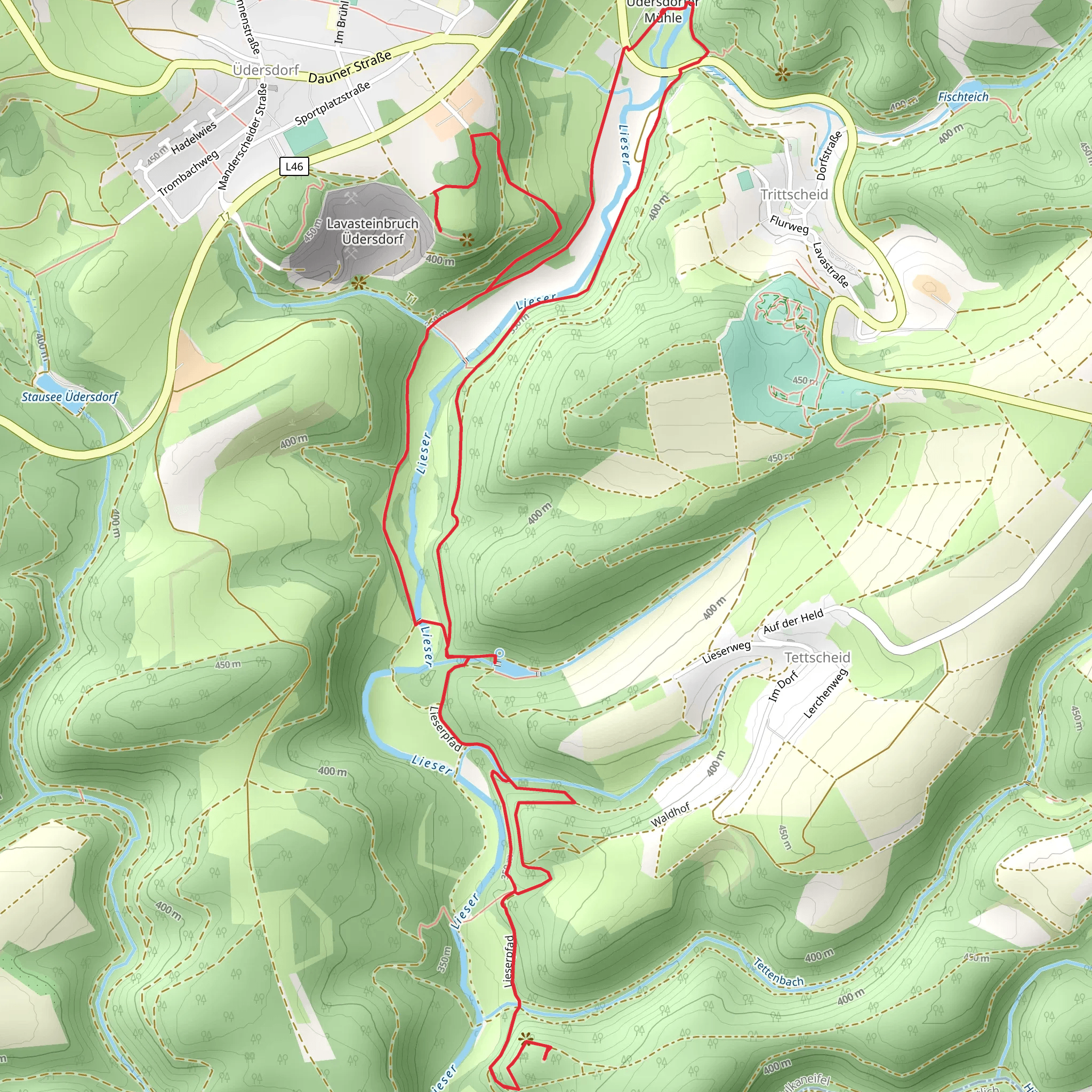
Starting near the picturesque region of Vulkaneifel, Germany, the Tettscheider Stausee via Lieserpfad and Wasserfallweg trail offers a captivating loop hike of approximately 11 km (6.8 miles) with an elevation gain of around 300 meters (984 feet). This medium-difficulty trail is perfect for those looking to immerse themselves in the natural beauty and historical richness of the area.
Getting There
To reach the trailhead, you can drive or use public transport. If driving, set your GPS to the nearest significant landmark, the town of Daun, which is well-connected by road. From Daun, follow local signage to the Vulkaneifel region. For those using public transport, take a train to the Daun station and then a local bus or taxi to the trailhead.
Trail Overview
The trail begins near the Tettscheider Stausee, a serene reservoir that sets the tone for the hike. As you start, you'll be greeted by the lush greenery and the gentle sounds of water, making it a peaceful beginning.
Lieserpfad Section
The first part of the trail follows the Lieserpfad, a well-known path that runs alongside the Lieser River. This section is relatively flat and easy, making it a good warm-up. You'll walk through dense forests and open meadows, offering a variety of landscapes. Keep an eye out for local wildlife such as deer and various bird species. The Lieserpfad is also known for its wildflowers, especially in the spring and summer months.
Historical Significance
As you continue, you'll come across remnants of ancient volcanic activity, which is a hallmark of the Vulkaneifel region. The area is dotted with maars—volcanic craters that have filled with water over time. These geological formations are not only fascinating but also add a unique character to the landscape.
Wasserfallweg Section
Around the halfway mark, you'll transition to the Wasserfallweg, or "Waterfall Way." This section involves a bit more elevation gain, so be prepared for some uphill trekking. The effort is well worth it, as you'll encounter several small waterfalls cascading down rocky outcrops. These natural features are especially striking after a period of rain.
Key Landmarks
One of the most significant landmarks on this trail is the Dreimühlen Waterfall, located approximately 7 km (4.3 miles) into the hike. This waterfall is a popular spot for photos and a great place to take a break. The water here is rich in minerals, giving the rocks a unique, colorful appearance.
Navigation and Safety
Given the varied terrain and the presence of multiple intersecting paths, it's advisable to use a reliable navigation tool like HiiKER to stay on track. The trail is generally well-marked, but having a digital map can provide extra assurance.
Flora and Fauna
The Vulkaneifel region is rich in biodiversity. As you hike, you'll pass through mixed forests of beech, oak, and pine. The underbrush is home to a variety of smaller plants and fungi, making it a botanist's dream. Wildlife is abundant, so keep your eyes peeled for foxes, badgers, and even the occasional wild boar.
Final Stretch
The last part of the loop brings you back towards the Tettscheider Stausee. This section is mostly downhill, allowing you to enjoy the views without too much effort. As you approach the reservoir, the trail opens up, offering panoramic views of the surrounding hills and valleys.
Practical Tips
- Wear sturdy hiking boots, as the trail can be rocky and uneven in places.
- Bring plenty of water and snacks, especially if you plan to take your time exploring.
- Check the weather forecast before you go; the trail can be slippery after rain.
- Consider bringing a camera to capture the stunning landscapes and wildlife.
This trail offers a perfect blend of natural beauty, geological wonders, and historical intrigue, making it a must-visit for any hiking enthusiast.
What to expect?
Activity types
Comments and Reviews
User comments, reviews and discussions about the Tettscheider Stausee via Lieserpfad and Wasserfallweg, Germany.
4.0
average rating out of 5
1 rating(s)
