Download
3D Flyover
Add to list
More
8.0 km
~1 hrs 56 min
203 m
Loop
“Explore the scenic Wartenberger Rundweg: nature, history, and panoramic views on a moderate 8 km hike.”
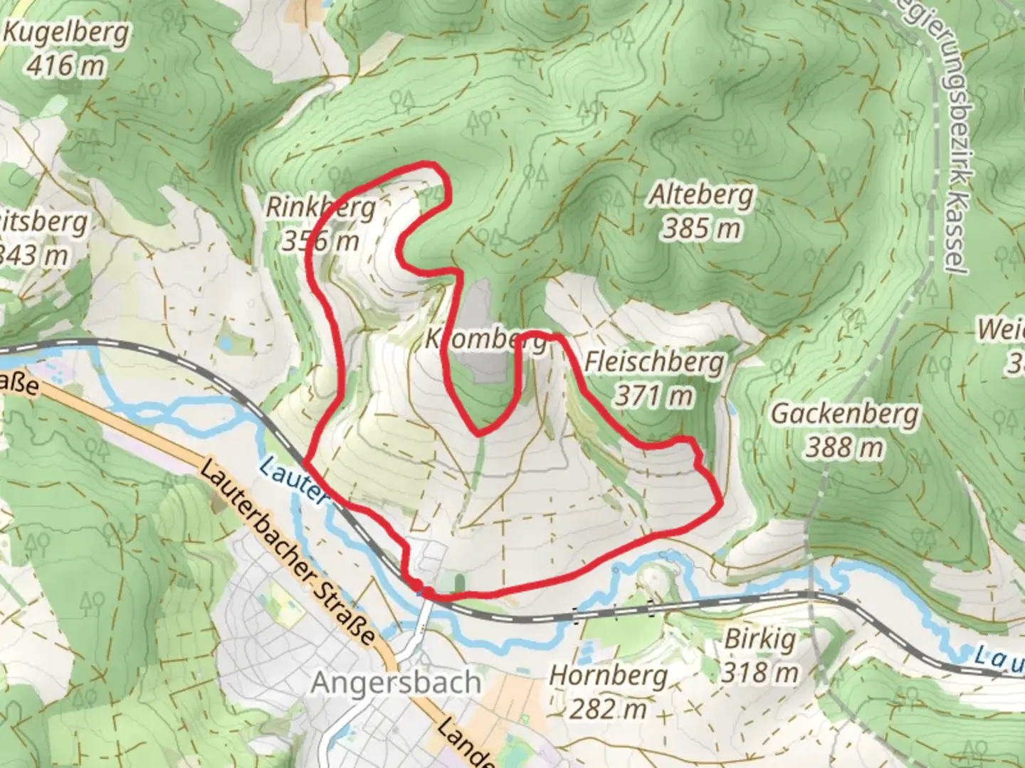
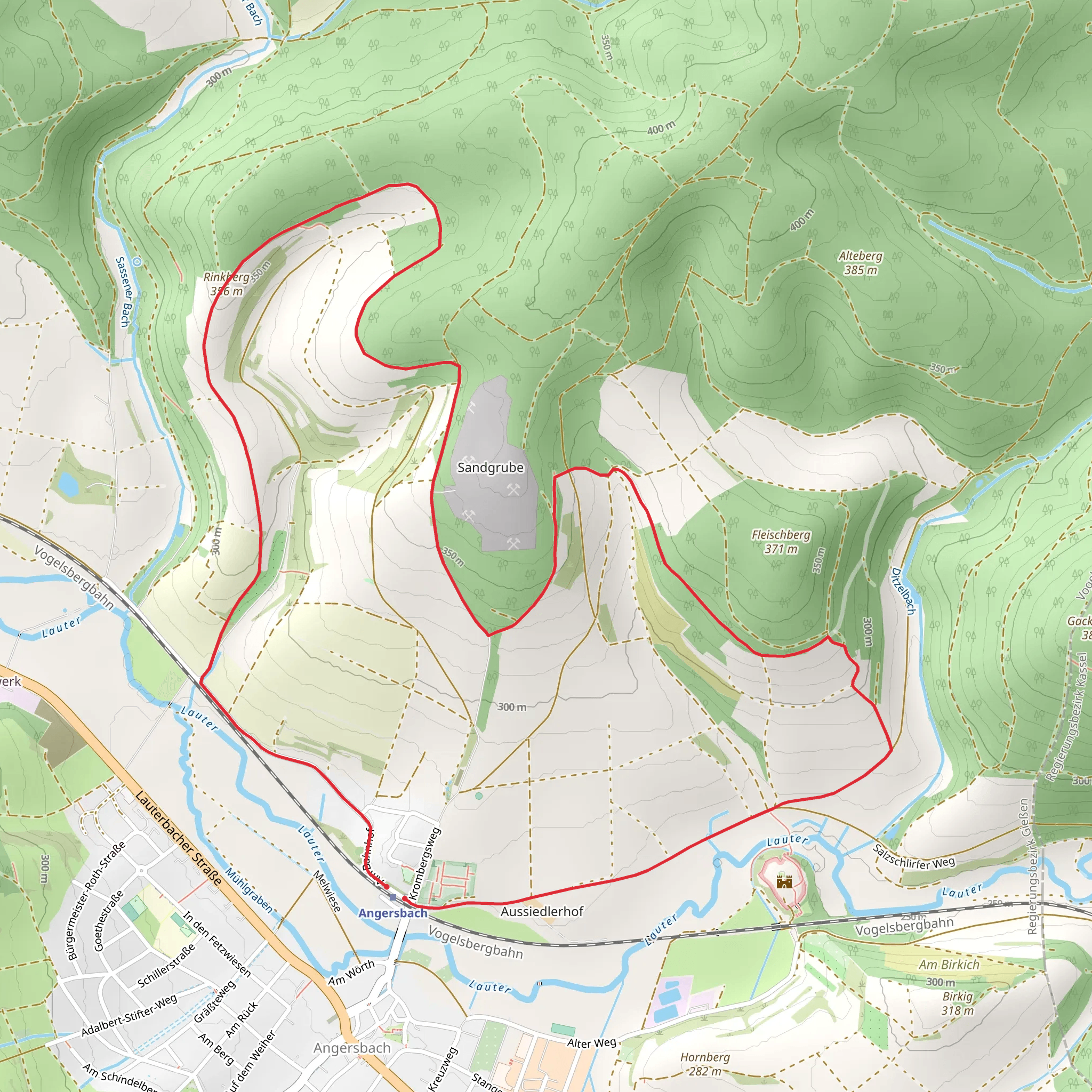
Starting near the picturesque Vogelsbergkreis in Germany, this 8 km (approximately 5 miles) loop trail offers a delightful mix of natural beauty and historical intrigue. With an elevation gain of around 200 meters (656 feet), the Wartenberger Rundweg is rated as a medium difficulty hike, making it accessible for most hikers with a moderate level of fitness.
Getting There
To reach the trailhead, you can drive or use public transport. If driving, set your GPS to the nearest significant landmark, which is the town of Lauterbach. From Lauterbach, follow local signage to Vogelsbergkreis, where parking is available near the trailhead. For those using public transport, take a train to Lauterbach Nord station. From there, local buses or a short taxi ride will get you to the starting point.
Trail Navigation
For navigation, it’s highly recommended to use the HiiKER app, which provides detailed maps and real-time updates. The trail is well-marked, but having a reliable navigation tool ensures you stay on track and can enjoy the hike without any worries.
Trail Highlights
Nature and Wildlife
The Wartenberger Rundweg takes you through a variety of landscapes, including dense forests, open meadows, and rolling hills. The Vogelsberg region is known for its rich biodiversity. Keep an eye out for native wildlife such as deer, foxes, and a variety of bird species. In spring and summer, the meadows are adorned with wildflowers, making it a perfect time for nature photography.
Historical Significance
One of the most fascinating aspects of this trail is its historical significance. The region has a rich history dating back to medieval times. About 3 km (1.86 miles) into the hike, you’ll come across the ruins of Wartenberg Castle. This medieval fortress, though now in ruins, offers a glimpse into the past and provides a great spot for a rest and some exploration. The castle dates back to the 12th century and played a significant role in the local history of the Vogelsbergkreis area.
Elevation and Terrain
The trail features a moderate elevation gain of around 200 meters (656 feet), with the most significant ascent occurring in the first half of the hike. The terrain varies from well-trodden paths to rocky sections, so sturdy hiking boots are recommended. The highest point of the trail offers panoramic views of the surrounding countryside, making the climb well worth the effort.
Points of Interest
- Wartenberg Castle Ruins: Located approximately 3 km (1.86 miles) from the start, these ruins are a must-see.
- Panoramic Viewpoint: Around the 5 km (3.1 miles) mark, you’ll reach a viewpoint that offers stunning vistas of the Vogelsberg region.
- Forest Sections: The dense forest areas provide a cool, shaded respite, especially during the warmer months.
Practical Tips
- Water and Snacks: There are no facilities along the trail, so bring enough water and snacks to keep you energized.
- Weather: Check the weather forecast before you go. The trail can be muddy and slippery after rain.
- Clothing: Dress in layers, as the weather can change rapidly in this region.
This trail offers a perfect blend of natural beauty and historical intrigue, making it a rewarding experience for any hiker.
Comments and Reviews
User comments, reviews and discussions about the Wartenberger Rundweg, Germany.
4.33
average rating out of 5
3 rating(s)
