Download
3D Flyover
Add to list
More
3.8 km
~49 min
38 m
Loop
“Explore serene Thuringian Basin landscapes on this 4 km scenic loop, perfect for nature and history lovers.”
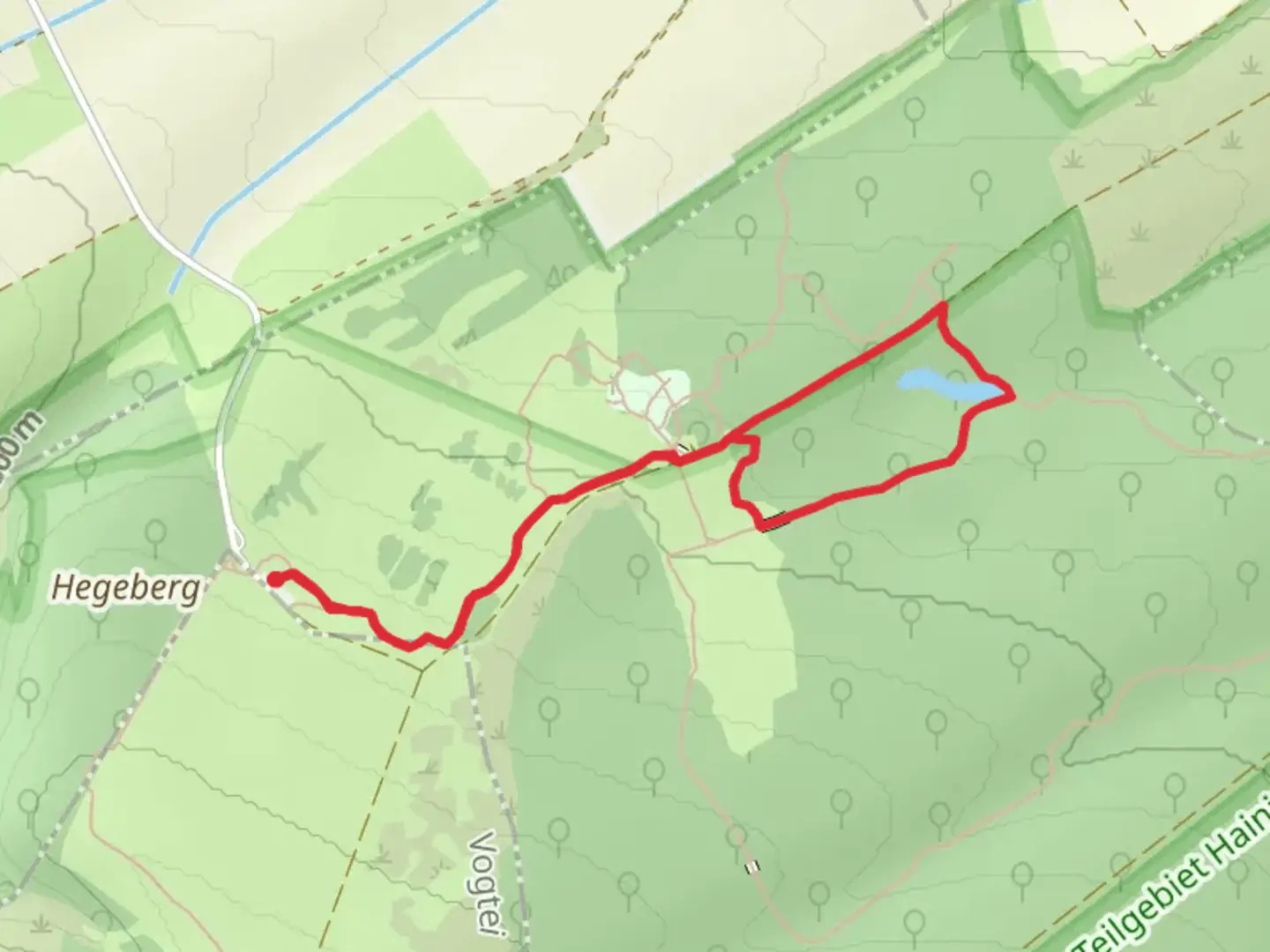
Starting near Unstrut-Hainich-Kreis in Germany, this 4 km (approximately 2.5 miles) loop trail offers a delightful journey through the serene landscapes of the Thuringian Basin. With no significant elevation gain, it is accessible to a wide range of hikers, though it is rated as medium difficulty due to some uneven terrain and potentially muddy sections.
Getting There
To reach the trailhead, you can drive or use public transport. If driving, set your GPS to the vicinity of Unstrut-Hainich-Kreis. For those relying on public transport, the nearest significant landmark is the town of Mühlhausen. From Mühlhausen, you can take a local bus or taxi to the trailhead.
Trail Navigation
For navigation, it is highly recommended to use HiiKER, which provides detailed maps and real-time updates. The trail is well-marked, but having a reliable navigation tool ensures you stay on track.
Key Sections and Landmarks
Start to Saugrabenweg (0-1 km / 0-0.6 miles): The trail begins with a gentle walk through mixed woodlands. Keep an eye out for the diverse bird species that inhabit this area. The path is relatively flat and easy to follow.
Saugrabenweg to Hünenteich (1-2 km / 0.6-1.2 miles): As you continue, you will reach Saugrabenweg, a historic path that has been used for centuries. This section is particularly scenic, with lush greenery and occasional glimpses of local wildlife such as deer and foxes. The trail here is slightly more rugged, so sturdy footwear is recommended.
Hünenteich (2-3 km / 1.2-1.9 miles): The highlight of the loop is Hünenteich, a picturesque pond surrounded by dense forest. This is a perfect spot for a short break. The pond is home to various aquatic birds and amphibians, making it a great spot for nature enthusiasts.
Return Loop (3-4 km / 1.9-2.5 miles): The final stretch of the trail loops back towards the starting point. This section is relatively straightforward, with a mix of open fields and forested areas. The terrain is mostly flat, making for a pleasant end to the hike.
Historical Significance
The region around Unstrut-Hainich-Kreis is steeped in history. The Saugrabenweg itself has historical significance, having been used for centuries as a route for local farmers and traders. The area was also a significant site during the medieval period, with numerous small settlements and fortifications. While hiking, you may come across remnants of old stone walls and other historical artifacts.
Flora and Fauna
The trail offers a rich tapestry of flora and fauna. The mixed woodlands are home to oak, beech, and pine trees, providing a diverse habitat for wildlife. Birdwatchers will enjoy spotting species such as woodpeckers, owls, and various songbirds. The pond at Hünenteich is particularly rich in biodiversity, with frogs, newts, and dragonflies commonly seen.
Practical Tips
- Footwear: Given the uneven terrain and potential for muddy sections, sturdy hiking boots are recommended.
- Weather: Check the weather forecast before heading out, as the trail can become slippery after rain.
- Supplies: Bring sufficient water and snacks, as there are no facilities along the trail.
- Navigation: Use HiiKER for accurate trail maps and real-time updates.
This loop trail offers a perfect blend of natural beauty, historical intrigue, and a moderate challenge, making it a rewarding hike for those exploring the Thuringian Basin.

What to expect?
Activity types
Comments and Reviews
User comments, reviews and discussions about the Hünenteich Loop via Saugrabenweg, Germany.
average rating out of 5
0 rating(s)