Download
3D Flyover
Add to list
More
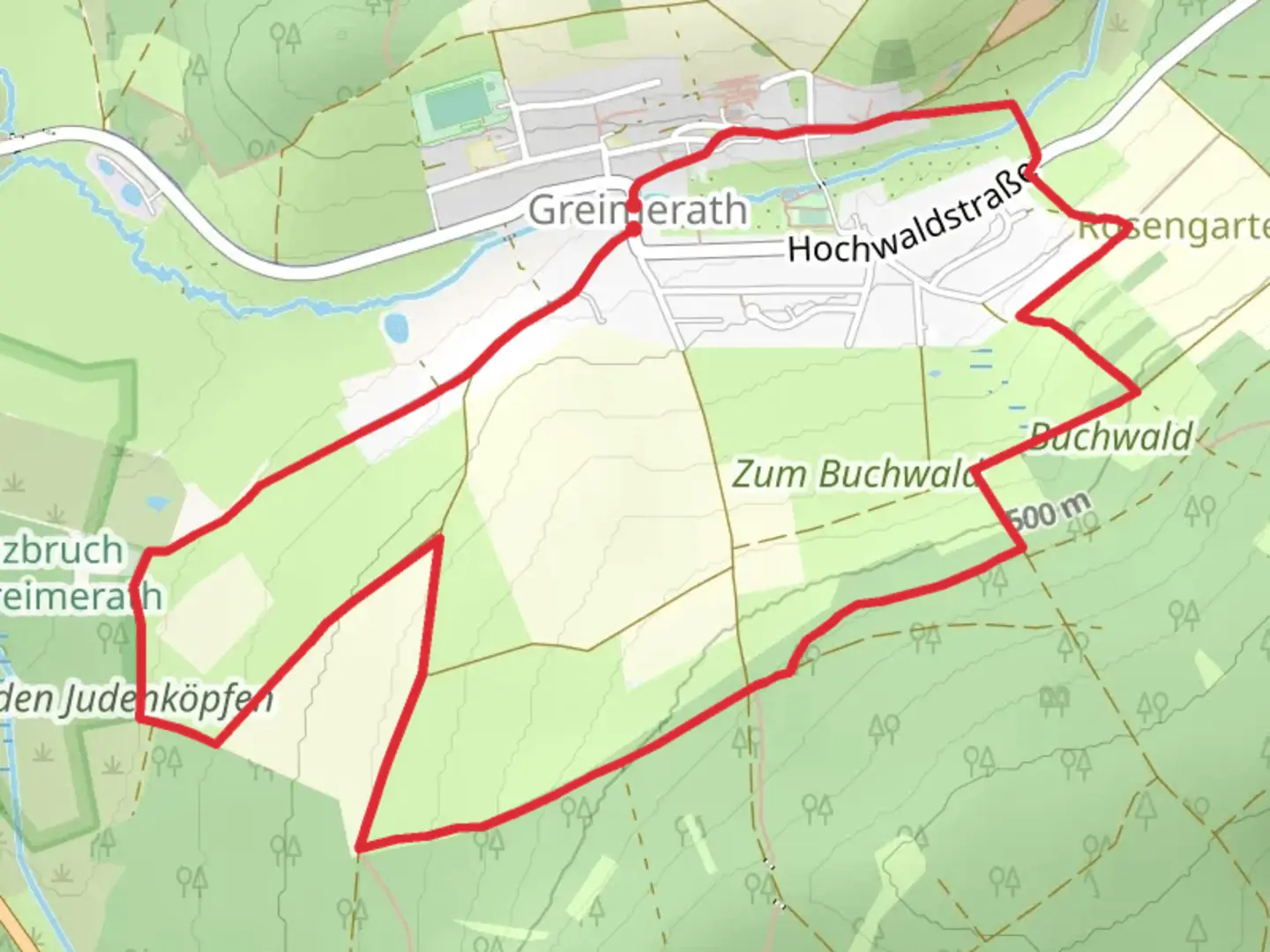
6.7 km
~1 hrs 33 min
133 m
Loop
“Explore the scenic 7 km RuT3 Loop near Trier-Saarburg, blending forests, meadows, and historic landmarks.”
Starting near Trier-Saarburg, Germany, the RuT3 Loop is a delightful 7 km (approximately 4.35 miles) trail with an elevation gain of around 100 meters (328 feet). This loop trail is rated as medium difficulty, making it suitable for moderately experienced hikers.
Getting There
To reach the trailhead, you can either drive or use public transport. If driving, set your GPS to the nearest known address in Trier-Saarburg. For those using public transport, take a train or bus to Trier-Saarburg station, and from there, it's a short walk to the trailhead.
Trail Overview
The RuT3 Loop offers a mix of forested paths, open meadows, and scenic viewpoints. The trail is well-marked, but it's always a good idea to have a reliable navigation tool like HiiKER to ensure you stay on track.
Key Landmarks and Points of Interest
- Forested Sections: The trail begins with a gentle ascent through a dense forest. This section is particularly beautiful in the fall when the leaves change color. Keep an eye out for local wildlife such as deer and various bird species.
- Open Meadows: After about 2 km (1.24 miles), the trail opens up into a series of meadows. These areas are perfect for a short break and offer panoramic views of the surrounding countryside.
- Scenic Viewpoints: Around the 4 km (2.48 miles) mark, you'll reach a high point with a stunning viewpoint. This is an excellent spot for photos and to take in the beauty of the region.
- Historical Significance: The area around Trier-Saarburg is rich in history. As you hike, you'll come across remnants of ancient Roman settlements and medieval structures. The region was once a significant Roman outpost, and you may see ruins and artifacts along the way.
Flora and Fauna
The trail is home to a variety of plant and animal life. In the spring and summer, the meadows are filled with wildflowers, and the forested areas are lush with greenery. Birdwatchers will enjoy spotting species like the European robin, blackbird, and various types of woodpeckers.
Elevation and Terrain
The total elevation gain of 100 meters (328 feet) is spread out over the 7 km (4.35 miles), making the inclines manageable for most hikers. The terrain varies from packed dirt paths to rocky sections, so sturdy hiking boots are recommended.
Final Stretch
The last 2 km (1.24 miles) of the trail loop back towards the starting point, descending gently through another forested area. This section is relatively easy and provides a relaxing end to your hike.
Preparation Tips
- Weather: Check the weather forecast before you go. The trail can be muddy after rain, so waterproof footwear is advisable.
- Supplies: Bring enough water and snacks, especially if you plan to take breaks at the scenic viewpoints.
- Navigation: Use HiiKER for real-time navigation and to ensure you stay on the correct path.
This trail offers a wonderful mix of natural beauty, historical intrigue, and moderate physical challenge, making it a rewarding experience for those who take it on.

What to expect?
Activity types
Comments and Reviews
User comments, reviews and discussions about the RuT3 Loop, Germany.
5.0
average rating out of 5
1 rating(s)