
Download
3D Flyover
Add to list
More
6.2 km
~1 hrs 48 min
337 m
Loop
“Explore lush forests, historic lookout points, and stunning vistas on Trier-Saarburg's scenic 6 km loop trail.”
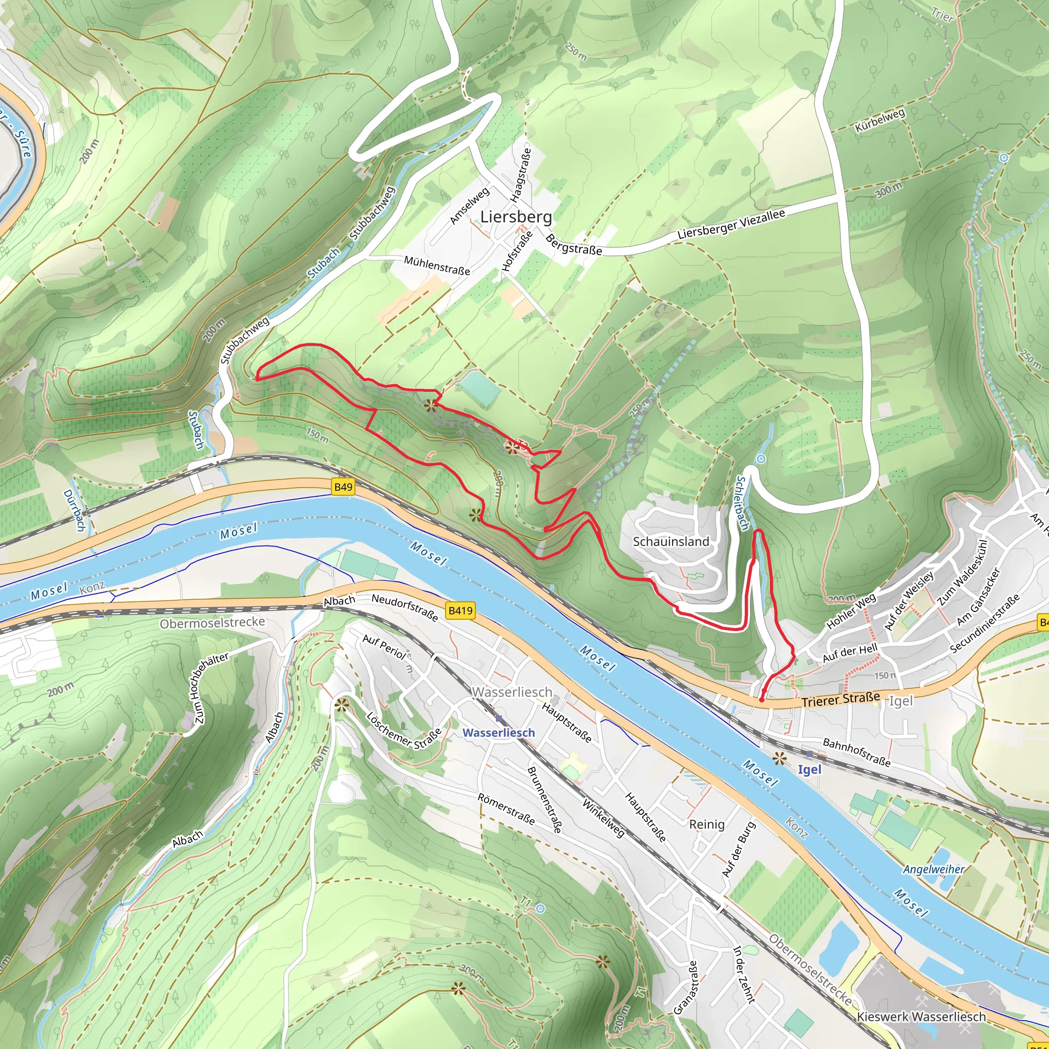
Starting near the picturesque town of Trier-Saarburg in Germany, the Grutenhäuschen and Richardshöhe Loop is a delightful 6 km (approximately 3.7 miles) trail with an elevation gain of around 300 meters (984 feet). This loop trail is rated as medium difficulty, making it suitable for hikers with some experience and a moderate level of fitness.
Getting There
To reach the trailhead, you can either drive or use public transport. If driving, head towards Trier-Saarburg and look for parking near the town center or designated trail parking areas. For those using public transport, take a train or bus to Trier-Saarburg station. From there, it's a short walk to the trailhead, which is conveniently located near the town.
Trail Highlights and Landmarks
As you embark on the trail, you'll first encounter a gentle ascent through lush forests, which are home to a variety of flora and fauna. Keep an eye out for native wildlife such as deer, foxes, and a variety of bird species. The forested sections provide ample shade, making it a pleasant hike even on warmer days.
Grutenhäuschen
Approximately 2 km (1.2 miles) into the hike, you'll reach the Grutenhäuschen, a historical lookout point. This small stone structure offers panoramic views of the surrounding countryside and is a perfect spot for a short break. The Grutenhäuschen dates back to the 19th century and was originally built as a shelter for hunters and hikers.
Richardshöhe
Continuing along the trail, you'll ascend to Richardshöhe, the highest point of the loop at around 300 meters (984 feet) above sea level. The climb is steady but manageable, and the effort is rewarded with stunning vistas of the Moselle Valley. On clear days, you can see for miles, making it an excellent spot for photography.
Nature and Wildlife
The trail meanders through a mix of deciduous and coniferous forests, offering a rich tapestry of colors, especially in autumn. Wildflowers are abundant in spring and summer, adding vibrant hues to the landscape. The diverse ecosystem supports a variety of wildlife, so be sure to tread lightly and respect the natural habitat.
Navigation and Safety
For navigation, it's highly recommended to use the HiiKER app, which provides detailed maps and real-time updates. The trail is well-marked, but having a reliable navigation tool ensures you stay on track and can enjoy the hike without any worries.
Historical Significance
The region around Trier-Saarburg is steeped in history, with Roman influences evident in the architecture and ruins scattered throughout the area. The trail itself passes near several historical sites, including remnants of ancient Roman roads and settlements. This adds an enriching layer to your hiking experience, as you traverse paths that have been walked for centuries.
Final Stretch
As you descend from Richardshöhe, the trail loops back towards Trier-Saarburg. The descent is gradual, allowing you to take in the serene beauty of the landscape. The final stretch of the hike brings you back to the starting point, completing a rewarding loop that combines natural beauty, historical intrigue, and a moderate physical challenge.
Whether you're a seasoned hiker or someone looking to explore the scenic trails of Germany, the Grutenhäuschen and Richardshöhe Loop offers a memorable adventure.
What to expect?
Activity types
Comments and Reviews
User comments, reviews and discussions about the Grutenhäuschen and Richardshöhe Loop, Germany.
4.33
average rating out of 5
3 rating(s)

