
Download
3D Flyover
Add to list
More
6.9 km
~2 hrs 16 min
541 m
Out and Back
“This moderately challenging 7 km hike near Traunstein, Germany, combines lush forests, historical landmarks, and breathtaking summit views.”
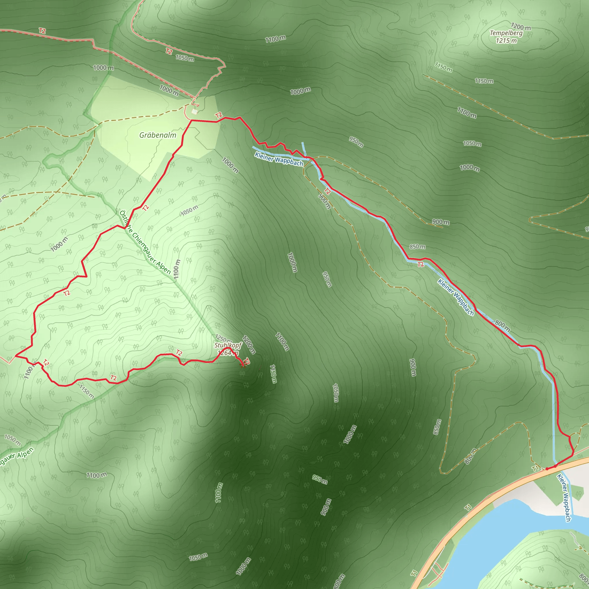
Starting near the picturesque town of Traunstein in Germany, this 7 km (4.35 miles) out-and-back trail offers a moderately challenging hike with an elevation gain of approximately 500 meters (1,640 feet). The trailhead is conveniently located near the town, making it accessible for both locals and visitors.
Getting There
To reach the trailhead, you can either drive or use public transportation. If driving, head towards Traunstein and look for parking options near the trailhead. For those using public transport, Traunstein is well-connected by train. From the Traunstein train station, you can take a local bus or taxi to the trailhead, which is a short distance away.
Trail Overview
The trail begins with a gentle ascent through lush, mixed forests. As you start your hike, you'll notice the dense canopy of beech and oak trees providing ample shade, making it a pleasant walk even on warmer days. The initial 1.5 km (0.93 miles) of the trail is relatively easy, with a gradual elevation gain of about 100 meters (328 feet).
Mid-Trail Highlights
Around the 2 km (1.24 miles) mark, the trail starts to become steeper. Here, you'll encounter a series of switchbacks that will take you up another 200 meters (656 feet) in elevation over the next kilometer. This section can be a bit strenuous, so take your time and enjoy the surroundings. The forest here is interspersed with clearings that offer stunning views of the surrounding Bavarian Alps.
Historical Significance
As you continue your ascent, you'll come across several historical markers. This region has a rich history dating back to medieval times. Keep an eye out for old stone walls and remnants of ancient settlements that hint at the area's past. These landmarks are often accompanied by informational plaques that provide context and historical background.
Flora and Fauna
The trail is a haven for nature enthusiasts. In spring and summer, the forest floor is carpeted with wildflowers, including species like wood anemones and wild garlic. Birdwatchers will also find plenty to observe, with common sightings including woodpeckers, nuthatches, and various species of tits. If you're lucky, you might even spot a red deer or a fox.
Final Ascent and Summit
The last 1.5 km (0.93 miles) of the trail involves a steeper climb, gaining the final 200 meters (656 feet) in elevation. This section is more rugged, with rocky outcrops and narrower paths. Proper hiking boots are recommended for this part of the trail. As you approach the summit of Stuhlkopf, the trees thin out, offering panoramic views of the surrounding landscape.
Summit Views
At the summit, you'll be rewarded with breathtaking vistas of the Chiemgau Alps and the distant peaks of the Berchtesgaden National Park. This is a perfect spot to take a break, have a snack, and soak in the natural beauty. On clear days, you can see as far as Lake Chiemsee, often referred to as the "Bavarian Sea."
Navigation and Safety
For navigation, it's advisable to use the HiiKER app, which provides detailed maps and real-time updates. The trail is well-marked, but having a reliable navigation tool can enhance your hiking experience and ensure you stay on track.
Return Journey
The return journey follows the same path back to the trailhead. While descending, take care on the steeper sections to avoid slipping. The descent offers a different perspective of the landscape, so take your time to enjoy the views and perhaps spot some wildlife you might have missed on the way up.
This trail offers a perfect blend of natural beauty, historical intrigue, and moderate physical challenge, making it a rewarding experience for hikers of all levels.
What to expect?
Activity types
Comments and Reviews
User comments, reviews and discussions about the Stuhlkopf, Germany.
4.67
average rating out of 5
3 rating(s)
