Download
3D Flyover
Add to list
More
14.6 km
~4 hrs 52 min
1177 m
Loop
“Embark on the Streicher Peak Loop for a 15 km adventure of history, wildlife, and breathtaking views.”
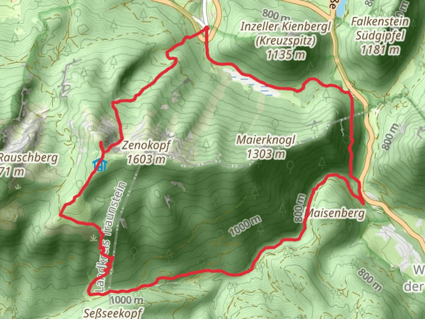
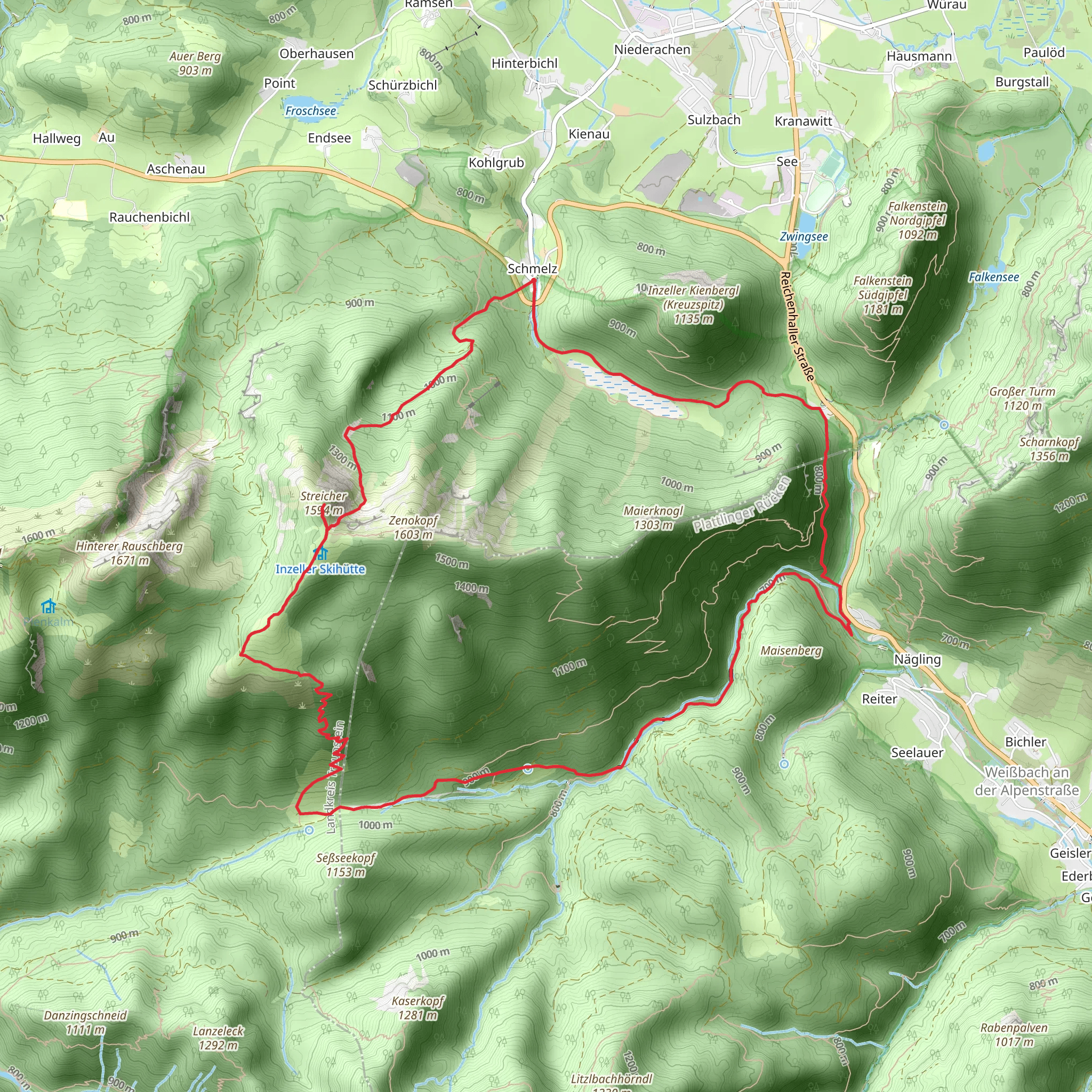
Starting near the charming town of Traunstein, Germany, the Streicher Peak Loop via Salzapensteig is a captivating 15 km (9.3 miles) loop trail with an elevation gain of approximately 1100 meters (3609 feet). This medium-difficulty hike offers a blend of natural beauty, historical significance, and diverse wildlife, making it a rewarding experience for any hiker.
Getting There
To reach the trailhead, you can either drive or use public transport. If driving, head towards Traunstein and follow signs to the trailhead near the town. For those using public transport, take a train to Traunstein station. From there, local buses or taxis can take you to the trailhead.
Trail Overview
The trail begins with a gentle ascent through lush forests, offering a serene start to your hike. As you progress, the path becomes steeper, leading you through a series of switchbacks. The initial 5 km (3.1 miles) will see you gaining significant elevation, approximately 600 meters (1968 feet), as you make your way towards the first major landmark, the Salzapensteig.
Salzapensteig and Historical Significance
The Salzapensteig is not just a trail but a historical route used for centuries. This path was once a significant trade route for salt, which was a valuable commodity in the region. As you hike along this section, imagine the traders and their pack animals traversing these same paths centuries ago. The trail here is well-marked and offers stunning views of the surrounding valleys.
Wildlife and Flora
Keep an eye out for the diverse wildlife that inhabits this region. Deer, foxes, and various bird species are commonly spotted along the trail. The flora is equally impressive, with dense forests of beech and spruce trees, interspersed with colorful wildflowers, especially in the spring and summer months.
Reaching Streicher Peak
After approximately 8 km (5 miles) and an elevation gain of around 900 meters (2953 feet), you will reach the Streicher Peak. The summit offers panoramic views of the Bavarian Alps and the surrounding countryside. This is an excellent spot to take a break, enjoy a snack, and soak in the breathtaking scenery.
Descent and Loop Completion
The descent begins with a steep downhill section, so take care with your footing. The trail then gradually levels out as you make your way back through the forest. The final 7 km (4.3 miles) of the loop are less strenuous, allowing you to enjoy the tranquil surroundings as you return to the trailhead.
Navigation and Safety
For navigation, it is highly recommended to use HiiKER, which provides detailed maps and real-time updates. Ensure you have adequate water, snacks, and appropriate clothing, as weather conditions can change rapidly in the mountains.
This trail offers a perfect blend of physical challenge, natural beauty, and historical intrigue, making it a must-do for any hiking enthusiast visiting the Traunstein area.
What to expect?
Activity types
Comments and Reviews
User comments, reviews and discussions about the Streicher Peak Loop via Salzapensteig, Germany.
4.75
average rating out of 5
4 rating(s)
