
Download
3D Flyover
Add to list
More
7.2 km
~2 hrs 25 min
586 m
Loop
“Discover the scenic 7 km Winklmoosalm loop, blending Bavarian Alps' beauty, moderate challenge, and rich history.”
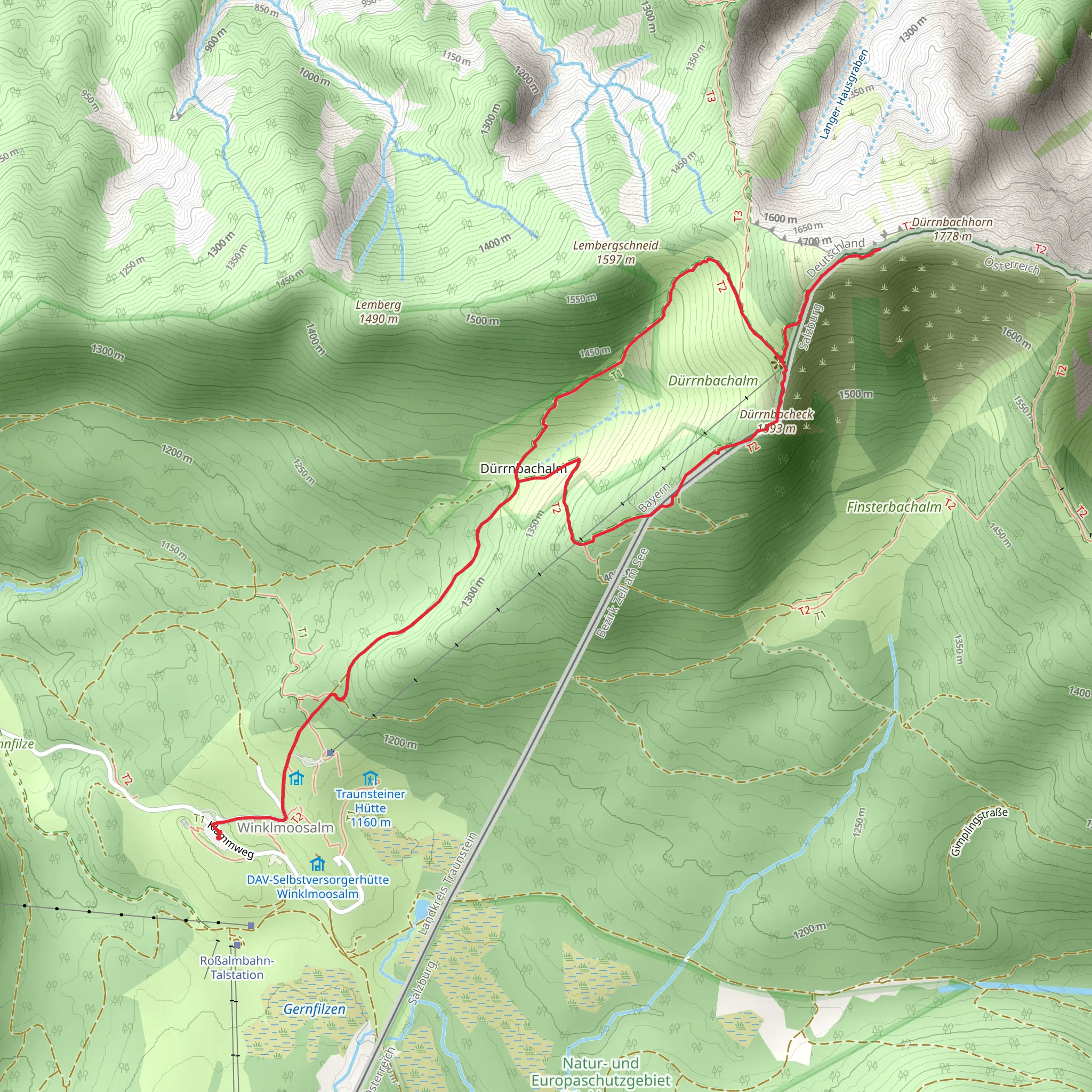
Starting your hike near Traunstein, Germany, the Dürnbachhorn and Dürrnbacheck via Winklmoosalm trail offers a captivating loop of around 7 km (4.3 miles) with an elevation gain of approximately 500 meters (1,640 feet). This medium-difficulty trail is perfect for those looking to experience the beauty of the Bavarian Alps.
Getting There
To reach the trailhead, you can drive or use public transport. If driving, head towards the Winklmoosalm parking area, which is well-signposted from Traunstein. For public transport, take a train to Ruhpolding and then a bus to the Winklmoosalm area. The nearest significant landmark is the Winklmoosalm ski resort, which serves as a convenient starting point.
Trail Overview
The trail begins at the Winklmoosalm, a picturesque alpine meadow known for its stunning views and traditional Bavarian huts. From here, the path ascends gradually through lush forests and open meadows, offering panoramic views of the surrounding mountains.
Key Landmarks and Sections
Winklmoosalm to Dürrnbacheck: The initial section of the trail takes you through dense forests and open meadows. After about 2 km (1.2 miles), you'll reach the Dürrnbacheck, a small peak offering breathtaking views of the Chiemgau Alps. This section has an elevation gain of around 200 meters (656 feet).
Dürrnbacheck to Dürnbachhorn: Continuing from Dürrnbacheck, the trail becomes steeper as you make your way to the Dürnbachhorn. This part of the hike is more challenging, with an additional elevation gain of approximately 300 meters (984 feet) over 2.5 km (1.5 miles). The summit of Dürnbachhorn provides a 360-degree view of the surrounding peaks and valleys, making the effort well worth it.
Descent and Loop Completion: After soaking in the views from Dürnbachhorn, the trail descends back towards Winklmoosalm. The descent is less steep but requires careful footing, especially in wet conditions. The final 2.5 km (1.5 miles) of the loop take you through scenic meadows and forests, eventually leading back to the starting point.
Nature and Wildlife
The trail is rich in flora and fauna. In the spring and summer months, you'll encounter a variety of wildflowers, including alpine roses and gentians. Wildlife enthusiasts might spot chamois, marmots, and a variety of bird species, including golden eagles and alpine choughs.
Historical Significance
The Winklmoosalm area has a rich history, dating back to its use as a summer pasture for local farmers. The traditional alpine huts you see along the trail are a testament to this heritage. Additionally, the region played a role during World War II, serving as a strategic location for both German and Allied forces.
Navigation
For navigation, it's recommended to use the HiiKER app, which provides detailed maps and real-time updates. The trail is well-marked, but having a reliable navigation tool ensures you stay on track and can fully enjoy the hike without any worries.
This trail offers a perfect blend of natural beauty, moderate challenge, and historical intrigue, making it a must-visit for any hiking enthusiast exploring the Bavarian Alps.
What to expect?
Activity types
Comments and Reviews
User comments, reviews and discussions about the Dürnbachhorn and Dürrnbacheck via Winklmoosalm, Germany.
4.0
average rating out of 5
2 rating(s)
