Download
Preview
Add to list
More
11.0 km
~3 hrs 45 min
928 m
Out and Back
“This scenic 11 km hike near Traunstein offers stunning views, rich history, and moderate difficulty.”
Starting near Traunstein, Germany, the Bründlingköpfl and Hochfelln Peak Walk is an 11 km (6.8 miles) out-and-back trail with an elevation gain of approximately 900 meters (2,950 feet). This medium-difficulty hike offers a blend of natural beauty, historical significance, and panoramic views.
Getting There
To reach the trailhead, you can drive or use public transport. If driving, head towards Bergen, a small town near Traunstein. The nearest significant landmark is the Hochfelln-Seilbahn Talstation (Hochfelln Cable Car Valley Station). For those using public transport, take a train to Traunstein and then a bus to Bergen. From Bergen, it's a short walk to the cable car station where the trail begins.
Trail Overview
The trail starts at the Hochfelln-Seilbahn Talstation, located at an elevation of about 600 meters (1,970 feet). The initial section of the trail is a gentle ascent through lush forests, offering a serene environment filled with the sounds of birds and rustling leaves. After approximately 2 km (1.2 miles), you will reach the Bründlingalm, a picturesque alpine meadow. This is a great spot to take a short break and enjoy the traditional Bavarian huts.
Bründlingköpfl
Continuing from Bründlingalm, the trail becomes steeper as you approach Bründlingköpfl. This section is about 3 km (1.9 miles) long and involves an elevation gain of around 400 meters (1,310 feet). The path is well-marked but can be rocky, so sturdy hiking boots are recommended. Upon reaching Bründlingköpfl, you will be rewarded with stunning views of the Chiemgau Alps and the Chiemsee lake in the distance.
Hochfelln Peak
From Bründlingköpfl, the trail continues towards Hochfelln Peak, the highest point of the hike at 1,674 meters (5,492 feet). This final stretch is about 2.5 km (1.6 miles) with an elevation gain of 500 meters (1,640 feet). The terrain here is more rugged, with some sections requiring careful footing. As you ascend, the vegetation becomes sparser, giving way to alpine flora and occasional sightings of marmots and chamois.
Historical Significance
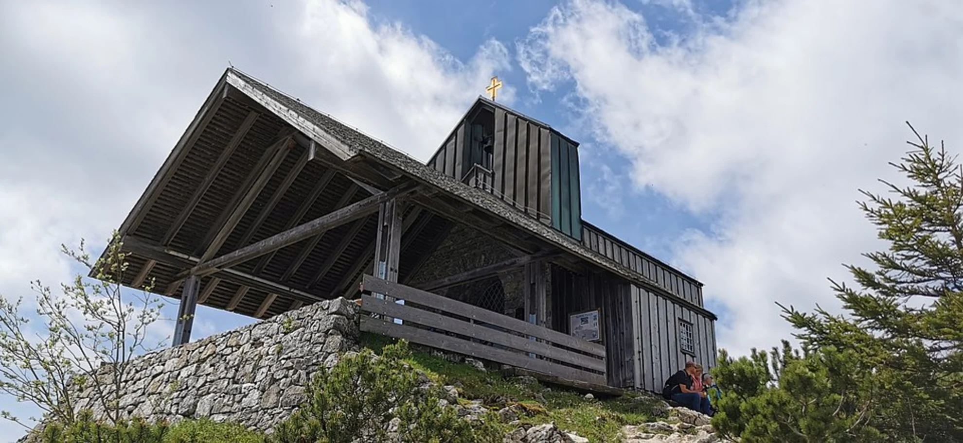
Hochfelln Peak has a rich history, with archaeological findings indicating that the area was inhabited during the Bronze Age. The summit is marked by a large cross and a small chapel, built in the early 20th century. The chapel is dedicated to St. Michael and offers a peaceful spot for reflection.
Navigation and Safety
For navigation, it is advisable to use the HiiKER app, which provides detailed maps and real-time updates. The trail is generally well-marked, but weather conditions can change rapidly, especially at higher elevations. Always check the weather forecast before starting your hike and carry essential gear such as a map, compass, and sufficient water.
Return Journey
The return journey follows the same path back to the Hochfelln-Seilbahn Talstation. The descent offers a different perspective of the landscape, with opportunities to spot wildlife and enjoy the tranquility of the forest.
This hike is a perfect blend of natural beauty, physical challenge, and historical intrigue, making it a must-do for any hiking enthusiast visiting the Chiemgau region.

What to expect?
Activity types
Comments and Reviews
User comments, reviews and discussions about the Bründlingköpfl and Hochfelln Peak Walk, Germany.
4.0
average rating out of 5
3 rating(s)