Download
3D Flyover
Add to list
More
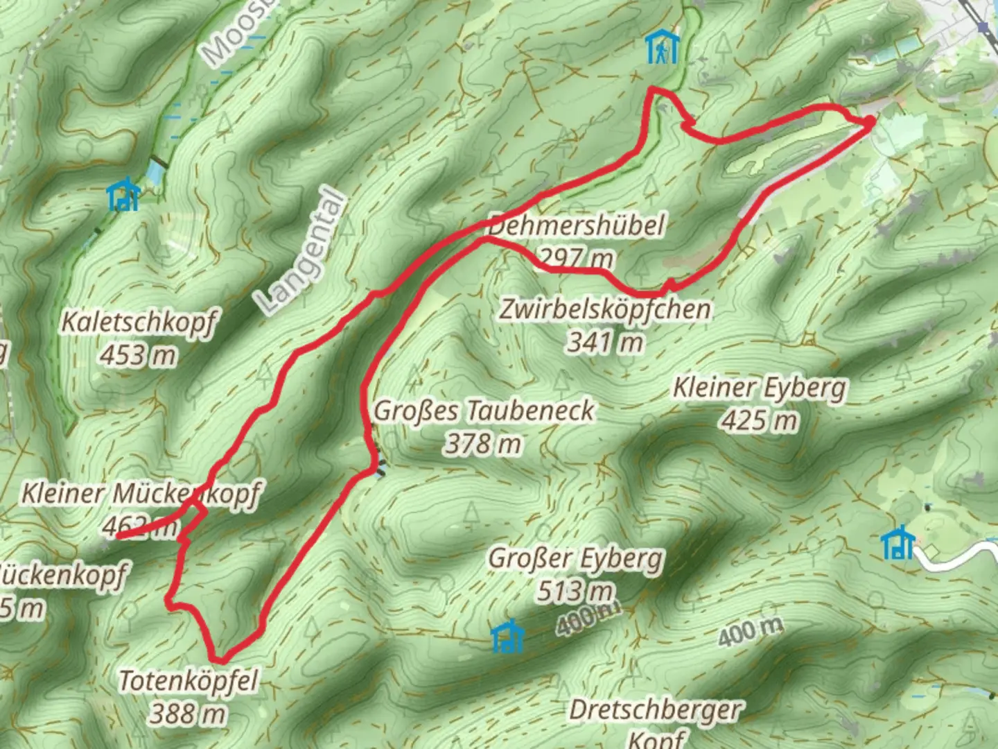
12.0 km
~3 hrs 3 min
399 m
Loop
“Explore a scenic, 12 km loop near Südwestpfalz, blending natural beauty, moderate challenge, and rich history.”
Starting near the picturesque town of Südwestpfalz in Germany, this 12 km (7.5 miles) loop trail offers a delightful mix of natural beauty and historical intrigue. With an elevation gain of around 400 meters (1,312 feet), the trail is rated as medium difficulty, making it accessible to most hikers with a moderate level of fitness.
Getting There
To reach the trailhead, you can either drive or use public transport. If driving, set your GPS to Südwestpfalz, Germany, and look for parking options near the town center. For those using public transport, take a train to the nearest major station, Pirmasens Hauptbahnhof. From there, local buses can take you closer to the trailhead. Check the latest schedules and routes on HiiKER for the most accurate information.
Trail Overview
The loop begins with a gentle ascent through dense forests, where you'll be greeted by the soothing sounds of rustling leaves and chirping birds. The first 3 km (1.9 miles) of the trail are relatively easy, with an elevation gain of about 100 meters (328 feet). This section is perfect for warming up your legs and getting into the rhythm of the hike.
Dehmershübel
As you approach the 4 km (2.5 miles) mark, you'll reach Dehmershübel, a small hill offering panoramic views of the surrounding countryside. This is a great spot to take a short break and soak in the scenery. The elevation here is around 300 meters (984 feet), providing a moderate challenge without being too strenuous.
Edersberg
Continuing on, the trail takes you to Edersberg, another notable hill in the region. This section involves a steeper climb, with an elevation gain of approximately 200 meters (656 feet) over the next 4 km (2.5 miles). The effort is well worth it, as the summit offers breathtaking views and a sense of accomplishment. Keep an eye out for local wildlife, including deer and various bird species that inhabit the area.
Historical Significance
The region around Südwestpfalz is steeped in history. During your hike, you'll come across remnants of ancient settlements and possibly even some old fortifications. These historical landmarks serve as a reminder of the area's rich past, dating back to Roman times and even earlier. Make sure to bring a map or use HiiKER to identify these points of interest along the way.
Final Stretch
The last 4 km (2.5 miles) of the trail are a gentle descent back towards the trailhead. This section is relatively easy, allowing you to cool down and reflect on the hike. The path winds through more forested areas, offering plenty of shade and opportunities to spot wildlife.
Preparation Tips
Given the medium difficulty rating, it's advisable to wear sturdy hiking boots and bring plenty of water. The trail can be muddy in places, especially after rain, so be prepared for varying conditions. A map or navigation tool like HiiKER is essential for staying on track, as some sections of the trail can be less clearly marked.
Overall, this loop trail near Südwestpfalz offers a rewarding mix of natural beauty, moderate physical challenge, and historical intrigue, making it a must-visit for any hiking enthusiast.

What to expect?
Activity types
Comments and Reviews
User comments, reviews and discussions about the Dehmershübel and Edersberg Loop, Germany.
4.0
average rating out of 5
2 rating(s)