Download
3D Flyover
Add to list
More
9.8 km
~2 hrs 26 min
296 m
Loop
“Explore a scenic 10 km loop with historical sites and diverse wildlife near Battweiler, Germany.”
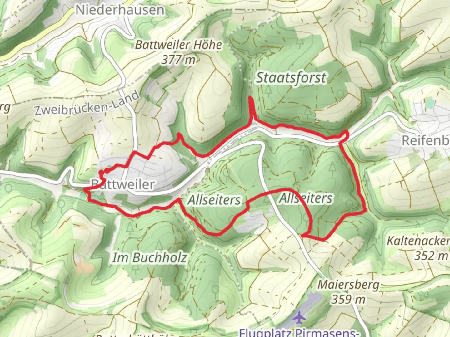
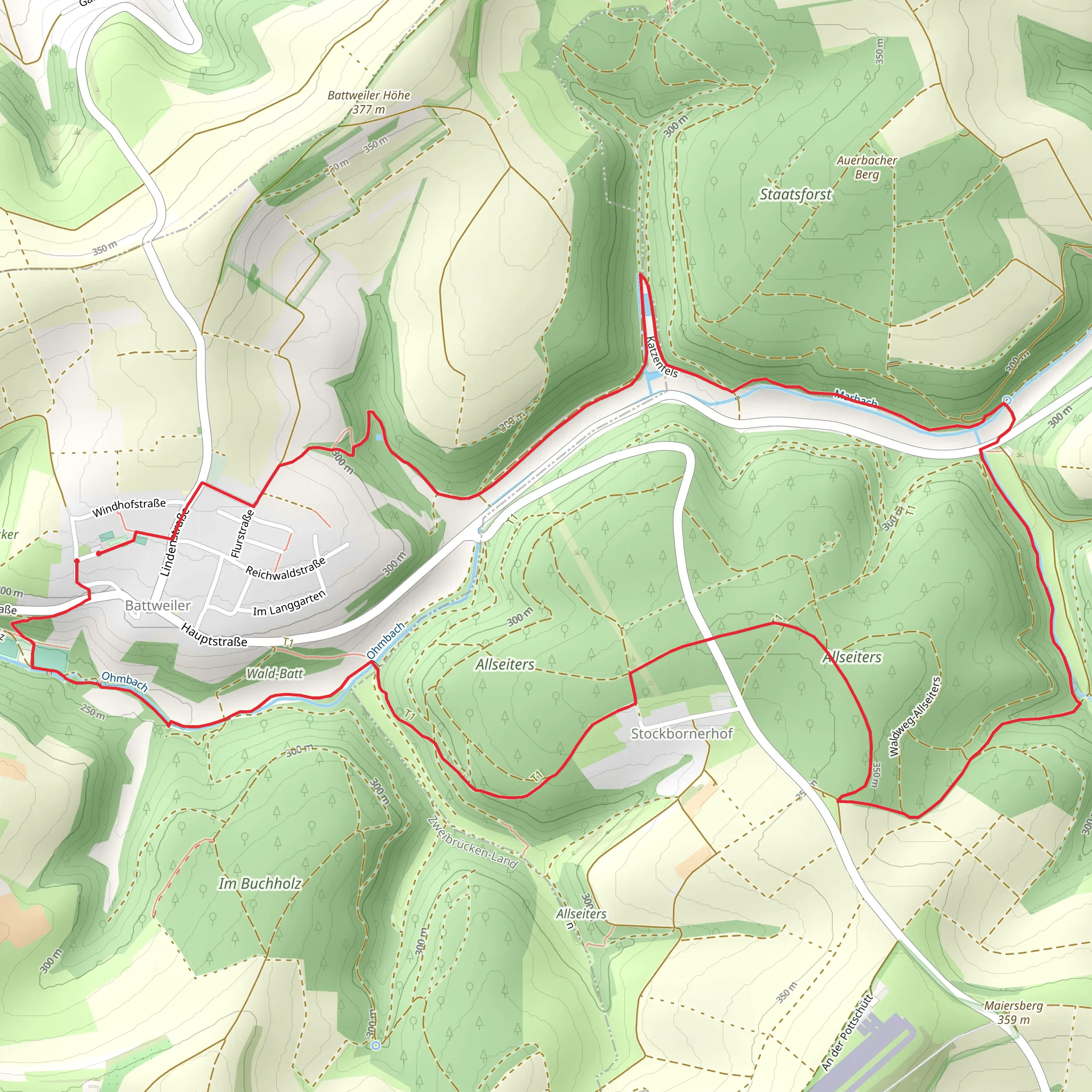
Starting near the charming village of Battweiler in the Südwestpfalz region of Germany, this 10 km (approximately 6.2 miles) loop trail offers a delightful mix of natural beauty and historical intrigue. With an elevation gain of around 200 meters (656 feet), the trail is rated as medium difficulty, making it accessible for most hikers with a moderate level of fitness.
Getting There
To reach the trailhead, you can either drive or use public transportation. If driving, set your GPS to Battweiler, Südwestpfalz, Germany. There is ample parking available near the village center. For those using public transport, take a train to the nearest major station, Zweibrücken, and then a local bus to Battweiler. The bus stop is conveniently located near the trailhead.
Trail Overview
The Battweiler Loop begins just outside the village, leading you through a picturesque landscape of rolling hills, dense forests, and open meadows. The trail is well-marked, but it's always a good idea to have a reliable navigation tool like HiiKER to ensure you stay on track.
Key Landmarks and Points of Interest
Forested Sections
About 2 km (1.2 miles) into the hike, you'll enter a dense forest area. The canopy provides a cool respite during warmer months, and the forest floor is often carpeted with wildflowers in spring. Keep an eye out for local wildlife such as deer, foxes, and a variety of bird species.
Historical Sites
Around the 5 km (3.1 miles) mark, you'll come across remnants of old fortifications and boundary stones that date back to medieval times. These historical markers offer a glimpse into the region's past, when it was a contested area between various feudal lords.
Scenic Overlook
At approximately 7 km (4.3 miles), the trail ascends to a scenic overlook. Here, you can take a break and enjoy panoramic views of the Südwestpfalz countryside. On a clear day, you can see as far as the Palatinate Forest, a UNESCO Biosphere Reserve.
Flora and Fauna
The trail is rich in biodiversity. In addition to the common European wildlife, the area is home to several rare plant species. During the spring and summer months, the meadows are alive with the colors of blooming wildflowers, including orchids and lilies.
Final Stretch
The last 3 km (1.9 miles) of the trail gradually descend back towards Battweiler. This section is relatively easy and offers a mix of open fields and small wooded areas. As you approach the village, you'll pass by several traditional German farmhouses, adding a quaint touch to the end of your hike.
Practical Tips
- Footwear: Given the mixed terrain, sturdy hiking boots are recommended.
- Water and Snacks: There are no facilities along the trail, so bring enough water and snacks.
- Weather: Check the weather forecast before heading out, as conditions can change rapidly.
- Navigation: Use HiiKER for real-time navigation and updates on the trail.
This loop trail offers a well-rounded hiking experience, combining natural beauty with historical elements, making it a rewarding adventure for those exploring the Südwestpfalz region.
What to expect?
Activity types
Comments and Reviews
User comments, reviews and discussions about the Battweiler Loop, Germany.
4.5
average rating out of 5
4 rating(s)
