Download
3D Flyover
Add to list
More
12.5 km
~3 hrs 56 min
868 m
Loop
“Explore the scenic Richard Loewenherz Weg, blending natural beauty, historical intrigue, and moderate challenge.”
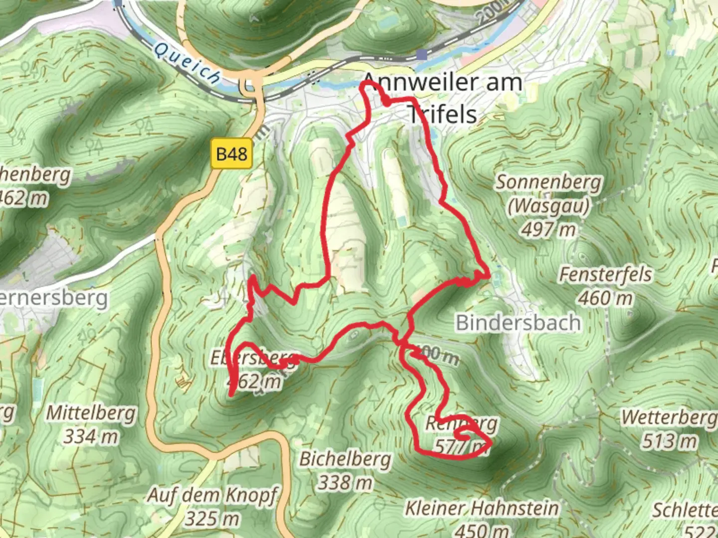
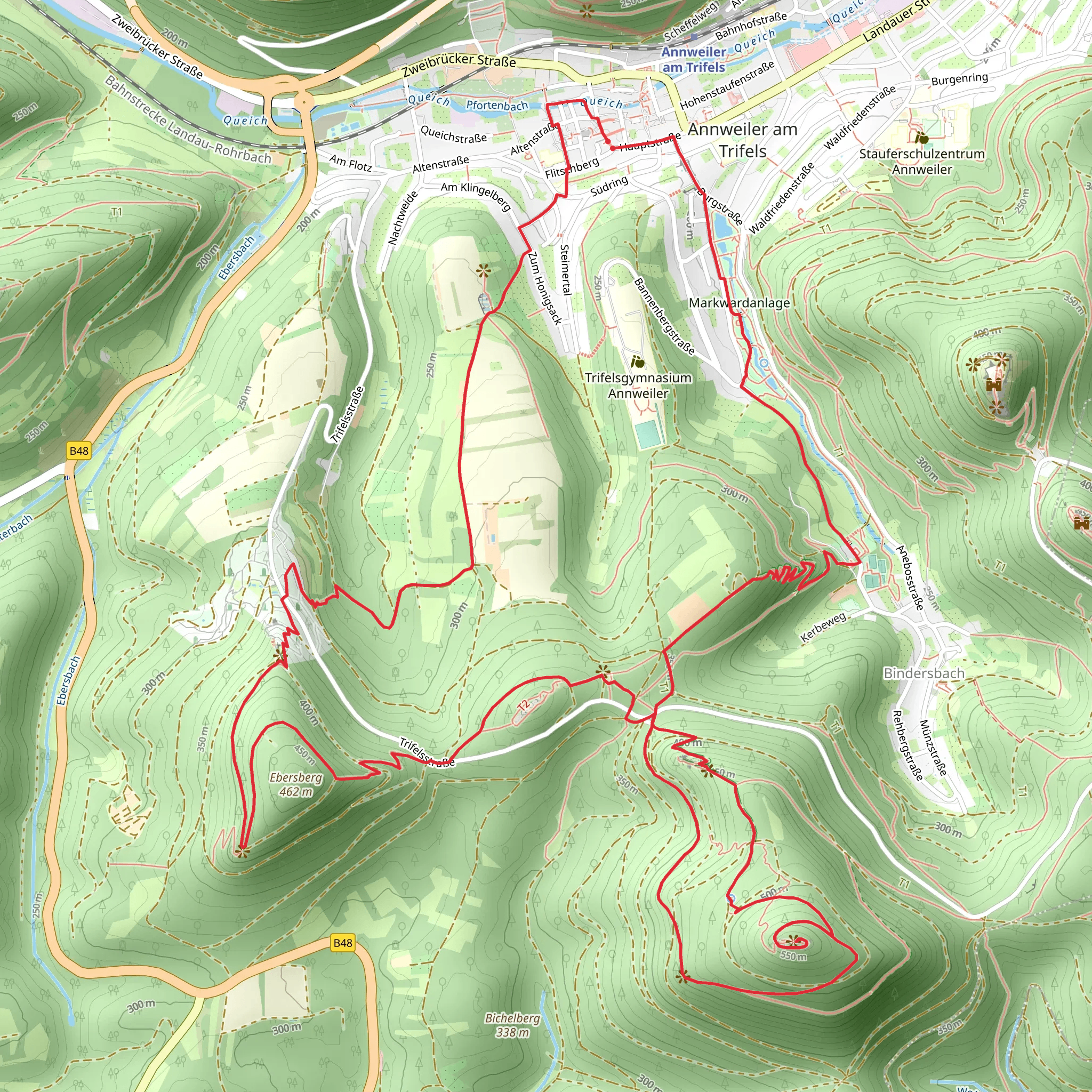
Starting near the picturesque region of Südliche Weinstraße in Germany, this 12 km (7.5 miles) loop trail offers an elevation gain of approximately 800 meters (2,625 feet), making it a moderately challenging hike. The trailhead is conveniently accessible by both public transport and car. If you're driving, you can park near the village of Annweiler am Trifels, which is a well-known starting point. For those using public transport, the Annweiler am Trifels train station is the closest, and from there, it's a short walk to the trailhead.
Trail Navigation and Terrain
The Richard Loewenherz Weg is well-marked, but it's always a good idea to have a reliable navigation tool like HiiKER to ensure you stay on track. The trail meanders through dense forests, open meadows, and rocky outcrops, offering a variety of terrains that keep the hike interesting. Expect some steep ascents and descents, particularly as you approach the higher elevations.
Historical Significance
One of the most captivating aspects of this trail is its historical significance. The trail is named after Richard the Lionheart (Richard Loewenherz), the King of England, who was imprisoned in the nearby Trifels Castle in the late 12th century. The castle itself is a significant landmark on this trail, located about 5 km (3.1 miles) from the start. The castle offers panoramic views of the surrounding Palatinate Forest and is a great spot for a rest and some historical exploration.
Flora and Fauna
The trail is a haven for nature enthusiasts. As you hike, you'll pass through lush forests dominated by oak, beech, and pine trees. In the spring and summer months, the meadows are adorned with a variety of wildflowers, adding a splash of color to the landscape. Wildlife is abundant; keep an eye out for deer, wild boar, and a variety of bird species, including woodpeckers and hawks.
Key Landmarks and Points of Interest
- Trifels Castle: Located approximately 5 km (3.1 miles) into the hike, this medieval castle is a must-visit. It offers not only historical insights but also stunning views of the surrounding area.
- Anebos Castle Ruins: About 3 km (1.9 miles) from the start, these ruins are less crowded and offer a peaceful spot to take in the scenery.
- Scharfenberg Castle (Münz): Another historical site located roughly 7 km (4.3 miles) into the hike. This castle is perched on a hill and provides another excellent vantage point.
Preparation and Safety Tips
Given the moderate difficulty of the trail, it's advisable to wear sturdy hiking boots and bring trekking poles, especially for the steeper sections. Carry enough water and snacks, as there are limited facilities along the route. Weather can be unpredictable, so pack a rain jacket and layers to adjust to changing conditions.
Getting There
If you're driving, set your GPS to Annweiler am Trifels, where you can find parking near the trailhead. For public transport users, take a train to Annweiler am Trifels station. From there, follow the signs to the trailhead, which is a short walk away.
This trail offers a perfect blend of natural beauty, historical intrigue, and moderate physical challenge, making it a rewarding experience for any hiker.
What to expect?
Activity types
Comments and Reviews
User comments, reviews and discussions about the Richard Loewenherz Weg, Germany.
4.75
average rating out of 5
4 rating(s)
