
Download
3D Flyover
Add to list
More
14.6 km
~3 hrs 55 min
605 m
Loop
“Discover a 15 km loop in Südliche Weinstraße with stunning views, diverse wildlife, and rich history.”
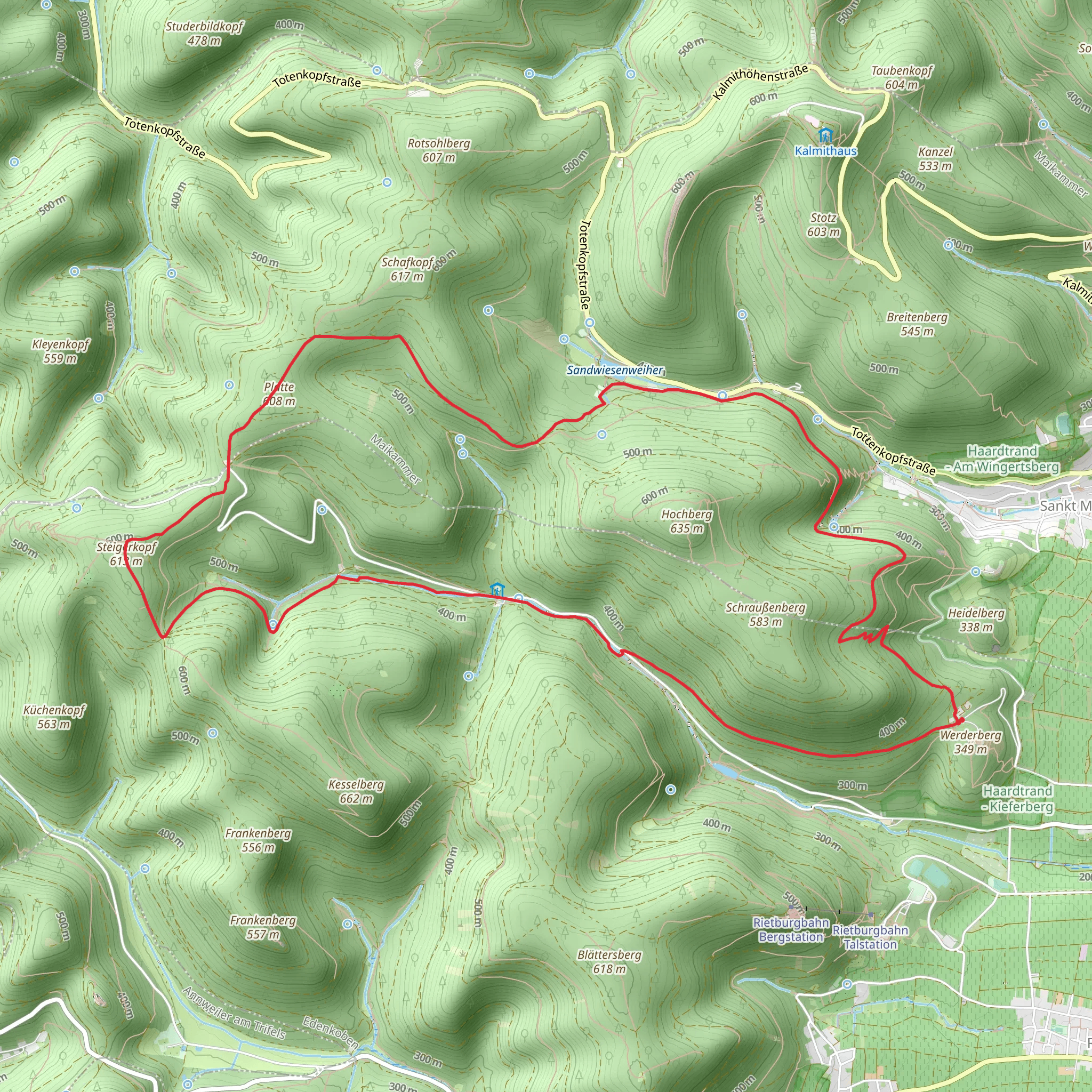
Starting near the charming region of Südliche Weinstraße in Germany, this 15 km (approximately 9.3 miles) loop trail offers a delightful mix of natural beauty and historical intrigue. With an elevation gain of around 600 meters (about 1,968 feet), the trail is rated as medium difficulty, making it suitable for moderately experienced hikers.
Getting There
To reach the trailhead, you can drive or use public transport. If driving, head towards the Südliche Weinstraße district, where ample parking is available near the starting point. For those using public transport, the nearest major town is Landau in der Pfalz. From Landau, you can take a regional bus to the village of Dernbach, which is a short walk from the trailhead.
Trail Highlights
The trail begins with a gentle ascent through lush forests, offering a serene start to your hike. As you progress, the path becomes steeper, leading you to the first significant landmark, the Platte. This vantage point provides stunning panoramic views of the surrounding Palatinate Forest and the Rhine Valley. The climb to the Platte covers approximately 5 km (3.1 miles) with an elevation gain of about 300 meters (984 feet).
Continuing along the trail, you'll encounter a mix of deciduous and coniferous trees, creating a diverse and vibrant ecosystem. Keep an eye out for local wildlife, including deer, foxes, and a variety of bird species. The trail is well-marked, but it's advisable to use HiiKER for navigation to ensure you stay on track.
Schänzelturm
Around the 10 km (6.2 miles) mark, you'll reach the Schänzelturm, a historic watchtower dating back to the 18th century. The tower was part of a series of fortifications built to protect the region from invasions. Climbing to the top of the Schänzelturm offers another opportunity for breathtaking views, making it a perfect spot for a rest and some photos.
Historical Significance
The Saar Pfalz Weg, part of which this trail follows, has historical significance dating back to Roman times. The region was a strategic location for trade and military routes, and remnants of ancient Roman roads can still be found in the area. The trail also passes through several small villages that have preserved their medieval charm, offering a glimpse into the region's rich history.
Final Stretch
The final 5 km (3.1 miles) of the trail lead you back through dense forests and open meadows, gradually descending towards the starting point. This section is less strenuous, allowing you to enjoy the natural beauty and reflect on the historical landmarks you've encountered.
Practical Tips
- Wear sturdy hiking boots, as some sections of the trail can be rocky and uneven.
- Bring plenty of water and snacks, especially if you plan to take your time exploring the landmarks.
- Check the weather forecast before you go, as conditions can change rapidly in the forested areas.
- Use HiiKER for real-time navigation and updates on trail conditions.
This trail offers a perfect blend of natural beauty, wildlife, and historical significance, making it a rewarding experience for any hiker.
What to expect?
Activity types
Comments and Reviews
User comments, reviews and discussions about the Platte and Schänzelturm via Saar Pfalz Weg, Germany.
4.0
average rating out of 5
2 rating(s)
