Download
Preview
Add to list
More
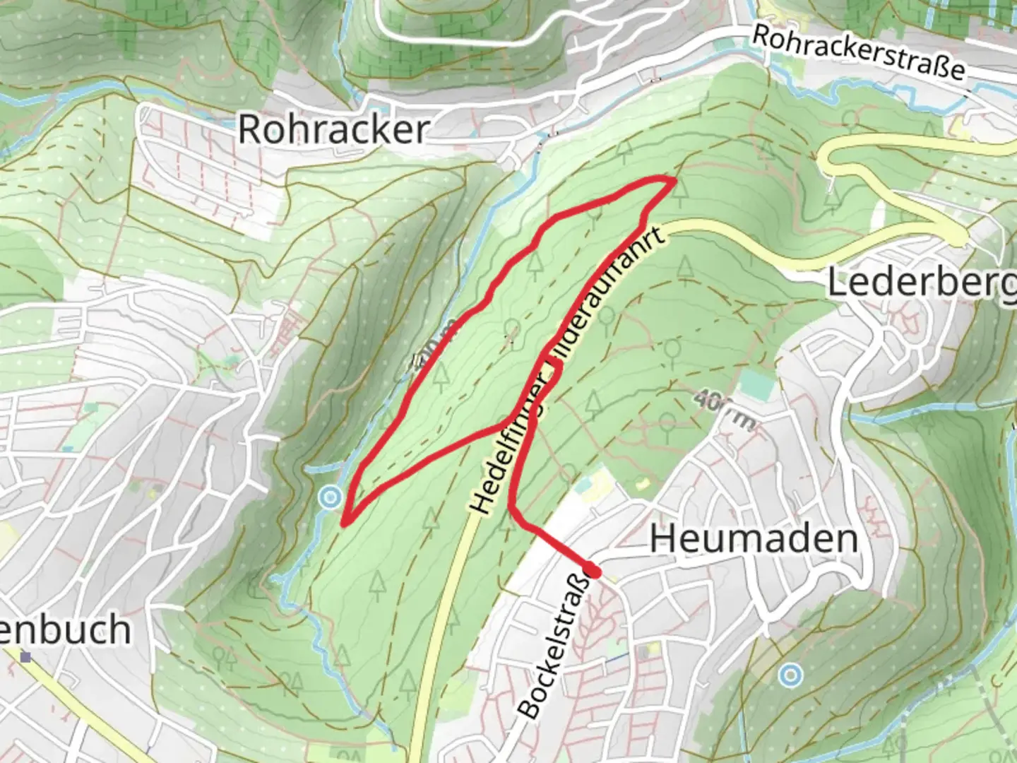
3.9 km
~58 min
118 m
Loop
“The Lederberg Loop combines scenic views, historical landmarks, and moderate hiking for a rewarding 4 km adventure.”
Starting near Stuttgart, Germany, the Lederberg Loop is a delightful 4 km (2.5 miles) trail with an elevation gain of around 100 meters (328 feet). This loop trail offers a medium difficulty rating, making it suitable for moderately experienced hikers looking for a rewarding day hike.
Getting There
To reach the trailhead, you can either drive or use public transport. If driving, head towards the suburb of Degerloch, where you can find parking near the Fernsehturm Stuttgart (Stuttgart TV Tower). For those using public transport, take the U-Bahn (U7 or U8) to the Degerloch station, which is a short walk from the trailhead.
Trail Overview
The Lederberg Loop begins with a gentle ascent through a mixed forest, offering a serene start to your hike. As you progress, the trail becomes steeper, leading you to the first significant landmark, the Bopser Hill. This section covers approximately 1.5 km (0.9 miles) and gains about 50 meters (164 feet) in elevation.
Landmarks and Nature
At Bopser Hill, you'll find a small clearing with panoramic views of Stuttgart and the surrounding Swabian Alps. This is an excellent spot for a short break and some photography. Continuing on, the trail meanders through dense woodland, where you might spot local wildlife such as deer, foxes, and various bird species. Keep an eye out for the distinctive European beech trees that dominate this area.
Historical Significance
As you hike, you'll come across several historical markers and plaques. The region around Stuttgart has a rich history dating back to Roman times. One notable site is the remnants of an old Roman road, which you will encounter around the 3 km (1.9 miles) mark. This ancient pathway once connected various settlements in the region and is a fascinating glimpse into the past.
Navigation and Safety
The Lederberg Loop is well-marked, but it's always wise to have a reliable navigation tool. The HiiKER app is highly recommended for this trail, providing detailed maps and real-time GPS tracking to ensure you stay on course.
Final Stretch
The last kilometer (0.6 miles) of the trail descends gradually back towards the starting point. This section is less strenuous, allowing you to enjoy the peaceful surroundings and reflect on the hike. As you near the end, you'll pass by the picturesque Lederberg Park, a perfect spot for a post-hike picnic or a leisurely stroll.
Wildlife and Flora
Throughout the hike, you'll be immersed in the natural beauty of the region. The forest is home to a variety of flora, including wildflowers in the spring and vibrant foliage in the autumn. Wildlife is abundant, so keep your camera ready for unexpected encounters with the local fauna.
The Lederberg Loop offers a balanced mix of natural beauty, historical intrigue, and moderate physical challenge, making it a must-visit for hikers in the Stuttgart area.

What to expect?
Activity types
Comments and Reviews
User comments, reviews and discussions about the Lederberg Loop, Germany.
4.5
average rating out of 5
2 rating(s)