Download
3D Flyover
Add to list
More
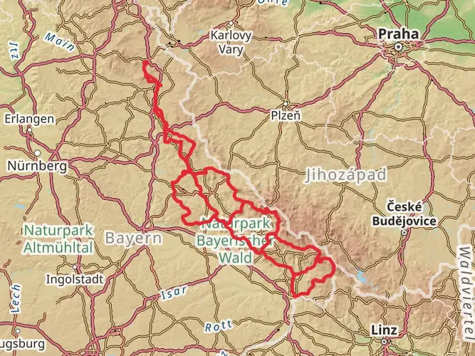
160.3 km
~7 days
3146 m
Multi-Day
“Embark on the Baierweg for a scenic hike through Bavaria's history and natural splendor.”
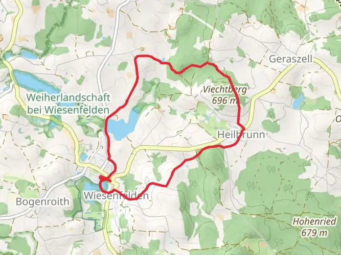
The Baierweg is a captivating long-distance trail that stretches approximately 160 kilometers (about 100 miles) and ascends roughly 3100 meters (around 10,170 feet) in elevation. This point-to-point trail begins near the historic town of Straubing, located in the picturesque region of Bavaria, Germany. Hikers embarking on this journey should prepare for a medium difficulty trek that offers a blend of natural beauty, cultural experiences, and historical insights.
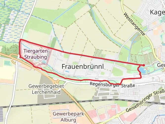
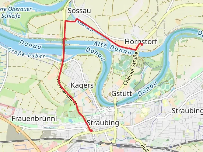
Getting to the Trailhead To reach the starting point of the Baierweg, hikers can utilize public transportation or drive. The nearest significant landmark to the trailhead is the town of Straubing, which is well-connected by train and bus services. For those driving, parking is available in the vicinity of the trailhead. It's advisable to use the HiiKER app to navigate to the exact starting location and to plan the route ahead of time.
Trail Experience As you set out from the vicinity of Straubing, the trail will lead you through a diverse landscape of rolling hills, dense forests, and serene river valleys. The initial segment of the trail is relatively flat, allowing hikers to ease into the journey as they pass through agricultural lands and small Bavarian villages.
Cultural and Historical Landmarks The Baierweg is not just a nature trek; it's a path steeped in history. The route takes hikers through areas that have been significant since medieval times. Along the way, you'll encounter ancient churches, castles, and ruins that tell the story of the region's past. One of the historical highlights is the Walhalla memorial, a hall of fame that honors laudable and distinguished figures in German history, located near Donaustauf.
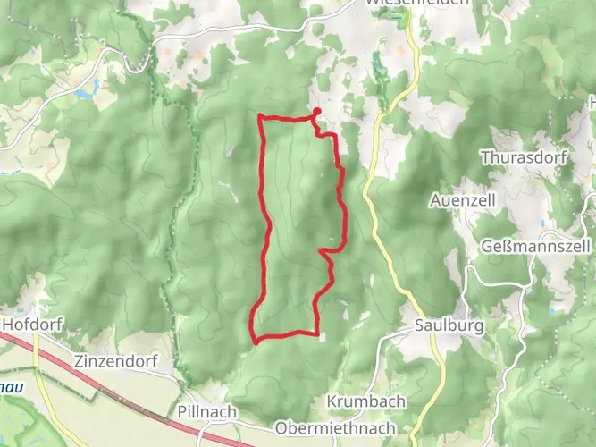
Natural Highlights As you progress along the Baierweg, the elevation begins to increase, offering more challenging terrain and stunning panoramic views. The trail meanders through the Bavarian Forest, a dense woodland area that is home to a rich variety of wildlife, including deer, lynx, and numerous bird species. Hikers should be prepared for the changing conditions and carry appropriate gear for forested areas.
Preparation and Navigation Given the trail's length and varied terrain, it's essential to be well-prepared with adequate supplies, including water, food, and suitable clothing for weather changes. The use of the HiiKER app is recommended for navigation, as it provides detailed maps and trail information that can be invaluable for route finding and staying on track.
Accommodation and Resupply Points Throughout the Baierweg, there are opportunities to rest and resupply in the towns and villages you'll pass. These locations offer a chance to experience local hospitality and cuisine, as well as to restock on necessities. It's wise to plan accommodation in advance, especially during peak hiking seasons.
End of the Trail The trail concludes in the town of Eslarn, a charming destination where hikers can celebrate the completion of their journey. From Eslarn, public transport is available to return to Straubing or to continue to other destinations.
The Baierweg is a trail that promises an enriching experience, combining the natural beauty of Bavaria with the deep historical roots of the region. Whether you're seeking a physical challenge, a cultural immersion, or a peaceful escape into nature, this trail offers something for every hiker.

Frequently asked questions
How long is the Baierweg and how many days does it usually take to hike?
The Baierweg is about 160.28 km long with 3,146 m of total ascent, so it is firmly a multi-day long-distance hike. Official tourism material describes it as a route commonly walked in 7 daily stages from Straubing to Furth im Wald, which makes it a realistic one-week trek for most hikers.
Where does the Baierweg start and finish in Bavaria?
The Baierweg starts in Straubing on the Danube side of Lower Bavaria and runs east through the Bayerischer Wald before finishing in Furth im Wald near the Czech border. Several regional trail descriptions also note that the route passes through the Czech towns of Kdyně and Domažlice before returning to Bavaria.
Is the Baierweg in the Bayerischer Wald and does it pass through Sankt Englmar?
Yes. The Baierweg is a historic long-distance trail through the Bayerischer Wald, beginning at Straubing and heading into the forested uplands of eastern Bavaria. Sankt Englmar is one of the named places associated with the route in regional tourism material, making it a useful reference point for planning stages in the central part of the walk.
Is the Baierweg a difficult hike or suitable for moderately experienced walkers?
The Baierweg is generally rated medium difficulty. Over 160.28 km it gains 3,146 m, so the challenge comes more from sustained multi-day walking and repeated climbs through the Bavarian and Bohemian Forest landscapes than from any single extreme mountain section.
Can the Baierweg be hiked with a map or GPX track?
Yes. Because the Baierweg is a waymarked long-distance route, it can be followed with mapping and GPX support for day-by-day navigation. The route is also known for its historic trail marking, including the blue lozenge symbol associated with the old Baierweg, which helps on the ground alongside digital navigation.
Can the Baierweg be walked without carrying full luggage?
The Baierweg is well suited to hut-to-inn or guesthouse style walking because it is normally divided into staged days between towns and villages. Regional walking providers in the Bayerischer Wald offer luggage-transfer style hiking holidays in the area, so walking the Baierweg without a full pack is possible when accommodations and transfers are arranged in advance.
Comments and Reviews
User comments, reviews and discussions about the Baierweg, Germany.
5.0
average rating out of 5
3 rating(s)