Download
3D Flyover
Add to list
More
117.7 km
~5 days
1519 m
Multi-Day
“Embark on King Ludwig's Way, a historical hike through Bavaria's heart with stunning vistas and cultural landmarks.”
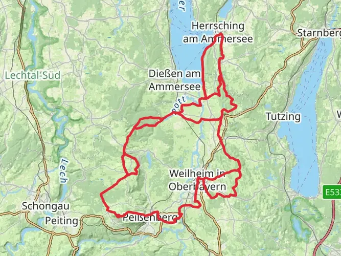
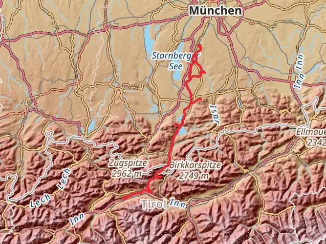
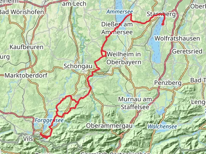
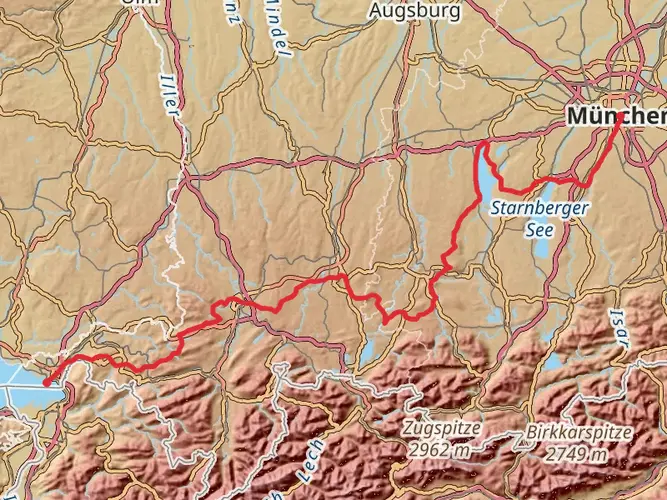
King Ludwig's Way, a scenic trail winding through the picturesque landscapes of Bavaria, begins near the shores of Lake Starnberg, just a short distance from Munich. This trail, approximately 118 kilometers (73 miles) in length with an elevation gain of around 1500 meters (4921 feet), offers a moderate challenge suitable for hikers with some experience.
Getting to the Trailhead
To reach the starting point near Starnberg, hikers can take advantage of the well-connected public transport system from Munich. The S-Bahn train S6 departs regularly from Munich's central station to Starnberg, which is a convenient gateway to the trail. For those preferring to drive, Starnberg is easily accessible by car, and parking is available in the area.
The Journey Begins
Setting out from the vicinity of Starnberg, the trail meanders through lush fields and quaint Bavarian villages. The path takes you past the memorial chapel for King Ludwig II, marking the location where the enigmatic king was found dead in the lake's shallow waters. This sets the historical tone for the trail, as it is dedicated to the memory of King Ludwig II, known for his fairytale castles and mysterious demise.
Through the Bavarian Countryside
As you progress, the trail unveils the rich tapestry of the Bavarian countryside, with its rolling hills and dense forests. The route passes through the Pfaffenwinkel region, an area renowned for its beautiful churches and monasteries. Approximately 20 kilometers (12 miles) from the start, the trail reaches the town of Andechs, famous for its Benedictine monastery and brewery. Here, hikers can take a break to enjoy traditional Bavarian hospitality and perhaps sample the local beer.
Ascending to Alpine Views
The King Ludwig's Way gradually ascends into the foothills of the Alps, offering increasingly dramatic views. The trail's highest point is near the town of Peißenberg, where hikers can enjoy panoramic vistas of the surrounding mountains. The elevation gain is gradual and spread out over the course of the trail, making the climbs manageable for most.
Historical Landmarks and Castles
One of the highlights of the trail is the approach to Neuschwanstein Castle, one of King Ludwig's most famous constructions. This iconic castle, which inspired Disney's Sleeping Beauty Castle, is visible from the trail and is a must-visit landmark. The trail does not lead directly to the castle, but a detour to this masterpiece is highly recommended.
Wildlife and Nature
The diverse habitats along the trail support a variety of wildlife. Hikers may spot deer, foxes, and a range of bird species. The trail also crosses through the Ammergau Alps Nature Reserve, a protected area where the natural beauty of the region is preserved.
Navigating the Trail
For navigation, the HiiKER app is an invaluable tool for hikers on King Ludwig's Way. It provides detailed maps and waypoints, ensuring that you stay on the right path and don't miss any of the significant sites along the route.
Preparation and Planning
Before embarking on this journey, hikers should prepare for variable weather conditions and pack accordingly. Sturdy hiking boots, layered clothing, and rain gear are essential. It's also wise to carry a first-aid kit, sufficient water, and snacks. Accommodations along the trail range from guesthouses to hotels, allowing for a comfortable multi-day hike with opportunities to rest and refuel.
King Ludwig's Way is a trail that not only challenges the body but also captivates the soul with its blend of natural beauty and historical intrigue. Whether you're a history buff, a nature lover, or simply seeking a memorable hiking experience, this trail promises a rich tapestry of sights and experiences in the heart of Bavaria.

Comments and Reviews
User comments, reviews and discussions about the King Ludwig's Way, Germany.
5.0
average rating out of 5
5 rating(s)