Download
3D Flyover
Add to list
More
8.9 km
~2 hrs 10 min
246 m
Loop
“Explore lush forests and historical landmarks on a scenic Bavarian hike near Schwandorf.”
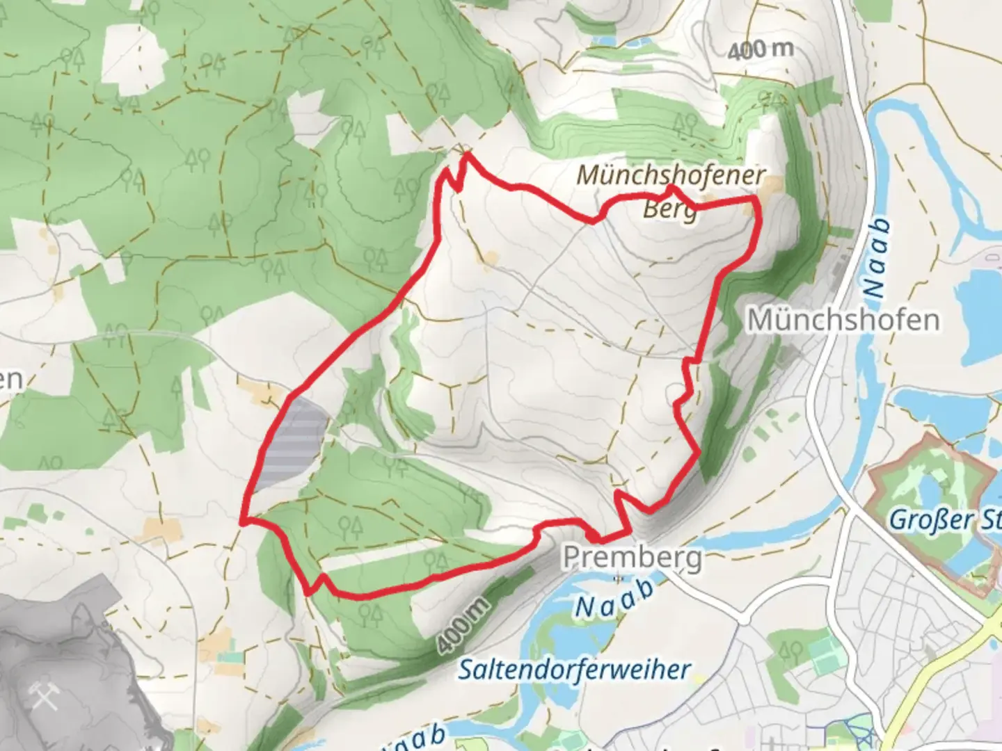
Nestled in the picturesque region near Schwandorf, Germany, this loop trail offers a delightful journey through the Bavarian landscape. Spanning approximately 9 kilometers (about 5.6 miles) with an elevation gain of around 200 meters (approximately 656 feet), this medium-difficulty hike is perfect for those looking to explore the natural beauty and historical richness of the area.
Getting There
To reach the trailhead, travelers can opt for public transport or drive. If you're using public transport, Schwandorf is well-connected by train, and from there, local buses can take you closer to the starting point. For those driving, parking is available near the trailhead, which is conveniently located just outside Schwandorf.
Trail Highlights
The journey begins with a gentle ascent, leading you through lush forests and open meadows. As you progress, the trail offers a mix of shaded woodland paths and open areas with panoramic views of the surrounding countryside. The diverse terrain keeps the hike engaging, with a few steeper sections that provide a rewarding challenge.
Hoellohe Runde
Around the 3-kilometer (1.9-mile) mark, you'll encounter the Hoellohe Runde, a section known for its serene beauty. This part of the trail meanders through dense forests, where the canopy overhead creates a tranquil atmosphere. Keep an eye out for local wildlife, including deer and various bird species, which are often spotted in this area.
Scharzenfeld
Continuing on, the trail leads you to Scharzenfeld, a notable landmark approximately 6 kilometers (3.7 miles) into the hike. This area is steeped in history, with remnants of ancient settlements that date back to the early medieval period. Take a moment to appreciate the historical significance and imagine the lives of those who once inhabited this region.
Nature and Wildlife
The trail is a haven for nature enthusiasts, offering a diverse array of flora and fauna. In spring and summer, wildflowers bloom in abundance, painting the landscape with vibrant colors. The forests are home to a variety of wildlife, including foxes, hares, and numerous bird species. Birdwatchers will particularly enjoy the opportunity to spot rare species in their natural habitat.
Navigation and Safety
For navigation, the HiiKER app is an invaluable tool, providing detailed maps and real-time updates to ensure you stay on track. The trail is well-marked, but it's always wise to have a reliable navigation aid at hand. As with any hike, it's important to wear appropriate footwear and carry sufficient water, especially during warmer months.
This loop trail near Schwandorf offers a perfect blend of natural beauty, historical intrigue, and a moderate challenge, making it an ideal choice for hikers seeking a rewarding day out in the Bavarian countryside.

Comments and Reviews
User comments, reviews and discussions about the Muenchshofener Berg via Hoellohe Runde and Scharzenfeld, Germany.
4.67
average rating out of 5
3 rating(s)